
Near Lithonia in DeKalb County, Georgia — The American South (South Atlantic)
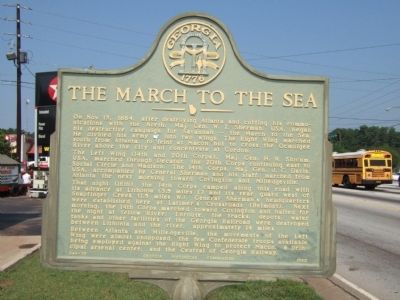
The March to the Sea
Photographed by Felch Dumas, August 3, 2008
1. The March to the Sea Marker
The Left Wing (14th and 20th Corps), Maj. Gen H.W. Slocum, USA, marched through Decatur, the 20th Corps continuing east to Social Circle and Madison. The 14th Corps, Maj. Gen. J.C. Davis, USA, accompanied by General Sherman and his staff, marched from Atlanta the next morning towards Covington and Milledgeville. That night (16th), the 14th Corps camped along this road with its advance at Lithonia (3.5 miles E) and its rear guard west of Snapfinger Creek) 1.5 miles W.). General Sherman’s headquarters were established here at Latimer’s Crossroads (Belmont). Next morning, the 14th Corps marched toward Covington and halted for the night at Yellow River. Enroute, the tracks, depots, water tanks and other facilities of the Georgia Railroad were destroyed between
this page online
Between Atlanta and Milledgeville, the movement of the Left Wing were almost unopposed, the few Confederate troops available being employed against the Right Wing to protect Macon, a principal arsenal center, and the Central Georgia Railway.
Erected 1957 by Georgia Historical Commission. (Marker Number 044-85.)
Topics and series. This historical marker is listed in this topic list: War, US Civil. In addition, it is included in the Georgia Historical Society, and the Sherman’s March to the Sea series lists. A significant historical date for this entry is October 15, 1864.
Location. 33° 43.362′ N, 84° 9.978′ W. Marker is near Lithonia, Georgia, in DeKalb County. It is on Covington Highway (U.S. 278) 0.1 miles east of Panola Road, on the right when traveling east. Touch for map. Marker is in this post office area: Lithonia GA 30058, United States of America. Touch for directions.

Regionally, this marker is in Georgia’s Piedmont and in Metro Atlanta. It is also in the American South and specifically in the Deep South. Globally, it is in North America, the Western Hemisphere, the Western
Photographed by Felch Dumas, August 3, 2008
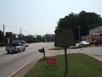
2. The March to the Sea Marker
The view is down Covington Highway in the direction of Lithonia (and Covington)
Other nearby markers. At least 8 other markers are within 6 miles of this marker, measured as the crow flies: Rebecca Latimer Felton (approx. 0.7 miles away); Lynching in America / Mob Violence in Lithonia (approx. 3.4 miles away); Bruce Street School (approx. 3.9 miles away); Georgia Railroad Depot (approx. 5.8 miles away); Stone Mountain Inn (approx. 5.8 miles away); Covered Bridge (approx. 5.9 miles away); Sherman's Neckties (approx. 5.9 miles away); Old Indian Trail (approx. 5.9 miles away). Touch for a list and map of all markers in Lithonia.
Another marker is no longer nearby. The March to the Sea (was approx. 4½ miles away but has been confirmed missing).
Photographed by David Seibert, July 31, 2010
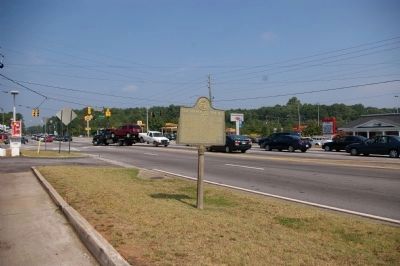
3. The March to the Sea Marker
The marker stands at the intersection of Covington Highway, US 278 (right) and Panola Road.
Credits. This page was last revised on June 16, 2016. It was originally submitted on August 4, 2008, by Felch Dumas of Decatur, Georgia. This page has been viewed 2,123 times since then and 56 times this year. Photos: 1, 2. submitted on August 4, 2008, by Felch Dumas of Decatur, Georgia. 3. submitted on July 31, 2010, by David Seibert of Sandy Springs, Georgia. • Craig Swain was the editor who published this page.
