Macon in Bibb County, Georgia — The American South (South Atlantic)
Macon City Hall
Georgia's Temporary Capitol Building
— Wilson's Raid Heritage Trail —
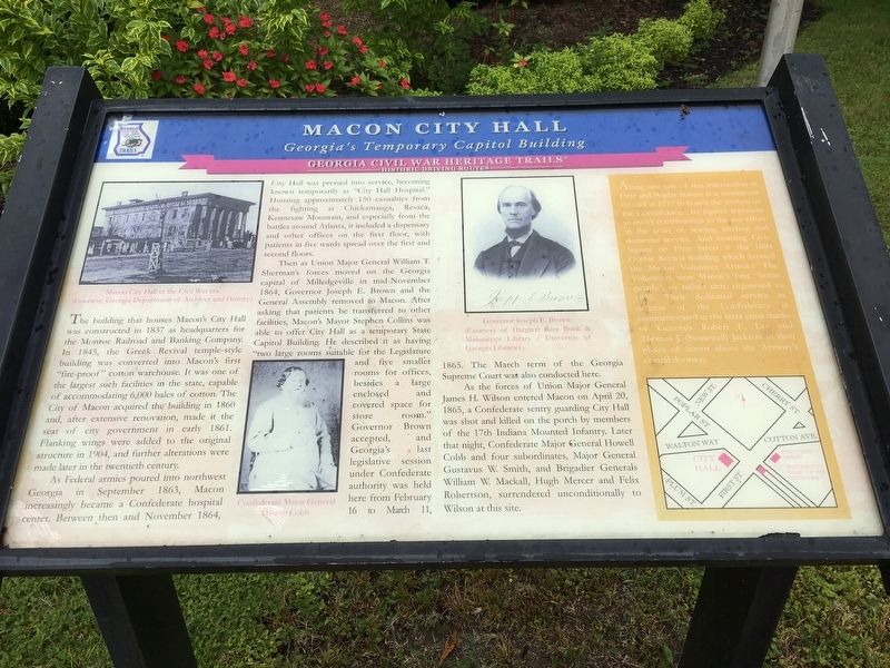
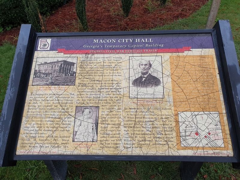
As Federal armies poured into northwest Georgia in September 1863, Macon increasingly became a Confederate hospital center. Between then and November 1864, City Hall was pressed into service, becoming known temporarily as “City Hall Hospital.” Housing approximately 150 casualties from the fighting at Chickamauga, Resaca, Kennesaw Mountain, and especially from the battles around Atlanta, it included a dispensary and other offices on the first floor, with patients in five wards spread over the first and second floors.
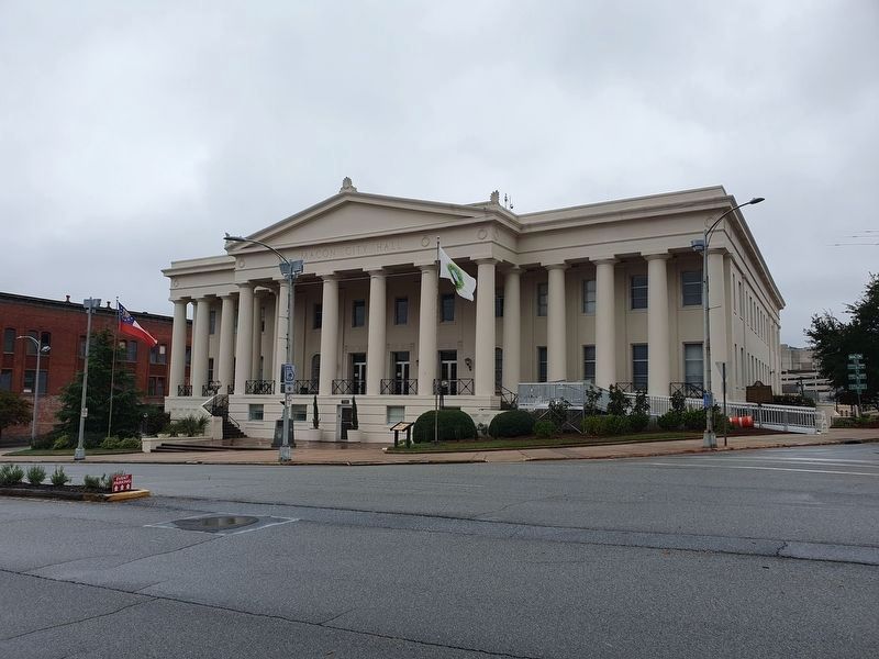
Then as Union Major General William T. Sherman’s forces moved on the Georgia capital of Milledgeville in mid-November 1864, Governor Joseph E. Brown and the General Assembly removed to Macon. After asking that patients be transferred to other facilities, Macon’s Mayor Stephen Collins was able to offer City Hall as a temporary State Capitol Building. He described it as having “two large rooms suitable for the Legislature and five smaller rooms for offices, besides a large enclosed and covered space for store room.” Governor Brown accepted, and Georgia’s last legislative session under Confederate authority was held here from February 16 to March 11, 1865. The March term of the Georgia Supreme Court was also conducted here.
As the forces of Union Major General James H. Wilson entered Macon on April 20, 1865, a Confederate sentry guarding City Hall was shot and killed on the porch by members of the 17th Indiana Mounted Infantry. Later that night, Confederate Major General Howell Cobb and four subordinates, Major General Gustavus W. Smith, and Brigadier Generals William W. Mackall, Hugh Mercer and Felix Robertson, surrendered unconditionally to Wilson at this site. (Sidebar): Along one side of this intersection at First and Poplar Streets is a monument erected in 1911 to honor the women of the Confederacy. Its figures represent women’s contributions to the war effort in the areas of sewing, nursing and domestic service. And fronting Civic Square on First Street is the 1884 Gothic Revival building which housed the Macon Volunteer Armory. The Volunteers were Macon’s first “home guards”, or militia unit, organized in 1825. Their dedicated service in defense of the Confederacy is commemorated in the terra cotta masks of Generals Robert E. Lee and Thomas J (Stonewall) Jackson in their places of honor above the Armory’s central doorway.
Erected 2002 by Georgia Civil War Heritage Trails. (Marker Number R10.)
Topics and series. This historical marker is listed in these topic lists: Architecture • War, US Civil. In addition, it is included in the Georgia Civil War Trails series list.
Location. 32° 50.178′ N, 83° 37.93′ W. Marker is in Macon, Georgia, in Bibb County. Marker is at the intersection of Poplar Street and DT Walton Sr. Way, on the right when traveling east on Poplar Street. Touch for map. Marker is in this post office area: Macon GA 31201, United States of America. Touch for directions.
Other nearby markers. At least 8 other markers are within walking distance of this marker. City Hall & Old Capitol (a few steps from this marker); Macon and Bibb County Veterans Memorial (a few steps from this marker); Medal of Honor (within shouting distance of this marker); Rosa Louise Parks (within shouting distance of this marker); City Auditorium (about 400 feet away, measured in a direct line); Capricorn Park (about 400 feet away); St. Joseph's Catholic Church (about 500 feet away); Walton Building (about 500 feet away). Touch for a list and map of all markers in Macon.
Credits. This page was last revised on November 13, 2023. It was originally submitted on November 7, 2016, by Brandon D Cross of Flagler Beach, Florida. This page has been viewed 549 times since then and 16 times this year. Photos: 1. submitted on November 7, 2016, by Brandon D Cross of Flagler Beach, Florida. 2, 3. submitted on November 12, 2023, by J. Makali Bruton of Accra, Ghana. • Bill Pfingsten was the editor who published this page.


