
Forest in Bedford County, Virginia — The American South (Mid-Atlantic)
How was the landscape partitioned?
Photographed by Michael C. Wilcox, October 1, 2016
1. How was the landscape partitioned? Marker
(left image text)
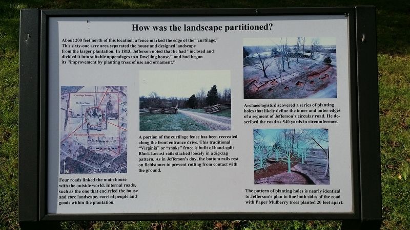
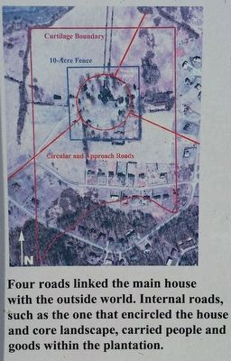
Four roads linked the main house with the outside world. Internal roads, such as the one that encircled the house and core landscape, carried people and goods within the plantation.
(center image text)
A portion of the curtilage fence has been recreated along the front entrance drive. This traditional "Virginia" or "snake" fence is built of hand-split Black Locust rails stacked loosely in a zig-zag pattern. As in Jefferson's day, the bottom rails rest on fieldstones to prevent rotting from contact with the ground.
(right-top image text)
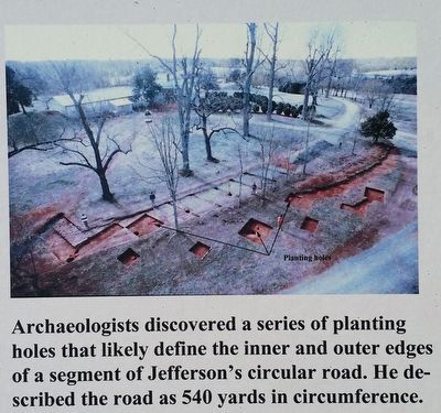
Archaeologists discovered a series of planting holes that likely define the inner and outer edges of a segment of Jefferson's circular road. He described the road as 540 yards in circumference.
(right-bottom
this page online
The pattern of planting holes is nearly identical to Jefferson's plan to line both sides of the road with Paper Mulberry trees planted 20 feet apart.
Topics. This historical marker is listed in these topic lists: Architecture • Horticulture & Forestry • Man-Made Features • Patriots & Patriotism. A significant historical year for this entry is 1805.
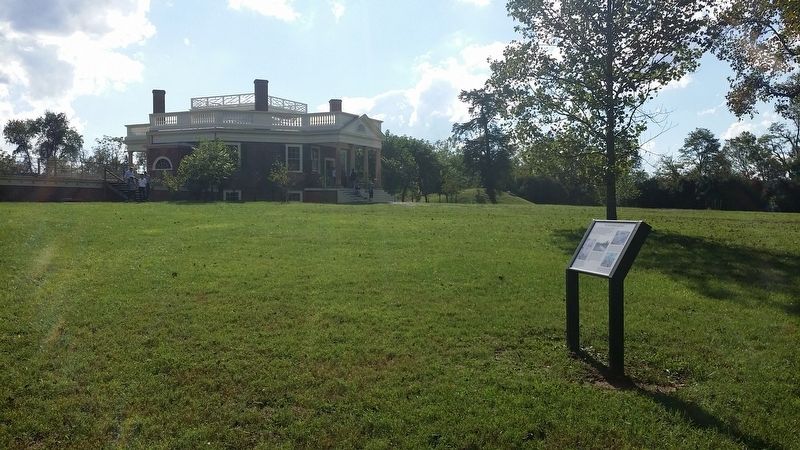
Location. This marker has been replaced by another marker nearby. It was located near 37° 20.902′ N, 79° 15.843′ W. Marker was in Forest, Virginia, in Bedford County. It could be reached from Bateman Bridge Road. Located on the grounds of Thomas Jefferson's Poplar Forest. Touch for map. Marker was in this post office area: Forest VA 24551, United States of America. Touch for directions.

Regionally, this marker was in Southwest Virginia. It was also in the American South and specifically in the Upper South. Globally, it was in North America, the Western Hemisphere, the Western World, and the Anglosphere. Historically, it found itself in what was once the territory of the Mississippian Culture, one of the original Thirteen Colonies, one of the Confederate
Photographed by Michael C. Wilcox, October 1, 2016
2. How was the landscape partitioned? Marker
Other nearby markers. At least 8 other markers are within 2 miles of this location, measured as the crow flies: "A Culture Productive of Infinite Wretchedness” (here, next to this marker); Plantation Worker Housing (within shouting distance of this marker); Poplar Forest Planting Memorandum 1812 (within shouting distance of this marker); Transforming a Plantation into a Private Retreat, 1806—1826 (about 300 feet away); Mounds Made of Ideas and Sweat (about 400 feet away); “I have this summer built a wing of offices...” (about 400 feet away); Crafting a Masterpiece, Longing for Home (about 400 feet away); Poplar Forest (approx. 1.2 miles away). Touch for a list and map of all markers in Forest.
Other markers no longer nearby. Commemorating Lewis and Clark (was about 300 feet away, measured in a direct line but has been replaced with another marker now near it); Why build the mounds? (was about 300 feet away but has been replaced with another marker now near it); Why is the lawn sunken? (was about 400 feet away but has been replaced with another marker now near it); What happened to Poplar Forest after Jefferson's death?
Photographed by Michael C. Wilcox, October 1, 2016
3. How was the landscape partitioned? Marker
Related marker. Click here for another marker that is related to this marker. New Marker At This Location titled "A Culture Productive of Infinite Wretchedness".
Photographed by Michael C. Wilcox, October 1, 2016
4. How was the landscape partitioned? Marker
Credits. This page was last revised on May 19, 2022. It was originally submitted on November 19, 2016, by Michael C. Wilcox of Winston-Salem, North Carolina. This page has been viewed 440 times since then and 13 times this year. Photos: 1, 2, 3, 4. submitted on November 19, 2016, by Michael C. Wilcox of Winston-Salem, North Carolina.
