Lockport in Lafourche Parish, Louisiana — The American South (West South Central)
Bouverans Plantation House
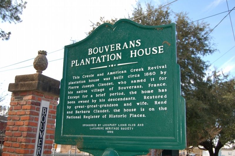
Photographed by Cajun Scrambler, November 25, 2016
1. Bouverans Plantation House Marker
Erected 1992 by Lockport Lions Club and Lafourche Heritage Society.
Topics. This historical marker is listed in these topic lists: Agriculture • Architecture • Settlements & Settlers.
Location. 29° 37.902′ N, 90° 30.487′ W. Marker is in Lockport, Louisiana, in Lafourche Parish. It is on State Highway 1 south of Jennifer Street, on the right when traveling south. Touch for map. Marker is in this post office area: Lockport LA 70374, United States of America. Touch for directions.

Regionally, this marker is in one of Louisiana’s River Parishes, in Acadiana — Cajun Country, and specifically in Bayou Country. It is also in the American South, specifically in the Deep South, and on the Gulf Coast.
this page online
Other nearby markers. At least 8 other markers are within 10 miles of this marker, measured as the crow flies: Holy Savior Cemetery (approx. 1.8 miles away); Lockport (approx. 2.2 miles away); Clotilda Plantation (approx. 3.3 miles away); Gheens Presbyterian Church (approx. 4½ miles away); Vacherie-Gheens (approx. 5.1 miles away); First American Casualty Of WW II (approx. 6½ miles away); Our Lady of the Rosary Catholic Church (approx. 8.7 miles away); Town of Bowie (approx. 9.3 miles away). Touch for a list and map of all markers in Lockport.

Photographed by Cajun Scrambler, November 25, 2016
2. Bouverans Plantation House Marker
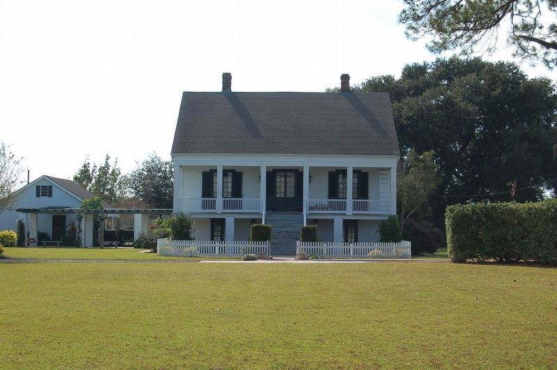
Photographed by Cajun Scrambler, November 25, 2016
3. Bouverans Plantation House
Credits. This page was last revised on December 11, 2022. It was originally submitted on November 26, 2016, by Cajun Scrambler of Assumption, Louisiana. This page has been viewed 1,362 times since then and 60 times this year. Photos: 1, 2, 3. submitted on November 26, 2016.
