Near Alexandria in Calhoun County, Alabama — The American South (East South Central)
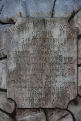
The Tallasahatchie Battle Field
Erected 1913 by Frederick Wm. Gray Chapter Daughters of the American Revolution.
Topics and series. This historical marker is listed in these topic lists: Notable Places • Wars, US Indian. In addition, it is included in the Daughters of the American Revolution, and the Former U.S. Presidents: #07 Andrew Jackson series lists. A significant historical date for this entry is October 3, 1837.
Location. 33° 47.007′ N, 85° 55.576′ W. Marker is near Alexandria, Alabama, in Calhoun County. Marker is on McCullars Lane west of County Road 73, on the left when traveling west. McCullars Lane located about 1.5 miles east of U.S. Highway 431. Touch for map. Marker is in this post office area: Alexandria AL 36250, United States of America. Touch for directions.
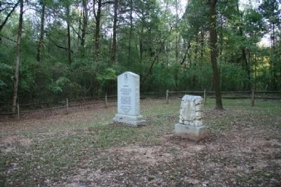
Other nearby markers. At least 8 other markers are within 8 miles of this marker, measured as the crow flies. Lincoyer (here, next to this marker); Crook Cemetery (approx. 0.4 miles away); Tallasseehatchee (approx. 2.2 miles away); Major John Pelham (approx. 4½ miles away); The Birthplace of the “Gallant Pelham” (approx. 4.6 miles away); Janney Furnace (approx. 5½ miles away); Fort Strother (approx. 7.9 miles away); Battle of “Ten Islands” (approx. 7.9 miles away). Touch for a list and map of all markers in Alexandria.
Additional commentary.
1. Location of Battle Field
According to author Donna Causey in her book "Alabama Footprints: Confrontation" (pg. 63), the town of Tallasseehatchee was located on the headwaters of the Tallasseehatchee Creek, about 2.5 miles southwest of Jacksonville, which would put it just off AL Hwy 21, across from RMC Hospital-Jacksonville. Anyone have any input as to the location of this battlefield?
— Submitted November 6, 2017, by Dr. Stephen Rowe of Jacksonville, Alabama.
Credits. This page was last revised on August 4, 2020. It was originally submitted on October 5, 2010, by Timothy Carr of Birmingham, Alabama. This page has been viewed 3,412 times since then and 116 times this year. Photos: 1, 2, 3. submitted on October 5, 2010, by Timothy Carr of Birmingham, Alabama. • Craig Swain was the editor who published this page.


