Augusta in Richmond County, Georgia — The American South (South Atlantic)
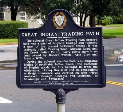
Great Indian Trading Path
During the colonial era the Path was Augusta’s lifeline of profitable Indian trade; the exchange of English goods for furs brought in from the wilderness. Along this trail and its connections a lively commerce was carried on with tribes westward through Georgia and Alabama, to Mississippi and Tennessee.
Erected 1986 by National Society Daughters of the American Colonists, George Walton Chapter.
Topics and series. This historical marker is listed in these topic lists: Colonial Era • Industry & Commerce • Native Americans • Settlements & Settlers. In addition, it is included in the Daughters of the American Colonists series list.
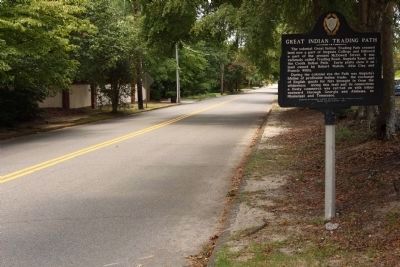
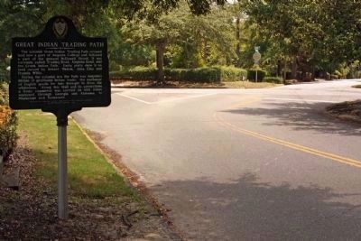
Location. 33° 28.448′ N, 82° 1.124′ W. Marker is in Augusta, Georgia, in Richmond County. Marker is at the intersection of McDowell Street and Johns Road, on the right when traveling west on McDowell Street. Touch for map. Marker is in this post office area: Augusta GA 30904, United States of America. Touch for directions.
Other nearby markers. At least 8 other markers are within walking distance of this marker. Augusta Arsenal (about 600 feet away, measured in a direct line); Augusta Arsenal 1941 (approx. 0.2 miles away); Home of Richard Henry Wilde (approx. 0.2 miles away); Bellevue (approx. 0.3 miles away); The Bell at Augusta State University (approx. 0.3 miles away); Montrose (approx. 0.3 miles away); Augusta College Three Original Arsenal Buildings (approx. 0.3 miles away); Stephen Vincent Benet House (approx. 0.3 miles away). Touch for a list and map of all markers in Augusta.
Credits. This page was last revised on June 16, 2016. It was originally submitted on August 6, 2008, by David Seibert of Sandy Springs, Georgia. This page has been viewed 1,872 times since then and 58 times this year. Photos: 1. submitted on August 6, 2008, by David Seibert of Sandy Springs, Georgia. 2, 3. submitted on August 6, 2010, by Mike Stroud of Bluffton, South Carolina. • Kevin W. was the editor who published this page.


