Dzibilchaltún in Mérida, Yucatán, Mexico — The Southeast (Yucatan Peninsula)
Edifice 44
Edificio 44
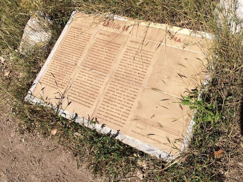
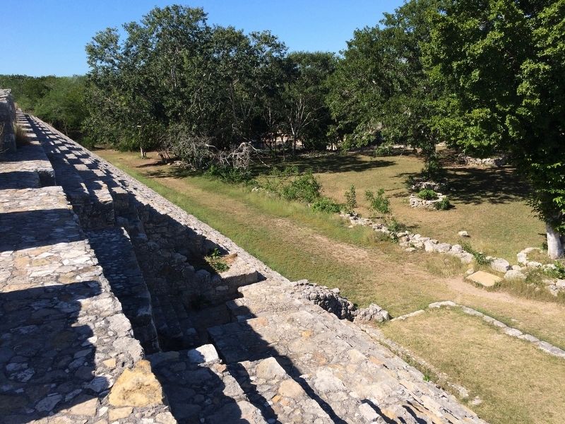
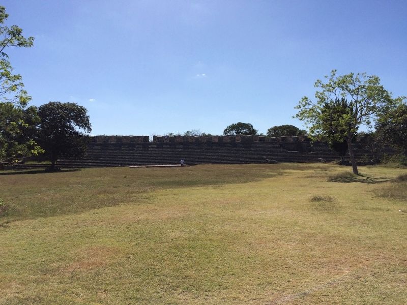
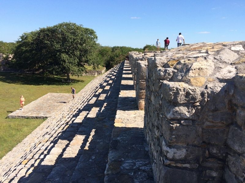
Es una estructura de gran volumen constructivo; mide 130 m. de largo y tiene una escalinata al frente, quizá la más larga de Mesoamérica. Presenta cuatro épocas constructivas: al oeste se encuentra la primera, que finaliza con una esquina redondeada hacia la parte central; al este se hallan los testimonios de la segunda época, que cubrió un edificio menor (la Subestructura 44); tiene un agregado mayor al este y otro menor que envolvió el edificio, principalmente por la parte posterior, donde se aprecian cinco escaleras remetidas. Fue utilizado durante el Clásico Tardío y el Terminal (600-1000 d.C.) y su función estuvo ligada a la Plaza Central, lugar desde donde cientos de espectadores contemplaban o participaban en los rituales.
Maya-Yucateco:
Na’jil 44.
Lela’ jump éel najil jach nojoch; ku p’isik 130 metros u chowakil yéetel yaan ti jump’éel tu’ux u na’akal máak tu táan, mii u maas chowakil Mesoamérica. Yaan ti’ kamp’éel u k’iinililo’ob u meentpajlil; tu chik’inile’ ti’ yaan u yáaxil, ku ts’o’okol yéetel jump’éel ti’its wóolista’an tu chúumukil; tu lak’inile’ tya’an u ka’ap’éelil k’iinil, lela’ tu pixaj jump’éel chichan naj (le kaabal paak’il 44); yaan ti’ jump’éel nojoch tsaayil ti’ tu lak’inil yéetel uláak’ chichan tu to’aj le pak’ilo’, tu paachil, tu’ux ku yila’al jo’op’éel eebo’ob oksa’ano’ob. Meyajnaj ti’ Clásico yéetel le Terminalo’ (600 tak 1000 ts’o’okol ki’ichkelem yuum), u meyaje’ láayli’ je’ex le chúumuk k’iiwikilo’, kúuchil kitak tu’ux ya’ab máako’ob tu yilajo’ob wa tu beetajo’ob le k’ultajo’obo’.
I. Edifice 44
It is a structure with great constructive volume, 130 mts long and, at the front, probably the longest series of steps in Mesoamerica. It shows four different periods of construction. The first is found to the West, terminating in a rounded corner facing towards the Central Square. Remnants of a second period are found to the East which cover a smaller building (Substructure 44). It has a larger addition on the further Eastern side and another smaller one which covers the building, mainly on the latter part, where one can observe five enclosed steps. It was in use during the Late Classic and Terminal periods (600-1000 A.D.) and was closely related to the function of the Central Square, where hundreds of spectators would look upon or participate in the rites held there.
Erected by Instituto Nacional de Antropología e Historia (INAH).
Topics. This historical
marker is listed in these topic lists: Anthropology & Archaeology • Architecture • Native Americans.
Location. 21° 5.431′ N, 89° 35.845′ W. Marker is in Dzibilchaltún, Yucatán, in Mérida. The marker is located about 100 meters to the right after the entrance to the Dzibilchaltun Archaeological Zone, at the southern base of Edifice 44. The park is off the road towards the small village of Dzilbilchaltun, to the east some 20 km north of Mérida on the Mérida-Progeso Highway (Hwy. 261). Touch for map. Marker is in this post office area: Dzibilchaltún YU 97300, Mexico. Touch for directions.
Other nearby markers. At least 8 other markers are within walking distance of this marker. Central Square (within shouting distance of this marker); The Open Chapel (within shouting distance of this marker); Structure 36 (about 120 meters away, measured in a direct line); Substructure 38 (about 150 meters away); Dzibilchaltún Archaeological Site (approx. 0.3 kilometers away); Sacbe 1 (approx. 0.3 kilometers away); The Habitational Complex (approx. 0.4 kilometers away); Adjoining Rooms (approx. 0.7 kilometers away). Touch for a list and map of all markers in Dzibilchaltún.
Credits. This page was last revised on October 14, 2022. It was originally submitted on January 29, 2017, by J. Makali Bruton of Accra, Ghana. This page has been viewed 240 times since then and 21 times this year. Photos: 1, 2, 3, 4. submitted on January 29, 2017, by J. Makali Bruton of Accra, Ghana.


