Near Dickerson in Montgomery County, Maryland — The American Northeast (Mid-Atlantic)
White's Ford
A Civil War Crossing and a Desperate Escape
— Chesapeake and Ohio Canal National Historical Park —
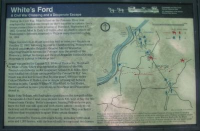
Major General J.E.B. Stuart used this ford to cross into Virginia on October 12, 1862, following his raid to Chambersburg, Pennsylvania. Federal cavalry under Brigadier General Alfred Pleasonton, expecting Stuart to recross the Potomac near the mouth of the Monocacy, rushed his troops and those of Brigadier General George Stoneman to attempt to intercept him.
Stuart was guided by Captain B.S. White of Poolesville, Maryland, to White's Ford, which was defended by 200 men of the 99th Pennsylvania Infantry under Lieutenant Colonel E.R. Biles. They were bluffed out of their strong position by Colonel W.H.F. Lee. Stuart was shocked to learn that his rear guard, 400 men under Colonel Matthew C. Butler, was in danger of being left behind. Sending an aide, Captain William W. Blackford, to find Butler, Stuart's position became precarious as Stoneman and Pleasonton closed in.
Major John Pelham, who had taken a position on the towpath of the Chesapeake & Ohio Canal, near the present Lock #26, kept at bay the 8th Pennsylvania Cavalry. Butler's troopers, hearing Pelham's one gun, knew the ford was still open and with drawn sabers - ready to cut their way out if necessary - raced toward the ford. They reached it with less than ten minutes to spare from certain disaster.
Stuart returned to Virginia with much booty, including 5,000 small arms and 1,200 horses, with the loss of only two men and two horses.
Erected by National Park Service, U.S. Department of the Interior.
Topics and series. This historical marker is listed in these topic lists: War, US Civil • Waterways & Vessels. In addition, it is included in the Chesapeake and Ohio (C&O) Canal series list. A significant historical month for this entry is July 1858.
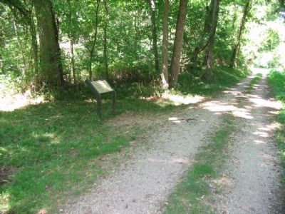
Location. 39° 11.293′ N, 77° 28.4′ W. Marker is near Dickerson, Maryland, in Montgomery County. Marker can be reached from Martinsburg Road, on the right when traveling south. Located south of Lock 26, on the Chesapeake and Ohio Canal towpath. The marker is best reached from the parking area in the Dickerson Conservation Park. Touch for map. Marker is in this post office area: Dickerson MD 20842, United States of America. Touch for directions.
Other nearby markers. At least 8 other markers are within 2 miles of this marker, measured as the crow flies. A different marker also named White's Ford (approx. half a mile away); Early Crosses At White's Ford (approx. half a mile away in Virginia); Lee Crosses Into Maryland (approx. half a mile away in Virginia); The Monacan Confederacy and Culture (approx. half a mile away in Virginia); Linden Farm (approx. 1½ miles away); Seneca Stone Barn (approx. 1.6 miles away); a different marker also named White’s Ford (approx. 1.7 miles away); Warren Historic Site (approx. 1.7 miles away). Touch for a list and map of all markers in Dickerson.
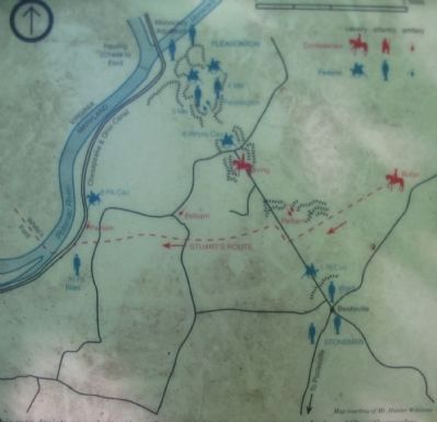
More about this marker. On the right side of the marker is a map of the tactical situation at the end of Stuart's Raid. This map depicts several situations: first, a brief initial contact between Irving of Stuart's Cavalry and Pleasanton; second, the screening movements of the horse artillery under Pelham as Stuart sought to cross White's Ford; and a third, Stoneman's reserve brigade under Ward at Beallsville. As Ward moved into position, most of Stuart's cavalry had crossed the Potomac except for the rear guard under Butler. It was between these forces that Butler slipped through on his way to the river crossing.
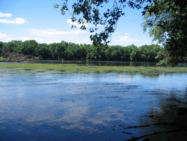
Photographed By Craig Swain, August 9, 2008
4. White's Ford
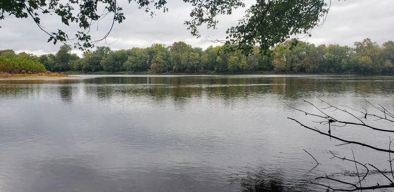
The Ford was located at the north end of Mason Island, about two tenths of a mile south of the marker location. The north tip of the island is within the tree snags on the left of this photo. The fishermen in the distance are in about the middle of the river.
Credits. This page was last revised on October 29, 2020. It was originally submitted on August 11, 2008, by Craig Swain of Leesburg, Virginia. This page has been viewed 2,638 times since then and 34 times this year. Photos: 1, 2, 3, 4. submitted on August 11, 2008, by Craig Swain of Leesburg, Virginia. 5. submitted on October 19, 2020, by Bradley Owen of Morgantown, West Virginia.
