Pisté in Tinum, Yucatán, Mexico — The Southeast (Yucatan Peninsula)
The Sacred Cenote
Cenote Sagrado
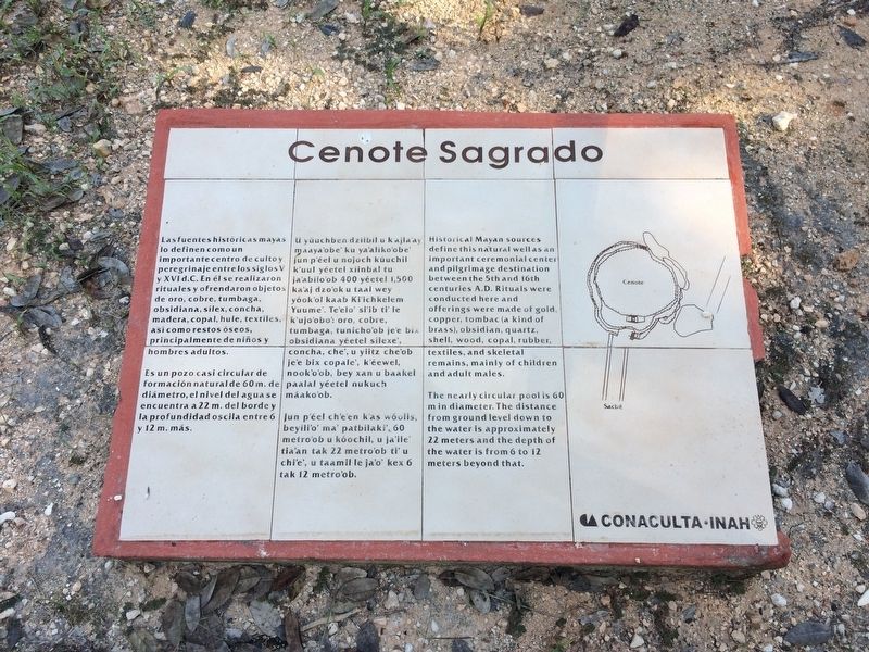
Las fuentes históricas mayas lo definen como un important centro de culto y peregrinaje entre los siglos V y XVI d.C. En él se realizaron rituales y ofrendaron objetos de oro, cobre, tumbaga, obsidiana, sílex, concha, madera, copal, hule, textiles así como restos óseos, principalmente de niños y hombres adultos.
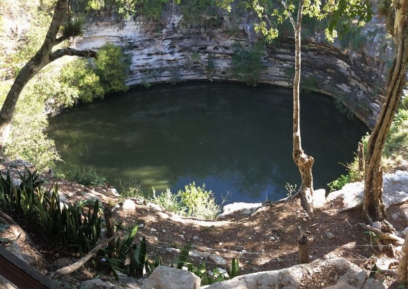
Es un pozo casi circular de formación natural de 60 m. de diámetro, el nivel de agua se encuentra a 22 m. del borde y la profundidad oscila enter 6 y 12 m. más.
Maya-Yucateco:
U yúuchben dzíibil u k’ajla’aj maaya’obe’ ku ya’aliko’obe’ jun p’éel u nojoch kúuchil k’uul yéetel xíinbal tu ja’abilo’ob 400 yéetel 1,500 ka’aj dzo’ok u taal wey yóok’ol kaab Ki’ichkelem Yuume’. Te’elo’ si’ib ti’ le k’ujo’obo’: oro, cobre, tumbaga, tunicho’ob je’e bix obsidian, yéetel sílexe, concha, che’, u yiitz che’ob je’e bix copale’, k’éewel, nook’o’ob, bey xan u baakel paalal yéetel nukuch máako’ob.
Jun p’éel ch’e’en k’as wóolis, beyili’o’ ma’ patbilaki’, 60 metro’ob u kóochil, u ja’ile’ tia’an tak 22 metro’ob ti’u chi’e’, u taamil le ja’o’ kex 6 tak 12 metro’ob.
English:
Historical Mayan sources define this natural well as an important ceremonial center and pilgrimage destination between the 5th and 16th centuries A.D. Rituals were conducted here and offerings were made of gold, copper, tombac (a kind of brass), obsidian, quartz, shell, wood, copal, rubber, textiles, and skeletal remains, mainly of children and adult males.
The nearly circular pool is 60 m in diameter. The distance from ground level down to the water is approximately 22 meters and the depth of the water is from 6 to 12 meters beyond that.
Erected by Consejo Nacional para la Cultura y las Artes de México (CONACULTA)-INAH.
Topics. This historical marker is listed in these topic lists: Anthropology & Archaeology • Native Americans.
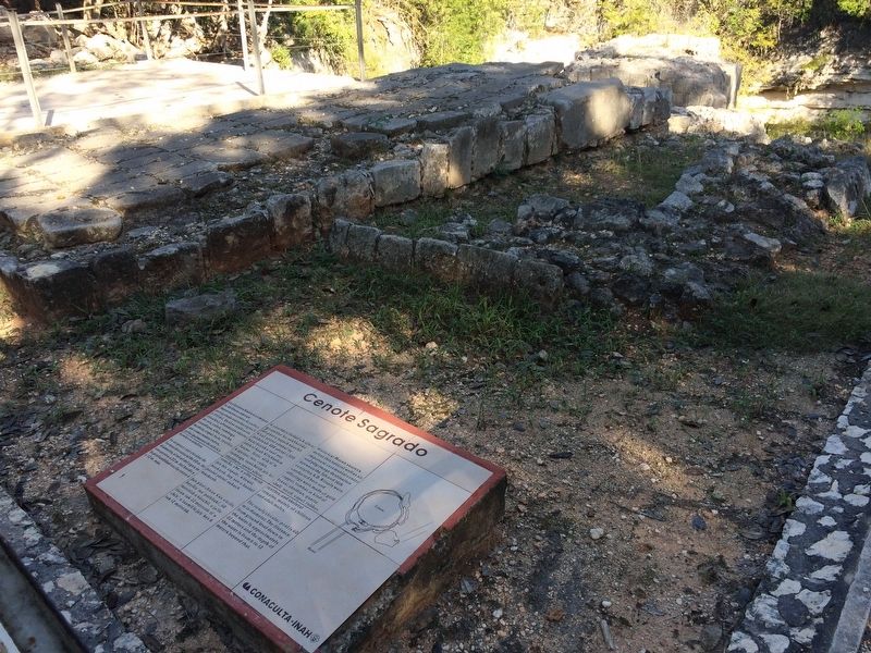
Location. 20° 41.238′ N, 88° 34.064′ W. Marker is in Pisté, Yucatán, in Tinum. Marker can be reached from Carretera Costera de Golfo (Route 180). The marker is on the southern rim of the cenote at the Chichen Itzá Archaeological Site. Touch for map. Marker is in this post office area: Pisté YU 97751, Mexico. Touch for directions.
Other nearby markers. At least 8 other markers are within walking distance of this marker. The Platform of Eagles and Jaguars (approx. 0.4 kilometers away); Temple of the Large Tables (approx. 0.4 kilometers away); The Great Ball Court (approx. 0.4 kilometers away); The Temple of the Warriors (approx. 0.4 kilometers away); The Castle or Temple of Kukulcán (approx. half a kilometer away); The Plaza of the Thousand Columns
(approx. half a kilometer away); The Northern Colonnade (approx. 0.6 kilometers away); The Colonnade of the Northeastern Corner (approx. 0.6 kilometers away). Touch for a list and map of all markers in Pisté.
Credits. This page was last revised on March 7, 2017. It was originally submitted on March 7, 2017, by J. Makali Bruton of Accra, Ghana. This page has been viewed 163 times since then and 10 times this year. Photos: 1, 2, 3, 4. submitted on March 7, 2017, by J. Makali Bruton of Accra, Ghana.


