Poncey-Highland in Atlanta in Fulton County, Georgia — The American South (South Atlantic)
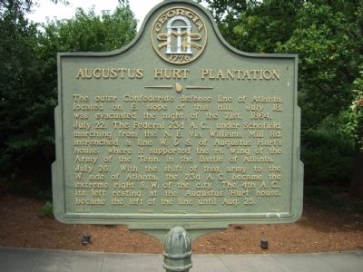
Augustus Hurt Plantation
The outer Confederate defense line of Atlanta, located on E. slope of this hill, July 18, was evacuated the night of the 21st, 1864. July 22. The Federal 23d A.C., under Schofield, marching from the N.E. via Williams Mill Rd. intrenched a line W. & S. of Augustus Hurt’s house, where it supported the rt. wing of the Army of the Tenn. in the Battle of Atlanta. July 26. With the shift of that army to the W. side of Atlanta, the 23d A.C. became the extreme right S.W. of the city. The 4th A.C., its left resting at the Augustus Hurt house, became the left of the line until Aug. 25.
Erected 1956 by Georgia Historical Commission. (Marker Number 060-80.)
Topics and series. This historical marker is listed in this topic list: War, US Civil. In addition, it is included in the Georgia Historical Society series list. A significant historical month for this entry is July 1818.
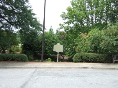
Location. 33° 46.015′ N, 84° 21.341′ W. Marker is in Atlanta, Georgia, in Fulton County. It is in Poncey-Highland. Marker can be reached from the intersection of East Freedom Parkway and Carter Center Entrance. This marker is located in the parking lot of the Carter Presidential Center near the rose garden. Touch for map. Marker is in this post office area: Atlanta GA 30307, United States of America. Touch for directions.
Other nearby markers. At least 8 other markers are within walking distance of this marker. Augustus Hurt House (a few steps from this marker); The Battles for Atlanta (within shouting distance of this marker); Sightless Among Miracles (within shouting distance of this marker); Stanley's Sector (approx. 0.2 miles away); National NuGrape Company (approx. 0.4 miles away); The March to the Sea (approx. half a mile away); The DeGress Battery (approx. half a mile away); The Troup Hurt House (approx. 0.6 miles away). Touch for a list and map of all markers in Atlanta.
More about this marker. This marker may have been moved as recently as the mid-1990s since the Carter Center construction changed the routes of several roads, including Williams Mill Road and Ralph McGill Boulevard.
Credits. This page was last revised on March 16, 2023. It was originally submitted on August 15, 2008, by Felch Dumas of Decatur, Georgia. This page has been viewed 1,534 times since then and 52 times this year. Photos: 1, 2. submitted on August 15, 2008, by Felch Dumas of Decatur, Georgia. • Craig Swain was the editor who published this page.

