Near Spotsylvania Courthouse in Spotsylvania County, Virginia — The American South (Mid-Atlantic)
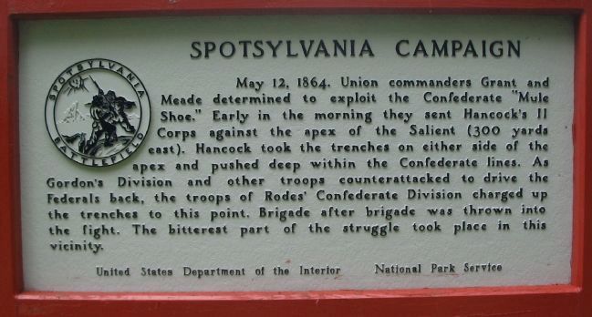
Spotsylvania Campaign
Erected by United States Department of the Interior - National Park Service.
Topics. This historical marker is listed in this topic list: War, US Civil. A significant historical date for this entry is May 12, 1864.
Location. 38° 13.401′ N, 77° 36.007′ W. Marker is near Spotsylvania Courthouse, Virginia, in Spotsylvania County. Marker can be reached from Grant Drive, on the left when traveling east. Located at tour stop three (Bloody Angle) on the driving tour of Spotsylvania Battlefield unit of the Fredericksburg and Spotsylvania National Military Park. The marker is a short walk from the parking area, on the Bloody Angle hiking trail. Touch for map. Marker is in this post office area: Spotsylvania VA 22553, United States of America. Touch for directions.
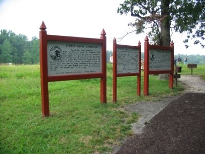
Other nearby markers. At least 8 other markers are within walking distance of this marker. A different marker also named Spotsylvania Campaign (here, next to this marker); McGowan's Brigade (a few steps from this marker); 49th New York Infantry (a few steps from this marker); 15th Regiment New Jersey Volunteers (within shouting distance of this marker); Aftermath (within shouting distance of this marker); The Confederate Earthworks (within shouting distance of this marker); Struggle for the Bloody Angle (within shouting distance of this marker); Bloody Angle, Crowded Ravine (within shouting distance of this marker). Touch for a list and map of all markers in Spotsylvania Courthouse.
Related markers. Click here for a list of markers that are related to this marker. Battle of Spotsylvania - Tour Stop - the Bloody Angle
Also see . . . Bloody Angle. National Park Service website entry (Submitted on August 15, 2008, by Craig Swain of Leesburg, Virginia.)
Photographed By Craig Swain, July 6, 2008
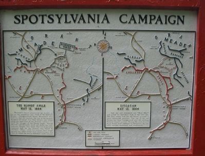
2. Campaign Map
Left side: The Bloody Angle May 12, 1864
Hancock's thrust penetrated the Salient as far as the secondary line south of the McCoull House. Counterattack drove Hancock's men back to, but not beyond, the top of the Salient. Wright's VI Corps was then thrown into the action along the west face of the Salient, and here ensued the struggle of the Bloody Angle. Though Warren and Burnside could not shake the Confederate flanks, Lee knew that his desperately renewed hold on the Salient was bound to weaken. Thus, while his soldiers here fought grimly on, other troops were constructing a new line to which the weary defenders could retreat.
Right side: Situation May 13, 1864
Lee has now evacuated the "Mule Shoe" and pulled its defenders back to the new line. The new center and the old flanks present a more defensible position. The top of the old Salient has been incorporated into the shifting Federal trench system. During the next several days Grant will continue to maneuver by the left, farther eastward and southward.
Double click on the photograph to view the map details.
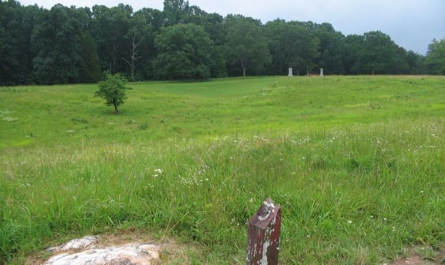
Photographed By Craig Swain, July 6, 2008
4. Federal Attack
Looking from across the open field opposite the marker location. The red backs of the markers can be seen between the two monuments in the distant right. Initially Federals from Birney's and Mott's Divisions advanced across the fields here. Later in the day elements of Wright's Corps were sent across here to reinforce the gains in the Mule Shoe.
Credits. This page was last revised on December 17, 2022. It was originally submitted on August 15, 2008, by Craig Swain of Leesburg, Virginia. This page has been viewed 1,231 times since then and 12 times this year. Photos: 1, 2, 3, 4. submitted on August 15, 2008, by Craig Swain of Leesburg, Virginia. 5. submitted on August 25, 2008, by Craig Swain of Leesburg, Virginia.
