Near Brandy Station in Culpeper County, Virginia — The American South (Mid-Atlantic)
The Hold at Mountain Run
Death of Farley and Wounding of Butler
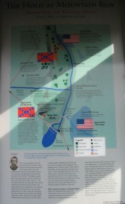
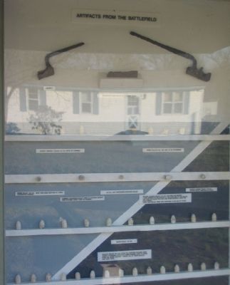
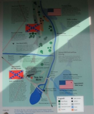
This map prepared from the first hand account of Col. Butler, other historians, and the personal account of the family, who in the early 1950s cleared, leveled and ditched this bottom for cultivation, disturbing the soil for the first time since the Civil War. The shallow trench, part of an existing ditch, and the earthwork in front of the ford was leveled at this time. The bottomland flooded a few days after the clearing operation and when the water receded, with much erosion, there appeared many exposed bullets whose location told the story of what had happened here in 1863. More than 50 bullets have been found in front of and on the hillside behind the trench, also pieces of saber blade, broken bayonet and other iron not identified. A small number of bullets have been found near the stream edge at the crossing site. No background on the bottomland on this site of the stream, to stop stray bullets fired from the trench. Major Lipscomb (2nd SC Cav.) in his official report stated that the cannon never crossed Mountain Run. This would indicate that early in the day someone made the decision to create a defensive line using the barrier Mountain Run and would explain the time element needed to build the earthworks.
Who ordered the defense at Mountain Run?
Butler and Wickham didn't know the whereabouts of the cannon and certainly Lipscomb would have mentioned it if he so ordered. So it would seem obvious then that since Stuart had asked Farley to take the 4th to Stevensburg, that it was probably Farley who early in the day knew that the natural barrier (Mountain Run) would be the only place a small number of men could turn back or delay a force as large as Duffie's. Farley would have been right as Duffie easily pushed through Butler's force east of Stevensburg but was stopped at Mountain Run. Duffie's failure to support Gregg - because of the action here - was decisive in allowing Stuart to hold his precarious position on Fleetwood Hill. Pleasonton did not withdraw his force until after Duffie failed to appear. The fighting here was as critical, for Stuart, as any engagement during the Battle of Brandy Station.
Topics. This historical marker is listed in this topic list: War, US Civil. A significant historical date for this entry is June 9, 1863.
Location. 38° 27.352′ N, 77° 54.027′ W. Marker is near Brandy Station, Virginia, in Culpeper County. Marker is on Stevensburg Road near County Route 663, on the right when traveling north. Located at a kiosk at a Culpeper County park on Stevensburg Road. Touch for map. Marker is at or near this postal address: 18063 Stevensburg Road, Brandy Station VA 22714, United States of America. Touch for directions.
Other nearby markers. At least 8 other markers are within 2 miles of this marker, measured as the crow flies
Photographed By Craig Swain, January 5, 2008
2. Close up of the Map
Key points, from top to bottom, indicated on the map are the sites of the Trenches and Ditch, Hansborough Ridge, Duffie's Artillery, Pleasonton Troops, Mountain Run, Non Battle Bullets, Butler's Cannon, Norman Mill Ford and Dam Crossing, 2nd South Carolina Cavalry, 4th Virginia Cavalry, and the site where Butler and Farley were shot.
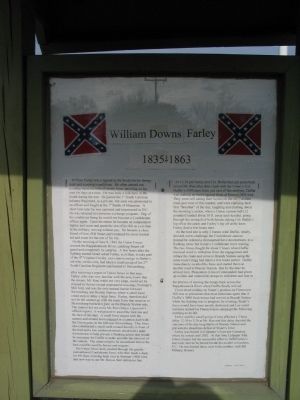
More about this marker. The marker displays a map of the area, as described in the text, and a portrait of Farley.
Regarding The Hold at Mountain Run. This is one of several markers interpreting the Battle of Brandy Station and the winter encampments of 1863-64 in Culpeper County. See the Battle of Brandy Station Virtual Tour by Markers linked below for additional related markers.
Also see . . .
1. Battle of Brandy Station. National Park Service summary of the battle, including a driving tour. (Submitted on January 21, 2008, by Craig Swain of Leesburg, Virginia.)
2. Battle of Brandy Station Virtual Tour by Markers. A set markers that document the Battle of Brandy Station, June 9, 1863, and the Winter Encampment of 1863-64. Note the order of appearance is geographic and not chronologically aligned to the battle. (Submitted on January 21, 2008, by Craig Swain of Leesburg, Virginia.)
Additional commentary.
1. William Downs Farley
Farley enlisted early in the war with the 1st South Carolina Cavalry. Commissioned as an officer, he would fight at 1st Manassas. Later he was captured, and as terms of his exchange could not serve as an officer again. Flaunting this restriction, Farley took up service as a scout working directly for Gen. J.E.B. Stuart, as a civilian without pay. Farley became a dependable scout, and to a degree, adviser to Stuart, serving on Stuart's famous ride around McClellan in the 1862 Peninsula Campaign. Here at Brandy Station, Stuart entrusted Farley, technically not in uniform, with the command of a detachment from the 4th Virginia Cavalry and a cannon dispatched to reinforce Col. Matthew C. Butler's 2nd South Carolina Cavalry.
— Submitted January 21, 2008, by Craig Swain of Leesburg, Virginia.
Photographed By Craig Swain, January 5, 2008
4. William Downs Farley
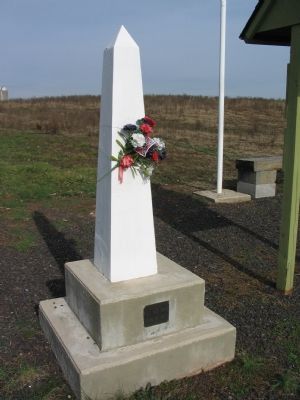
Next to this is a kiosk station detailing the life of Farley and his contribution to the battle. He was killed, at about the same time Butler was wounded, by an artillery shell. The shell severed both of Farley's legs, and killed the horse he was riding. He would die on the field and be buried in Culpeper.
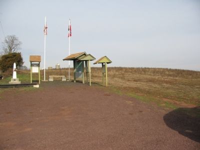
While too long to reproduce for a proper marker entry, this station is likely to be replaced by a formal marker in the future.
While too long to reproduce for a proper marker entry, this station is likely to be replaced by a formal marker in the future.
Photographed By Craig Swain, January 5, 2008
7. Artillery Position and Defensive Line
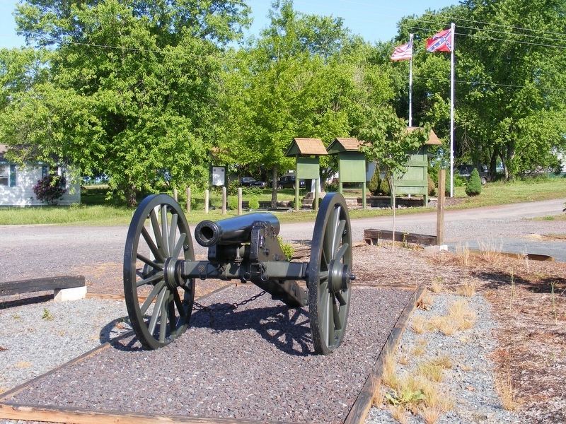
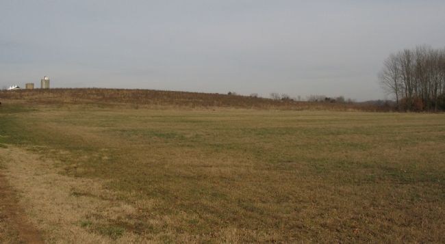
From this rise, the artillery piece was able to cover the crossing of Mountain Run at Norman's Mill. Later, in the fall and winter after the Battle of Brandy Station, the Federal II Corps camped in this vicinity, and may well have contributed to the artifacts, particularly bullets, found at this site.
Credits. This page was last revised on May 22, 2017. It was originally submitted on January 21, 2008, by Craig Swain of Leesburg, Virginia. This page has been viewed 2,891 times since then and 42 times this year. Last updated on May 20, 2017, by Pete Payette of Orange, Virginia. Photos: 1, 2, 3, 4, 5, 6, 7. submitted on January 21, 2008, by Craig Swain of Leesburg, Virginia. 8. submitted on May 10, 2017, by Pete Payette of Orange, Virginia. 9, 10, 11. submitted on May 20, 2017, by Pete Payette of Orange, Virginia. • Bernard Fisher was the editor who published this page.
