Yorktown in York County, Virginia — The American South (Mid-Atlantic)
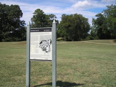
Redoubts 9 and 10
1781 Siege of Yorktown
— Colonial National Historical Park —
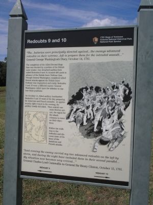
“The … batteries were principally directed against … the enemys advanced redoubts on their extreme … left to prepare them for the intended assault …”
General George Washington’s Diary, October 14, 1781.
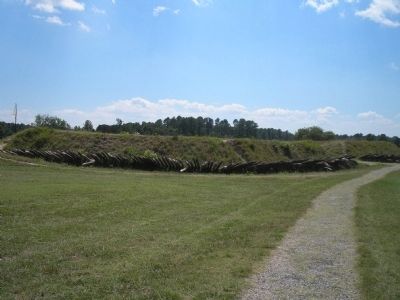
The completion of the Allied Second Siege Line was blocked by a portion of the British outer works – two detached earthen forts called Redoubts 9 and 10, located 400 yards in advance of the British Inner Defense Line. Though General Washington considered allied frontal attacks against the British Inner Defense Line impractical and costly, Redoubts 9 and 10 were a different matter. General Washington called upon the infantry to capture these positions.
On October 14, Allied artillery bombarded Redoubts 9 and 10 most of the day, preparing for American and French assaults. At approximately eight o’clock in the evening, the artillery briefly fell silent. Then several cannons fired in unison, the signal for the attack columns to move on their objectives.
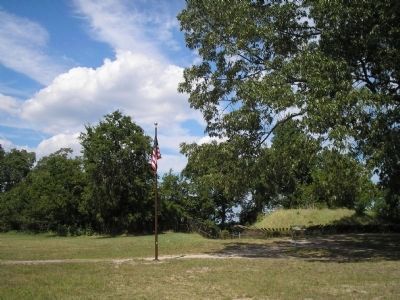
Follow the walkway to the redoubts and discover more of the story of the American and French attacks.
“Last evening the enemy carried my two advanced redoubts on the left by storm, and during the night have included them in their second parallel … My situation now becomes very critical …”
General Charles Lord Cornwallis to General Sir Henry Clinton, October 15, 1781.
← →
Erected by Colonial National Historical Park, National Park Service.
Topics and series. This historical marker is listed in these topic lists: Notable Events • Notable Places • War, US Revolutionary. In addition, it is included in the Former U.S. Presidents: #01 George Washington series list. A significant historical date for this entry is October 14, 1780.
Location. 37° 13.689′ N, 76° 29.842′ W. Marker is in Yorktown, Virginia, in York County. Marker is on Ballard Street (Virginia Route 238), on the left when traveling south. Marker is located on the Yorktown Battlefield in Colonial National Historical Park, at stop D on the Battlefield Tour. Touch for map. Marker is in this post office area: Yorktown VA 23690, United States of America. Touch for directions.
Other nearby markers. At least 8 other markers are within walking distance of this marker. The Second Siege Line (a few steps from this marker); Grand American Battery (within shouting distance of this marker); Redoubt 9 (within shouting distance of this marker); Time, Tide and Erosion (about 300 feet away, measured in a direct line); Capture of Redoubt No. 10 (about 400 feet away); Redoubt 10 (about 400 feet away); French Soldiers and Sailors (about 400 feet away); Communicating Trench (about 400 feet away). Touch for a list and map of all markers in Yorktown.
More about this marker. The right of the marker contains a picture of the storming of one of the redoubts. The left of the marker features a map, titled “Plan for the Storming of the British Redoubts,” showing the fortification at Yorktown.
Also see . . .
1. Yorktown Battlefield. National Park Service. (Submitted on August 28, 2008, by Bill Coughlin of Woodland Park, New Jersey.)
2. The Battle of Yorktown. The Patriot Resource website. (Submitted on August 28, 2008, by Bill Coughlin of Woodland Park, New Jersey.)
3. The Battle of Yorktown 1781. A British perspective of the Battle of Yorktown from BritishBattles.com. (Submitted on August 28, 2008, by Bill Coughlin of Woodland Park, New Jersey.)
Credits. This page was last revised on June 16, 2016. It was originally submitted on August 28, 2008, by Bill Coughlin of Woodland Park, New Jersey. This page has been viewed 1,754 times since then and 34 times this year. Photos: 1, 2, 3, 4. submitted on August 28, 2008, by Bill Coughlin of Woodland Park, New Jersey.


