Yorktown in York County, Virginia — The American South (Mid-Atlantic)
News of Victory
Colonial National Historical Park
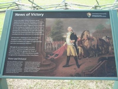
On November 3, Washington’s aide, Colonel David Humphreys (right), arrived in Philadelphia and presented to members of Congress 27 regimental flags and colors surrendered at Yorktown.
Although the war lasted another two years, the victory at Yorktown brought forth peace negotiations. With the signing of the Treaty of Paris on September 3, 1783, Great Britain formally recognized the independence of the United States.
Victor and Defeated
More than 7,000 British and German prisoners fell into the hands of the Allied forces following the surrender. On October 21, 1781, all able-bodied prisoners marched from Yorktown toward internment camps located in Virginia and Maryland and ultimately Pennsylvania. Though some prisoners escaped and others died, most remained in the camps until the end of the war. Cornwallis was granteed parole, as were many of his officers. He returned to England expecting disgrace but instead received overwhelming support. King George III said he did not “lay anything at the charge of Lord Cornwallis.”
Erected by Colonial National Historical Park, National Park Service.
Topics. This historical marker is listed in these topic lists: Notable Events • War, US Revolutionary. A significant historical month for this entry is September 1781.
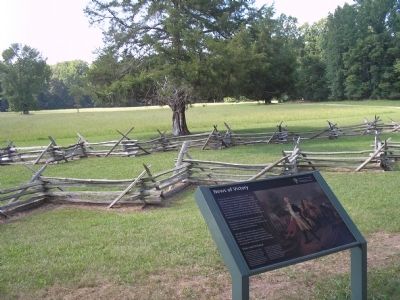
Location. 37° 12.542′ N, 76° 30.283′ W. Marker is in Yorktown, Virginia, in York County. Marker can be reached from Historical Tour Drive, on the right when traveling south. Marker is located on the Yorktown Battlefield in Colonial National Historical Park, at stop F on the Battlefield Tour. Touch for map. Marker is in this post office area: Yorktown VA 23690, United States of America. Touch for directions.
Other nearby markers. At least 8 other markers are within walking distance of this marker. In Solemn Step (within shouting distance of this marker); Brotherhood Preserved (within shouting distance of this marker); Ground Your Firelocks! (about 300 feet away, measured in a direct line); Trophies of War (about 300 feet away); Surrender Road (about 400 feet away); Surrender Field (about 400 feet away); American Field Hospital (approx. 0.3 miles away); Marquis de Lafayette and His Division (approx. 0.3 miles away). Touch for a list and map of all markers in Yorktown.
More about this marker. The right of the marker features a painting of Colonel David Humphreys arriving in Philadelphia with captured colors. The picture was supplied by the Yale University Art Gallery.
Also see . . .
1. Yorktown Battlefield. National Park Service. (Submitted on August 29, 2008, by Bill Coughlin of Woodland Park, New Jersey.)
2. The Battle of Yorktown. The Patriot Resource website. (Submitted on August 29, 2008, by Bill Coughlin of Woodland Park, New Jersey.)
3. The Battle of Yorktown 1781. A British perspective of the Battle of Yorktown from BritishBattles.com. (Submitted on August 29, 2008, by Bill Coughlin of Woodland Park, New Jersey.)
Credits. This page was last revised on June 16, 2016. It was originally submitted on August 29, 2008, by Bill Coughlin of Woodland Park, New Jersey. This page has been viewed 1,036 times since then and 21 times this year. Photos: 1, 2, 3. submitted on August 29, 2008, by Bill Coughlin of Woodland Park, New Jersey.


