Hilo in Hawaii County, Hawaii — Hawaiian Island Archipelago (Pacific Ocean)
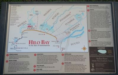
Hilo Bay: In the days of Kamehameha
(Legend to Points of Interest to on the Hilo Bay map:)
➊ Kānoe Heiau Kānoe Heiau was one of six major lauakini or sacrificial heiau on the island of Hawai'i dating back to ancient times.
➋ Naha Stone A large, elongated stone was located at Piano Heiau near the current State Library. The stone was associated with the Naha line of chiefs and was used to show prowess as a warrior and to foretell the future of royal born children. Kamehameha as said to have lifted the stone as a young warrior adding to his reputation as a great future leader.
➌ Ahupua'a There were 7 ahupua'a or land divisions which began at Hilo Bay and extended into the upper forests. Much of the early settlement of Hilo took place near the coast with agricultural fields scattered along the slopes. 'Auwai or ditches were dug from the upland springs to bring water to the settlement for drinking and farming.
➍ Hilo Palikū A region north of Hilo with high sea cliffs.
➎ Hilo One Region of Hilo fronting the sandy beach of the bay.
➏ Kaipalaoa This was the location of a chiefly compound near the mouth of the Wailuku River where Kamehameha and other ali'i were known to reside. It was the site of an important heiau. Today it is the name of a boat landing near the lighthouse.
➐ Waiolama A wetland area that was fed by springs and intermittent stream flow from Alenaio Stream. The wetlands were transformed into rich fishponds and wetland agriculture known as kipi. Reeds and mud were mounded into floating islands which were planted with kalo (taro) and other crops.
➑ Hilo Hanahahi Region south of Hilo Bay named after an early chief and known for is groves of hala (pandamus).
➒ Pi'opi'o Pi'opi'o is an 'ili (smaller land division) of the Waiākea ahupua'a and considered an ipukai or food bowl because its people controlled the rich "royal ponds." of the Wailoa River estuary. The 'ili was a favored place of chiefly residents from ancient times. Kamehameha I's father, Keōua, was with the court of the paramount chief Alapa'inu when he died at Pi'opi'o in the 1750s. Upon Kamehameha's death, Pi'opi'o went to his wife, Ka'ahumanu. It was the site of a residence for Princes Ruth Ki'ilikōlani, the governess of Hawai'i in the 1860s and became part of the Estate of Bernice Pauahi Bishop in 1883. Pi'opi'o was traded to the Territory of Hawai'i in 1948 as part of the post-1946 tsunami redevelopment of the Hilo Bayfront.
➓ Moku'ola Moku'ola was an important wahi pana or special place in Hilo. It was a pu'uhonua or place of refuge where Hawaiians sought sanctuary from punishment for their transgressions. The island was a place for healing rituals through the early 20th Century. Today, Moku'ola is referred to as "Coconut Island."
⓫ Maka'okū This 'ili contained the Waihonu fishponds known for their turtles. A heiau dedicated at Maka'okū was dedicated to the god Kū. A portion of this area is now Queen Lili'uokalani Park.
Topics. This historical marker is listed in these topic lists: Animals • Anthropology & Archaeology • Asian Americans • Waterways & Vessels. A significant historical year for this entry is 1883.
Location. 19° 43.248′ N, 155° 4.602′ W. Marker is in Hilo, Hawaii, in Hawaii County. Marker is on Mamalahoa Highway (Hawaii Route 19) near Pauahi Street, on the right when traveling east. Touch for map. Marker is in this post office area: Hilo HI 96720, United States of America. Touch for directions.
Other nearby markers. At least 8 other markers are within 7 miles of this marker, measured as the crow flies. Kamehameha at Hilo Bay (a few steps from this marker); Mo'oheau Park and Bandstand (approx. half a mile away); Hilo Town Plantation Bell Tower (approx. 0.6 miles away); Waiakea Social Settlement Clock (approx. 0.6 miles away); Waiakea Town (Yashijima) (approx. 0.6 miles away); Lyman House Memorial (approx. 0.9 miles away); The Spiritual Power of Stones (approx. 0.9 miles away); Onomea Bay (approx. 6.1 miles away). Touch for a list and map of all markers in Hilo.
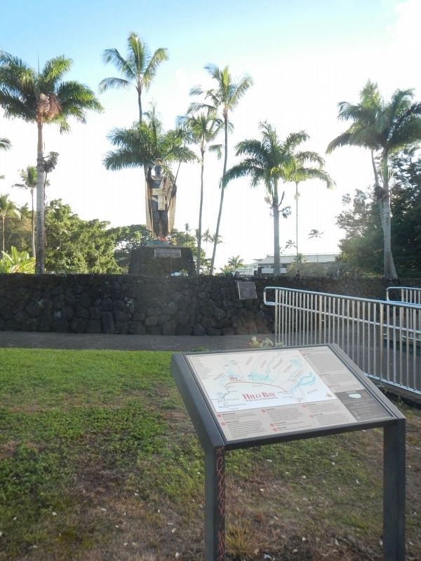
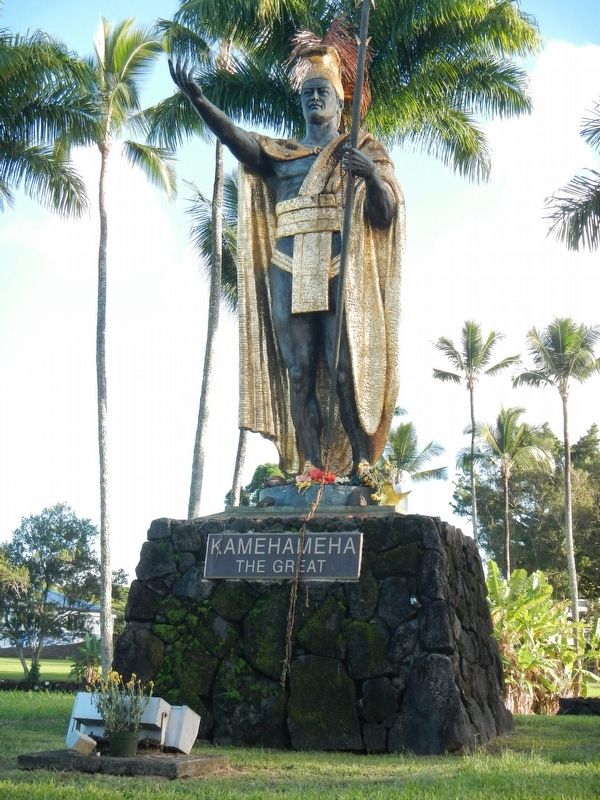
More about this marker. The Kamehameha the Great Statue is located in Wailoa River State Park.
Additional keywords. Native Hawaiians, Pacific Islanders
Credits. This page was last revised on September 9, 2020. It was originally submitted on December 9, 2017, by Barry Swackhamer of Brentwood, California. This page has been viewed 759 times since then and 62 times this year. Photos: 1, 2, 3. submitted on December 9, 2017, by Barry Swackhamer of Brentwood, California.


