Near Fredericksburg in Spotsylvania County, Virginia — The American South (Mid-Atlantic)
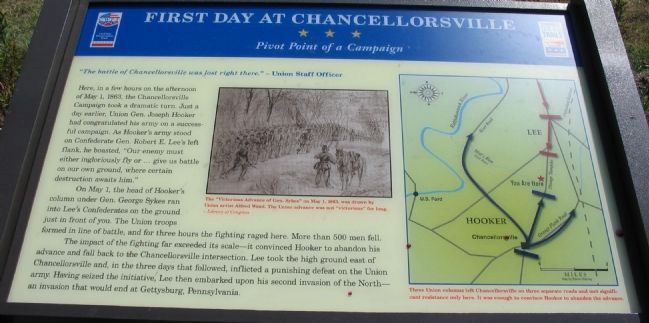
First Day at Chancellorsville
Pivot Point of a Campaign
- Union Staff Officer.
Here, in a few hours on the afternoon of May 1, 1863, the Chancellorsville Campaign took a dramatic turn. Just a day earlier, Union Gen. Joseph Hooker had congratulated his army on a successful campaign. As Hooker's army stood on Confederate Gen. Robert E. Lee's left flank, he boasted, "Our enemy must either ingloriously fly or ... give us battle on our own ground, where certain destruction awaits him."
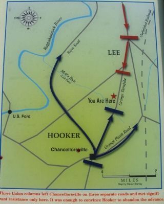
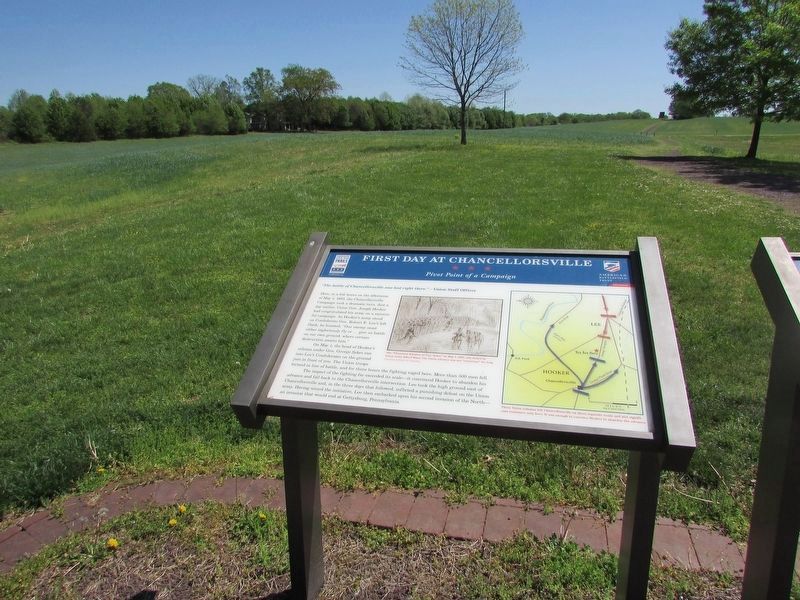
On May 1, the head of Hooker's column under Gen. George Sykes ran into Lee's Confederates on the ground just in front of you. The Union troops formed in line of battle, and for three hours the fighting raged here. More than 500 men fell.
The impact of the fighting far exceeded its scale - it convinced Hooker to abandon his advance and fall back to the Chancellorsville intersection. Lee took the high ground east of Chancellorsville and, in the three days that followed, inflicted a punishing defeat on the Union army. Having seized the initiative, Lee then embarked upon his second invasion of the North - an invasion that would end at Gettysburg, Pennsylvania.
Erected 2008 by Virginia Civil War Trails.
Topics and series. This historical marker is listed in this topic list: War, US Civil . In addition, it is included in the Virginia Civil War Trails series list. A significant historical date for this entry is May 1, 1863.
Location. 38° 17.772′ N, 77° 35.785′ W. Marker is near Fredericksburg, Virginia, in Spotsylvania County. Marker is on Plank Road (State Highway 3), on the right when traveling west. Located on a 140 acres tract preserved by Central Virginia Battlefields Trust. Touch for map. Marker is at or near this postal address: 6161 Plank Road, Fredericksburg VA 22407, United States of America. Touch for directions.
Other nearby markers. At least 8 other markers are within walking distance of this marker. A different marker also named The First Day at Chancellorsville (here, next to this marker); Chancellorsville Campaign (here, next to this marker); a different marker also named Chancellorsville Campaign (here, next to this marker); a different marker also named First Day at Chancellorsville (approx. 0.2 miles away); a different marker also named First Day at Chancellorsville (approx. 0.2 miles away); a different marker also named First Day at Chancellorsville (approx. 0.2 miles away); a different marker also named First Day at Chancellorsville (approx. 0.3 miles away); a different marker also named First Day at Chancellorsville (approx. 0.3 miles away). Touch for a list and map of all markers in Fredericksburg.
More about this marker. In the center of the
To the right is a map showing the action described in the text, Three Union columns left Chancellorsville on three separate roads and met significant resistance only here. It was enough to convince Hooker to abandon the advance.
Related markers. Click here for a list of markers that are related to this marker. The CWPT First Day of Chancellorsville Battlefield Tour by Markers
Photographed By Craig Swain
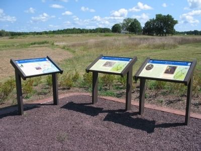
4. First Day of Chancellorsville Trail Head
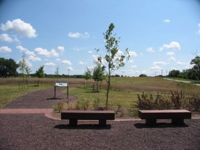
Three Civil War Trails markers stand at the trail head for the First Day of Chancellorsville Battlefield site. On the left is an informational marker detailing the efforts of Civil War Preservation Trust. In the center is the First Day at Chancellorsville - Pivot Point of a Campaign marker. And on the right is the Chancellorsville Campaign - Hooker vs. Lee marker.
Photographed By Craig Swain, August 24, 2008
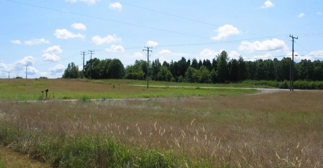
6. The Orange Turnpike
Looking east on Virginia 3, what is today called both the "Plank Road" and Germanna Highway. The Confederate columns advanced from the east down this road (toward the camera). Meanwhile the center Federal column under General Sykes advanced west (from behind the camera). When these two forces collided on May 1, 1863, the high ground in the distance became important terrain.
Photographed By Craig Swain, August 24, 2008
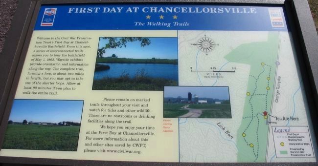
9. First Day at Chancellorsville
The Walking Trails
The Walking Trails
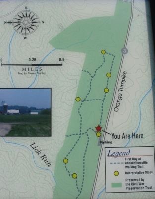
Welcome to the Civil War Preservation Trust's First Day at Chancellorsville Battlefield. From this spot, a series of interconnected trails allows you to tour the battlefield of May 1, 1863. Wayside exhibits provide orientation and information along the way. The complete trail, forming a loop, is about two miles in length, but you may opt to take one of the shorter loops. Allow at least 90 minutes if you plan to walk the entire trail.
Please remain on marked trails throughout your visit and watch for ticks and other wildlife. There are no restrooms or drinking facilities along the trail.
We hope you enjoy your time at the First Day at Chancellorsville. For more information about this and other sites saved by CWPT, please visit www.civilwar.org.
Credits. This page was last revised on April 25, 2023. It was originally submitted on September 13, 2008, by Craig Swain of Leesburg, Virginia. This page has been viewed 1,950 times since then and 21 times this year. Photos: 1. submitted on September 13, 2008, by Craig Swain of Leesburg, Virginia. 2. submitted on March 13, 2009, by Craig Swain of Leesburg, Virginia. 3, 4. submitted on September 13, 2008, by Craig Swain of Leesburg, Virginia. 5. submitted on April 22, 2023, by Bill Coughlin of Woodland Park, New Jersey. 6, 7, 8, 9. submitted on September 13, 2008, by Craig Swain of Leesburg, Virginia.
