Vernal in Uintah County, Utah — The American Mountains (Southwest)
Fort Ashley Center
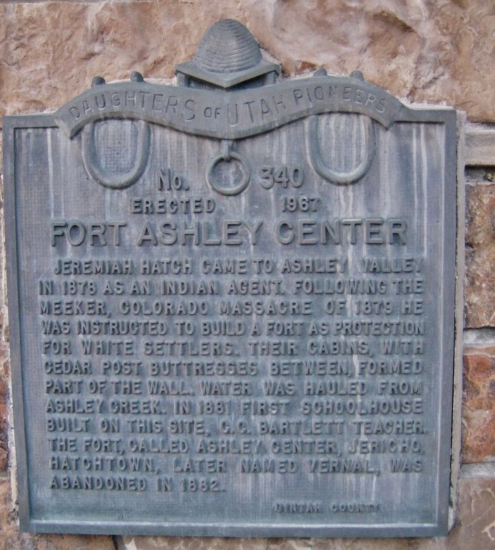
Jeremiah Hatch came to Ashley Valley in 1878 as an Indian agent. Following the Meeker, Colorado massacre of 1879 he was instructed to build a fort as protection for white settlers. Their cabins, with cedar post buttresses between, formed part of the wall. Water was hauled from Ashley Creek. In 1881 first schoolhouse built on this site, C.C. Bartlett, teacher. The fort, called Ashley Center, Jericho, Hatchtown, later named Vernal was abandoned in 1882.
Erected 1967 by Daughters of Utah Pioneers. (Marker Number 340.)
Topics and series. This historical marker is listed in these topic lists: Forts and Castles • Native Americans • Settlements & Settlers • Wars, US Indian. In addition, it is included in the Daughters of Utah Pioneers series list. A significant historical year for this entry is 1878.
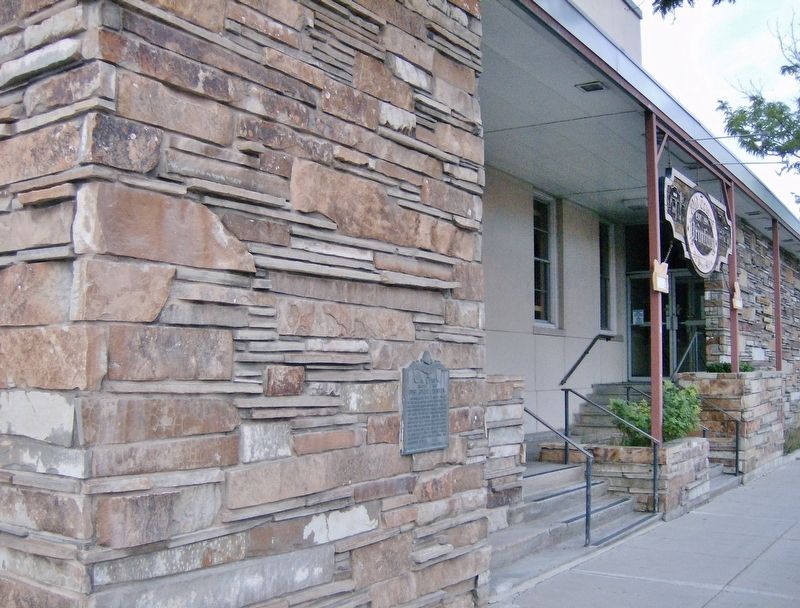
Location. 40° 27.35′ N, 109° 31.812′ W. Marker is in Vernal, Utah, in Uintah County. Marker is at the intersection of West Main Street (U.S. 40) and North 100 West, on the right when traveling west on West Main Street. Marker is mounted at eye-level on the former Vernal Post Office building at the northeast corner of the West Main Street and North 100 West street intersection. Touch for map. Marker is at or near this postal address: 98 West Main Street, Vernal UT 84078, United States of America. Touch for directions.
Other nearby markers. At least 8 other markers are within 12 miles of this marker, measured as the crow flies. Vernal Post Office (within shouting distance of this marker); Cobble Rock Gas Station (about 400 feet away, measured in a direct line); Do Religion and Money Mix? (about 400 feet away); Parcel Post Bank (about 400 feet away); Farm Exchange Building (about 400 feet away); Where the Dollar has More Cents (about 500 feet away); Shipped Another 12,000 Hen Fruit by Parcel Post (approx. 0.2 miles away); Jensen (Mau-be) Ferry (approx. 11.8 miles away). Touch for a list and map of all markers in Vernal.
Also see . . . Settlement of Ashley Valley.
Jeremiah Hatch and his sons, Alva Jeremiah Jr., and Leoranzo, were called by President Brigham Young to come here to Ashley Valley on a mission and teach the gospel to the Indians. They settled closed to the creek, close to the foothills. There was one hill they called the “Look-out-Rock,” where they could climb to the top and watch for enemies, not only Indians, but there were outlaws to watch out for. They could see for miles. Large bands of Indians would come in the spring and fall with smaller crowds in between times. (Submitted on February 25, 2018, by Cosmos Mariner of Cape Canaveral, Florida.)
Credits. This page was last revised on October 14, 2020. It was originally submitted on February 25, 2018, by Cosmos Mariner of Cape Canaveral, Florida. This page has been viewed 350 times since then and 51 times this year. Photos: 1, 2. submitted on February 25, 2018, by Cosmos Mariner of Cape Canaveral, Florida. • Andrew Ruppenstein was the editor who published this page.

