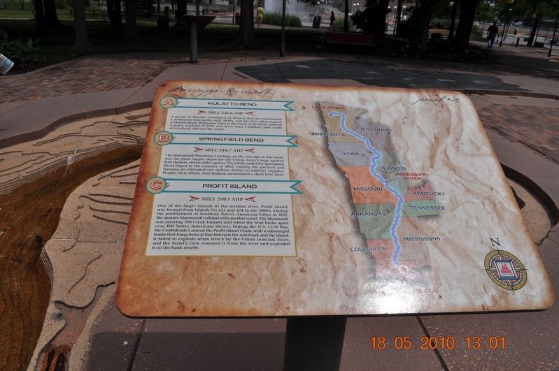
Mulatto Bend/Springfield Bend/Profit Island
Panel # 18
A. Mulatto Bend
Mile 236.6 AHP
A group of Mulatto Freedmen of French dissent established a settlement here in the early 1800ís and the river pilots named it Mulatto Bend. Wilkinson Point at the crook of the bend suffered a major washout in 1950, and a more than 4 million cubic yards of riverbank slid into the water.
B. Springfield Bend
Mile 244.7 AHP
The Springfield Plantation Landing, on the east side of this bend, was the main supply depot for the Union Armyís siege against Port Hudson, eleven miles upriver. The rebels raided the Springfield bend Depot in the summer of 1863, routing the garrison and burning an estimated one million dollars in military supplies. Despite their efforts, Port Hudson surrendered a short time later.
C. Profit Island
Mile 249.5 AHP
One of the larger island in the modern river, Profit Island was formed from the Island No. 123 and 124 in the 1800ís. During the resettlement of Southern Native American Tribes in 1837, the steamer Monmouth collided with another vessel. The Monmouth was carrying 700 Creek Indians and when the boat broke apart over 400 Native Americans drown. During the U. S. Civil War, the Confederateís mined the Profit Island Chute with a submerged bomb the hung from a line between the east bank and the island. It failed to
expose when struck by the Union Ironclad, Essex, and the vesselís crew removed it from the river and exploded it on the bank nearby. (Marker Number 18.)Topics. This historical marker is listed in these topic lists: Disasters • Native Americans • Settlements & Settlers • Waterways & Vessels. A significant historical year for this entry is 1837.
Location. 35° 8.968′ N, 90° 3.507′ W. Marker is in Memphis, Tennessee, in Shelby County. Marker is on Riverside Drive. Mud Island Mississippi Riverwalk. Touch for map. Marker is at or near this postal address: 125 N Front St, Memphis TN 38103, United States of America. Touch for directions.
Other nearby markers. At least 8 other markers are within walking distance of this marker. The Mississippi Riverwalk (here, next to this marker); Ohio River (here, next to this marker); Cairo, Illinois (here, next to this marker); Islands No. 2, 3, and 4 / Fort Jefferson, Kentucky / Birdís Point, Missouri (here, next to this marker); Island No. 5 (Wolf Island)/Belmont, Missouri/Columbus, Kentucky (here, next to this marker); Donaldson Point, Missouri/Island No. 8/Hickman, Kentucky/Dorena Crevasse (here, next to this marker); New Madrid, Missouri/Cates Casting Field/Island No. 10 (here, next to this marker); Tiptonville, Tennessee/Bixby Towhead (here, next to this marker). Touch for a list and map of all markers in Memphis.
Credits. This page was last revised on July 11, 2021. It was originally submitted on March 14, 2018, by Sandra Hughes Tidwell of Killen, Alabama, USA. This page has been viewed 406 times since then and 91 times this year. Photo 1. submitted on March 14, 2018, by Sandra Hughes Tidwell of Killen, Alabama, USA. • Bill Pfingsten was the editor who published this page.
