Bayou Petit Caillou
Marguerite Moffett Audubon Sanctuary
— Atchafalaya Water Heritage Trail —
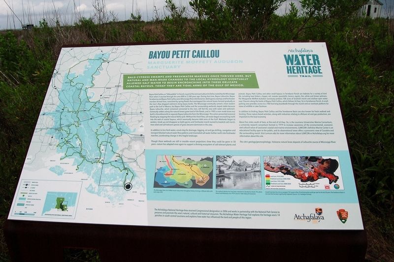
Bald cypress swamps and freshwater marshes once thrived here, but natural and man-made changes to the hydrology eventually allowed salt water to begin encroaching into these delicate coastal bayous. Today they are tidal arms of the Gulf of Mexico.
Bayou Petit Caillou, or “little pebble” in French, is part of the remnant Lafourche Delta created by the Mississippi River when it coursed through this area 800 to 2,500 years ago. During that time, Bayou Lafourche, Bayou Terrebonne and Bayou Petit Caillou were Mississippi River distributaries. Bald cypress swamps and freshwater marshes thrived here, nourished by spring floods that overtopped the natural levees formed gradually as the river’s flow dropped sediment along bayou banks. The Mississippi eventually carved a more eastern path to the Gulf of Mexico, but Bayou Petit Caillou and the surrounding wetlands stayed stable because Bayou Lafourche, which remained connected to the river, still fed the area with water and sediment. Eventually settlers along the natural levees grew tired of the floods, and in 1905 a man-made levee was built in Donaldsonville to separate Bayou Lafourche from the Mississippi. This action prevented seasonal flooding by stopping the natural delta cycle. Without this fresh flow, salt water began encroaching north into the web of coastal bayous,
which eventually became tidal arms of the Gulf. Wetlands began to weaken, break up and disappear as bald cypress and freshwater marsh turned to brackish salt marsh, trees died and salt-tolerant species of grass became dominant in the area.In addition to less fresh water, canals dug for drainage, logging, oil and gas drilling, navigation and transport blocked natural water flow patterns and channeled salt water farther north into freshwater marshes, accelerating change in this fragile landscape.
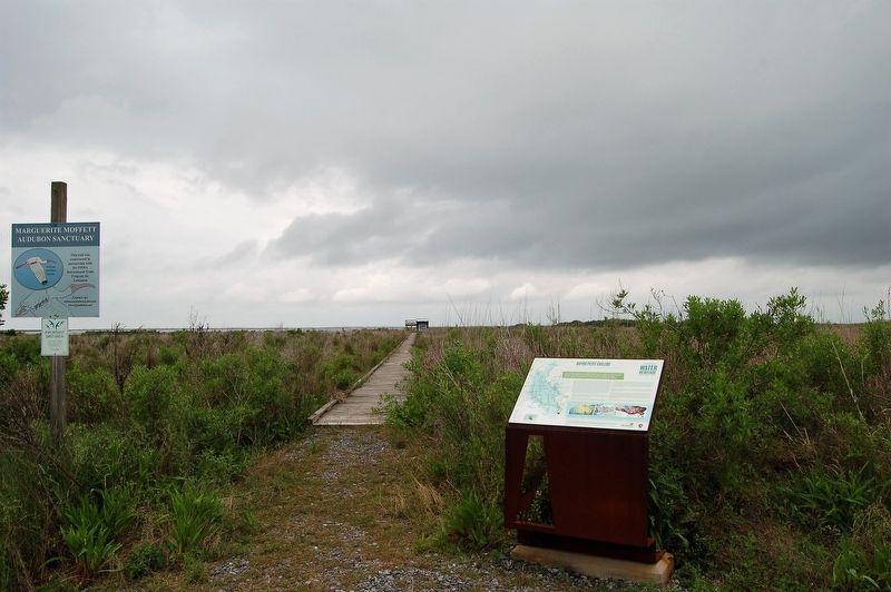
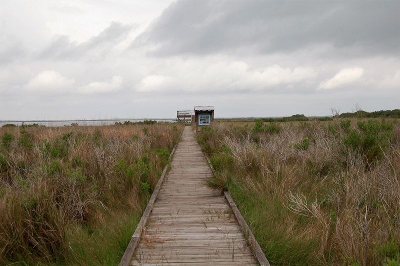
Though these wetlands are still in trouble—recent projections show they could be gone in 50 years—nature has adapted once again to support a thriving ecosystem of salt-tolerant plants and animals. Bayou Petit Caillou and other small bayous in Terrebone Parish are habitats for a variety of bird life, including least bittern, clapper rail, roseate spoonbills, herons, egrets, ibis, white and brown pelicans. The Marguerite Moffett Audubon Sanctuary protects 108 acres of brackish marsh and shallow open water near Chauvin along the banks of Bayou Petit Caillou, which follows LA Hwy. 56 in Terrebonne Parish. A small parking area provides access to a 700-foot-long boardwalk through the marsh and an overlook platform for views of wildlife in Lake Quitman.
In addition to birding, Bayou Petit Caillou and the Terrebonne Basin are also known for fresh seafood and boating.
These nature-based activities, along with industries relating to offshore oil and gas production, are important to the local economy.About five miles south of here, at the end of LA Hwy. 56, is the Louisiana Universities Marine Consortium, a university research consortium formed in 1979 to increase awareness of the environmental, economic and cultural value of Louisiana’s coastal and marine environments. LUMCON’s DeFelice Marine Center is an educational facility open to the public, and its observational tower offers a panoramic view of Cocodrie and the surrounding marsh. Visit Lumcon.edu for more information about LUMCON.
Visit Atchafalaya.org for more information about this site.
This site’s geology/geomorphology: Holocene natural levee deposits of Lafourche course of Mississippi River.
Erected by State of Louisiana and National Park Service.
Topics and series. This historical marker is listed in these topic lists: Environment • Waterways & Vessels. In addition, it is included in the Atchafalaya Water Heritage Trail series list.
Location. 29° 19.412′ N, 90° 38.699′ W. Marker is in Chauvin, Louisiana, in Terrebonne Parish. Marker is on Little Caillou Road (State Road 56) 0.3 miles south of Riggio Street, on the right
Other nearby markers. At least 5 other markers are within 13 miles of this marker, measured as the crow flies. La Butte (approx. 0.9 miles away); Saint Joseph Church (approx. 10.2 miles away); Montegut School (approx. 11.9 miles away); Sacred Heart Church (approx. 12.1 miles away); "Hello Baby!" (approx. 12.3 miles away).
Credits. This page was last revised on May 28, 2023. It was originally submitted on March 17, 2018, by Cajun Scrambler of Assumption, Louisiana. This page has been viewed 442 times since then and 60 times this year. Photos: 1, 2, 3. submitted on March 17, 2018.


