Near Bolivar in Jefferson County, West Virginia — The American South (Appalachia)
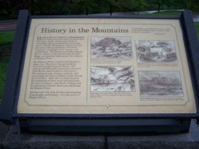
History in the Mountains
"I will pledge myself that there is not a spot in the United States which combines more or greater requisites...."
George Washington
May 5, 1798
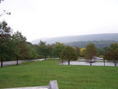
Harpers Ferry's history and geography have influenced each other for more than 250 years. Early settlers crossed these mountains and operated ferries across the rivers. George Washington, impressed with the area's natural resources, convinced Congress to establish a U.S. armory and arsenal here. The Potomac and Shenandoah Rivers, which cut the gap through the Blue Ridge, provided the water power for industry at Harpers Ferry.
But Harpers Ferry's location had disadvantages too. The rivers that powered the factories brought frequent floods. The armory and defensible mountains attracted John Brown and his plan to end slavery. The mountain gap, armory, railroad, and canal made the area a military target during the Civil War. After the war had stripped the mountains of their trees and destroyed the town's industry, only Storer College and its education of former slaves provided hope for Harpers Ferry.
During your visit, look for the intermingling of geography and history - it is the story of Harpers Ferry.
Topics and series. This historical marker is listed in these topic lists: African Americans • Settlements & Settlers • War, US Civil • Waterways & Vessels. In addition, it is included in the Former U.S. Presidents: #01 George Washington, and the Historically Black Colleges and Universities series lists. A significant historical month for this entry is May 1850.
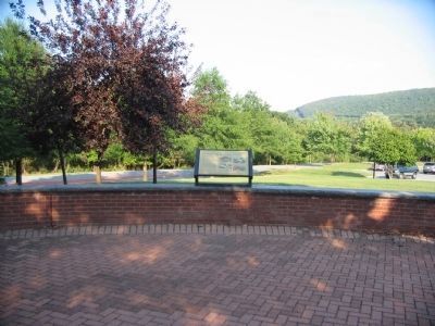
Location. 39° 18.992′ N, 77° 45.389′ W. Marker is near Bolivar, West Virginia, in Jefferson County. Marker can be reached from Shenandoah St.. Marker is on the grounds of the Harpers Ferry Visitors Center. Touch for map. Marker is in this post office area: Harpers Ferry WV 25425, United States of America. Touch for directions.
Other nearby markers. At least 8 other markers are within walking distance of this marker. A Union Predicament (within shouting distance of this marker); Harpers Ferry National Historical Park (within shouting distance of this marker); Discover Harpers Ferry (within shouting distance of this marker); Confederate Victory (within shouting distance of this marker); The Trap Closes (within shouting distance of this marker); Jackson at Harpers Ferry (approx. 0.3 miles away); Home Becomes Battlefield (approx. 0.4 miles away); From Civil War to Civil Rights / Battle of Harpers Ferry (approx. 0.4 miles away). Touch for a list and map of all markers in Bolivar.
More about this marker.
Illustration 1
Industry powered by two rivers rushing through these mountains made Harpers Ferry a weapons manufacturing center from 1800 to 1861.
Illustration 2
Civil war swept across these hills and valleys from 1861 to 1865 as armies struggled to capture or defend Harpers Ferry.
Illustration 3
John Brown planned to use the Blue Ridge as a fortress for his army of freed slaves, but U.S. Marines stopped his raid here in 1859.
Illustration 4
Black Americans progressed from slavery to earning degrees at Storer College on Camp Hill from 1857 to 1955.
Credits. This page was last revised on August 12, 2020. It was originally submitted on October 4, 2008, by Bill Pfingsten of Bel Air, Maryland. This page has been viewed 1,050 times since then and 11 times this year. Photos: 1. submitted on October 4, 2008, by Bill Pfingsten of Bel Air, Maryland. 2. submitted on May 14, 2009, by Craig Swain of Leesburg, Virginia. 3. submitted on October 4, 2008, by Bill Pfingsten of Bel Air, Maryland. 4. submitted on May 14, 2009, by Craig Swain of Leesburg, Virginia.


