Near Point Pleasant in Mason County, West Virginia — The American South (Appalachia)
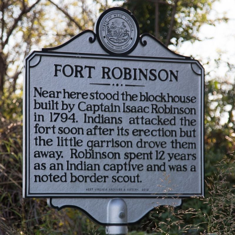
Fort Robinson
Erected 2012 by West Virginia Archives and History.
Topics and series. This historical marker is listed in these topic lists: Forts and Castles • Native Americans • Wars, US Indian. In addition, it is included in the West Virginia Archives and History series list. A significant historical year for this entry is 1794.
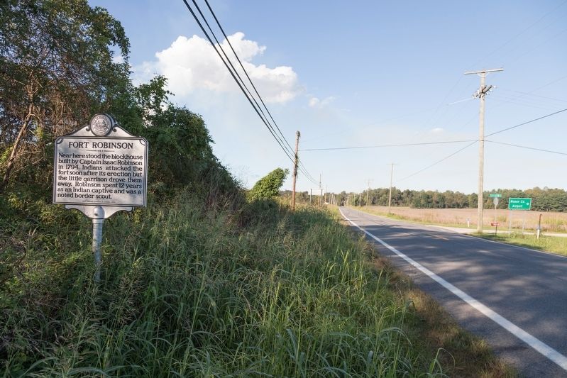
Location. 38° 54.82′ N, 82° 6.904′ W. Marker is near Point Pleasant, West Virginia, in Mason County. Marker is on Ohio River Road (West Virginia Route 62) just west of Airport Road (Local Road 62/4), on the right when traveling west. Touch for map. Marker is in this post office area: Point Pleasant WV 25550, United States of America. Touch for directions.
Other nearby markers. At least 8 other markers are within 4 miles of this marker, measured as the crow flies. John Hall (approx. 0.2 miles away); Grandma Gatewood (approx. 2.2 miles away in Ohio); Kellian V. Whaley (approx. 2.9 miles away); Medal of Honor Park (approx. 3 miles away); “Mark Twain” Family (approx. 3.3 miles away); Silver Bridge Collapse and Creation of National Bridge Inspection Standards (NBIS) (approx. 3.7 miles away in Ohio); The Silver Bridge Disaster / Silver Bridge Memorial (approx. 3.7 miles away in Ohio); The Silver Bridge Disaster (approx. 3.7 miles away in Ohio). Touch for a list and map of all markers in Point Pleasant.
Credits. This page was last revised on August 3, 2021. It was originally submitted on October 15, 2018, by J. J. Prats of Powell, Ohio. This page has been viewed 561 times since then and 69 times this year. Photos: 1, 2. submitted on October 15, 2018, by J. J. Prats of Powell, Ohio.

