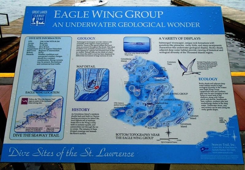
Eagle Wing Group
An Underwater Geological Wonder
— Dive Sites of the St. Lawrence —
[Excerpts follow]
A Variety of Displays
Submerged 'riverscapes', unique rock formations with gumdrop-like pinnacles, rocky folds, and steep escarpments characterize this underwater geological display. Rocky shoals adjacent deep water habitat provide viewing of historical and ecological diversity of the Thousand Islands region.
Geology
Submerged 'riverscapes' provide visitors with examples of the region's varied geological features. Traces of the glacial phases and fault lines are present throughout the shoals. Flat sided boulders were probably plucked from a distant outcropping by a glacier and dropped here as the ice melted. Abrupt cliffs are the result of a fault line where the earth's crust has been displaced by differential movement of large sections of rock.
History
As Grindstone Island's residents shuttle back and forth to Clayton hauling provisions for island life, local legends tell of mishaps, boats lost to the Wing's rocky teeth in summer squalls, and automobiles lost through the ice in winter. The remains of these ill-fated crossings rest beneath the River's surface.
The Eagle Wing shoals, owned by the Thousand Islands Land Trust, are some of the last natural island nesting sites for the threatened Common Tern left in the Thousand Islands.
Erected by
Topics and series. This historical marker is listed in these topic lists: Environment • Waterways & Vessels. In addition, it is included in the Great Lakes Seaway Trail National Scenic Byway series list.
Location. 44° 14.571′ N, 76° 5.25′ W. Marker is in Clayton, New York, in Jefferson County. Marker is on Riverside Drive west of Merrick Street, on the right when traveling west. Touch for map. Marker is in this post office area: Clayton NY 13624, United States of America. Touch for directions.
Other nearby markers. At least 8 other markers are within walking distance of this marker. U.S.S. Maine Memorial (within shouting distance of this marker); War Memorial (within shouting distance of this marker); The Muskie (within shouting distance of this marker); Simon Johnston House (about 300 feet away, measured in a direct line); Korean War • Honor Roll • Vietnam War (about 400 feet away); World War I • Honor Roll • World War II (about 400 feet away); Penet Square (approx. 0.8 miles away); Weteringhra Guentere (approx. 0.9 miles away). Touch for a list and map of all markers in Clayton.
Regarding Eagle Wing Group. Marker has limited historical information.
Credits. This page was last revised on November 16, 2018. It was originally submitted on November 16, 2018, by William Fischer, Jr. of Scranton, Pennsylvania. This page has been viewed 274 times since then and 19 times this year. Photo 1. submitted on November 16, 2018, by William Fischer, Jr. of Scranton, Pennsylvania.
Editor’s want-list for this marker. Distance photo showing marker and surroundings • Can you help?
