Fort Scott
From military outpost to thriving city
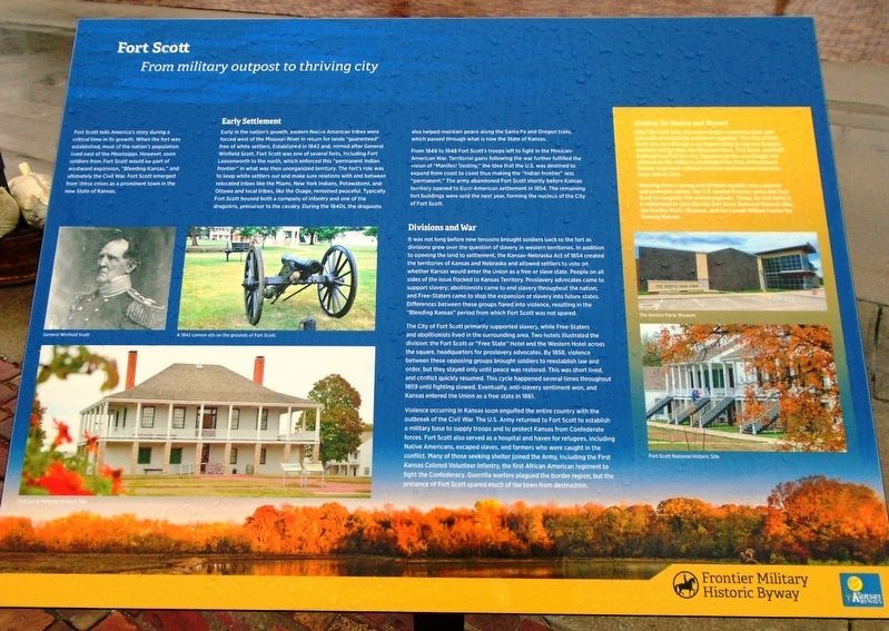
Fort Scott tells America's story during a critical time in its growth. When the fort was established, most of the nation's population lived east of the Mississippi. However, soon soldiers from Fort Scott would be part of westward expansion, "Bleeding Kansas," and ultimately the Civil War.* Fort Scott emerged from these crises as a prominent town in the new State of Kansas.
Early Settlement
Early in the nation's growth, eastern Native American tribes were forced west of the Mississippi River in return for lands "guaranteed" free of white settlers. Established in 1842 and, named after General Winfield Scott, Fort Scott was one of several forts, including Fort Leavenworth to the north, which enforced this "permanent Indian frontier" in what was then unorganized territory. The fort's role was to keep white settlers out and make sure relations with and between relocated tribes like the Miami, New York Indians, Potawatomi, and Ottawa and local tribes, like the Osage, remained peaceful. Typically Fort Scott housed both a company of infantry and one of the dragoons, precursor to the cavalry. During the 1840s, the dragoons also helped maintain peace along the Santa Fe and Oregon trails, which passed through what is now the State of Kansas.
From 1846 to 1848 [most of] Fort Scott's troops
left to fight in the Mexican-American War. Territorial gains following the war further fulfilled the vision of "Manifest Destiny," the idea that the U.S. was destined to expand from coast to coast thus making the "Indian frontier" less "permanent." The army abandoned [sic - closed] Fort Scott shortly before Kansas territory opened to Euro-American settlement in 1854. The remaining fort buildings were sold the next year, forming the nucleus of the City of Fort Scott.
Divisions and War
It was not long before new tensions brought soldiers back to the fort [sic - town] as divisions grew over the question of slavery in western territories. In addition to opening the land to settlement, the Kansas-Nebraska Act of 1854 created the territories of Kansas and Nebraska and allowed settlers to vote on whether Kansas would enter the Union as a free or slave state. People on all sides of the issue flocked to Kansas Territory. Proslavery advocates came to support slavery; abolitionists came to end slavery throughout the nation; and Free-Staters came to stop the expansion of slavery into future states. Differences between these groups flared into violence, resulting in the "Bleeding Kansas" period from which [the town of] Fort Scott was not spared.
[Settlers in] The City of Fort Scott primarily supported slavery, while Free-Staters and abolitionists lived in the surrounding
Violence occurring in Kansas soon engulfed the entire country with the outbreak of the Civil War. The U.S. Army returned to [the town of] Fort Scott to establish a military base to supply troops and to protect Kansas from Confederate forces. Fort Scott also served as a hospital and haven for refugees, including Native Americans, escaped slaves, and farmers who were caught in the conflict. Many of those seeking shelter joined the Army, including the First Kansas Colored Volunteer Infantry, the first African American regiment to fight the Confederacy. Guerrilla warfare plagued the border region, but the presence [of military forces in and around the town] of Fort Scott spared much of the town from destruction.
Healing the Nation and Beyond
After the Civil War, the nation began reconstruction, and railroads soon tied the continent together. The City
Growing from a young and divided republic into a mature and powerful nation, the U.S. needed frontier posts like Fort Scott to complete this metamorphosis. Today, its rich history is celebrated at sites like the Fort Scott National Historic Site, the Gordon Parks Museum, and the Lowell Milken Center for Unsung Heroes.
[Photo captions, from left to right, read]
• General Winfield Scott
• A [replica] 1842 cannon sits on the grounds of Fort Scott [National Historic Site].
• Fort Scott National Historic Site
• The Gordon Parks Museum
• Fort Scott National Historic Site
Erected by Frontier Military Historic Byway (Kansas Byways).
Topics and series. This historical marker is listed in these topic lists: Forts and Castles • Native Americans • Settlements & Settlers • War, US Civil. In addition, it is included in the Fort Scott, Kansas series list. A significant historical year for this entry is 1842.
Location. 37° 50.576′ N, 94° 42.347′ W. Marker is in Fort Scott, Kansas, in Bourbon County. Marker is at the intersection of Old Fort Boulevard and Main Street, in the median on Old Fort Boulevard. Marker is adjacent to Skubitz Plaza. Touch for map. Marker is in this post office area: Fort Scott KS 66701, United States of America. Touch for directions.
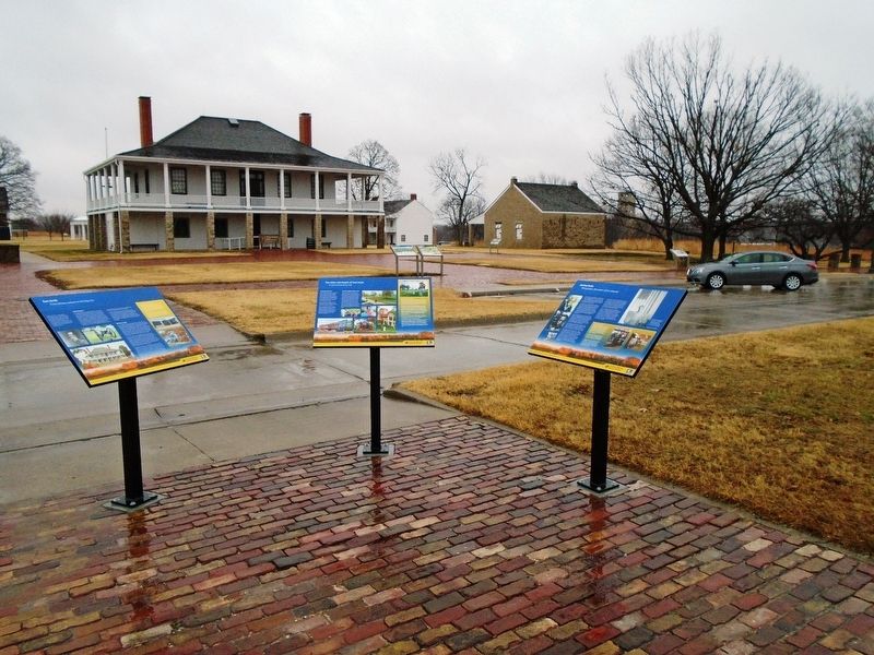
Other nearby markers. At least 8 other markers are within walking distance of this marker. The Sites and People of Fort Scott (here, next to this marker); Gordon Parks (here, next to this marker); Fort Scott Yesterday (a few steps from this marker); Sutler Store (within shouting distance of this marker); Medal of Honor (within shouting distance of this marker); Civil War Town (within shouting distance of this marker); Star Clothing House (within shouting distance of this marker); Fort Gardens (within shouting distance of this marker). Touch for a list and map of all markers in Fort Scott.
Regarding Fort Scott. * - For clarification, the US Army closed Fort Scott in 1853 but maintained it in caretaker status until the government sold the buildings at auction in 1855 to create the civilian town of Fort Scott. Any soldiers during "Bleeding Kansas" were not based at Fort Scott (the fort no longer existed), although soldiers from Fort Leavenworth temporarily did come to the civilian town of Fort Scott to quell "Bleeding Kansas" violence. There is often confusion because the civilian town kept the name "Fort Scott." The contributor was the Fort Scott National Historic Site historian from 2010 to 2016, before this marker was placed.
Also see . . .
1. Fort Scott National Historic Site. (Submitted on January 16, 2019, by William Fischer, Jr. of Scranton, Pennsylvania.)
2. Gordon Parks Museum. (Submitted on January 16, 2019, by William Fischer, Jr. of Scranton, Pennsylvania.)
3. Lowell Milken Center for Unsung Heroes. (Submitted on January 16, 2019, by William Fischer, Jr. of Scranton, Pennsylvania.)
Credits. This page was last revised on September 1, 2020. It was originally submitted on January 16, 2019, by William Fischer, Jr. of Scranton, Pennsylvania. This page has been viewed 266 times since then and 32 times this year. Photos: 1, 2. submitted on January 17, 2019, by William Fischer, Jr. of Scranton, Pennsylvania.

