Chetumal in Othón P. Blanco, Quintana Roo, Mexico — The Yucatan Peninsula (The Southeast)
La Calle del Relox
Paseo de los Héroes

Photographed By J. Makali Bruton, March 27, 2019
1. La Calle del Relox Marker
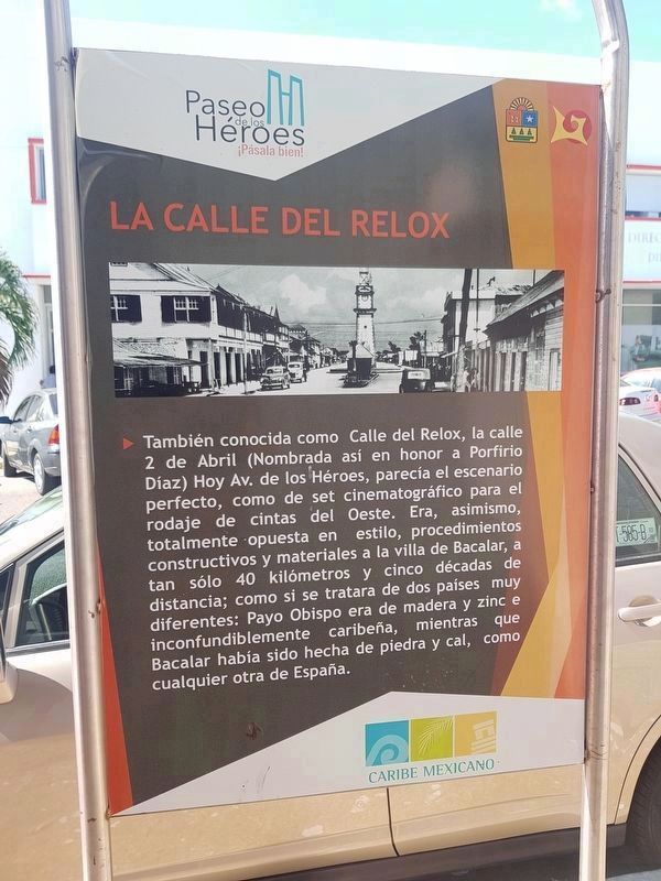
The marker includes a black and white photo looking north up the nearby Avenida de los Héroes at an earlier clocktower, from which the road's previous name (Relox or reloj, clock in Spanish) was taken.
Note that the marker also mentions Chetumal's previous name, Payo Obispo.
También conocida como Calle del Relox, la calle 2 de Abril (Nombrada así en honor a Porfirio Díaz) Hoy Av. de los Héroes, parecía el escenario perfecto como de set cinematográfico para el rodaje de cintas del Oeste. Era, asimismo, totalmente opuesta en estilo, procedimientos constructivos y materiales a la villa de Bacalar, a tan sólo 40 kilómetros y cinco décadas de distancia; como si se tratara de dos países muy diferentes: Payo Obispo era de madera y zinc e inconfundiblemente caribeña, mientras que Bacalar había sido hecha de piedra y cal, como cualquier otra de España.
Calle del Relox (Relox Street)
Also known as Calle del Relox (Relox Street), Calle 2 de Abril (Abril 2nd Street, named after Porfirio Díaz) is today known as Avenida de los Héroes (Avenue of the Heroes). It once looked like the perfect place for a movie set from the Old West. It was also totally opposed in style, construction procedures and materials to the town of Bacalar, only 40 kilometers and five decades away; as if they were two very different countries: Payo Obispo was made of wood and zinc and unmistakably Caribbean, while Bacalar had been made of stone and lime, like any other town in Spain.
Topics. This historical marker is listed in these topic lists: Man-Made Features • Roads & Vehicles • Settlements & Settlers.
Location. 18° 30.085′ N, 88° 17.8′ W. Marker is in Chetumal, Quintana Roo, in Othón P. Blanco. Marker is on Avenida Héroes de Chapultepec just west of Avenida Juárez, on the left when traveling east. Touch for map. Marker is in this post office area: Chetumal QR 77000, Mexico. Touch for directions.
Other nearby markers. At least 8 other markers are within walking distance of this marker. Belisario Domínguez (within shouting distance of this marker); Juan Erlindo Erales (about 90 meters away, measured in a direct line); Vice Admiral Othón Pompeyo Blanco Núñez de Cáceres (about 90 meters away); Hurricane Janet (about 90 meters away); Avenida 5 de Mayo (about 90 meters away); The History of Chetumal - 1937-1955 / 1960-2016 (about 90 meters away); The History of Chetumal: 1940-1950 (about 120 meters away); Avenida 5 de Mayo No. 132-A (about 150 meters away). Touch for a list and map of all markers in Chetumal.
Credits. This page was last revised on March 28, 2019. It was originally submitted on March 28, 2019, by J. Makali Bruton of Accra, Ghana. This page has been viewed 138 times since then and 8 times this year. Photos: 1, 2. submitted on March 28, 2019, by J. Makali Bruton of Accra, Ghana.
