Poolesville in Montgomery County, Maryland — The American Northeast (Mid-Atlantic)
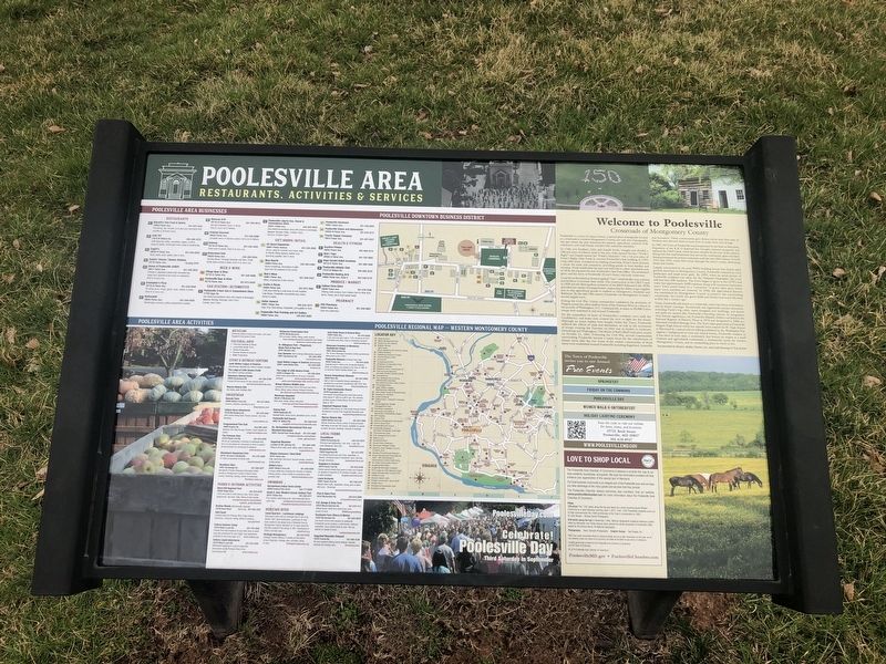
Welcome to Poolesville
Poolesville is a town of unique charm, a special place strategically located at a crossroads in western Montgomery County, not only one of geography but also where the past intersects the present, agriculture connects with commerce, and rural beauty coexists with suburban amenities.
In 1760, two brothers, John and Joseph Poole, bought and divided a 160-acre tract of tobacco land in the area. John named his tract "Poole's Right" and JOseph named his "Poole's Hazzard." On a 15-acre piece of Poole's Right, John Poole Jr. erected Poolesville's first building in 1793, a log cabin store. Located at an existing crossroads, Poole's Store became a log cabin store. Located at an existing crossroads, Poole's Store became a center for trade and commerce, providing goods to local families and travelers. Poole subdivided his tract and sold lots to other merchants and, in 1810, the log store became Poolesville's first Post Office. The settlement grew, and the town of Poolesville (Poole's Store) was truly underway.
Local farms flourished as farmers applied "new" methods like crop rotation and fertilizer to increase their yields. The construction of the C&O Canal in 1828 and the Metropolitan extension of the B&O Railroad in the 1870s provided new modes of transportation, improving the ability to get supplies and to ship agricultural goods to markets in Georgetown, Frederick and Baltimore. By the mid-19th century, Poolesville was Montgomery County's second largest town.
During the Civil War, Union commanders considered the proximity of Virginia across the often-shallow fords of the Potomac River as a threat to the security of Washington, D.C. Consequently, as many as 20,000 Union troops were stationed in and around Poolesville.
Yet the sympathies of most of Poolesville's residents were with the Confederacy, and many men crossed the river to fight for the South. Although no major battles were fought within the Town, Poolesville suffered the effects of raids and skirmishes, as well as the movement of troops crossing the Potomac on their way to battles in Antietam, Gettysburg and Washington. The Battle of Ball's Bluff took place nearby on October 21, 1861. Following the Civil War, several communities surrounding Poolesville became a major focus for the resettlement of former slaves after the war. Some of the earliest communities of freed slaves were established around Poolesville including Sugarland, Jonesville and Jerusalem. These communities gave former slaves their first taste of freedom and allowed them to learn how to make their own livings.
In 1867, the Town of Poolesville was incorporated by the State of Maryland. Expansion of the B & O Railroad line brought renewed prosperity
Largely untouched by the post-WWII building boom that fueled rapid growth elsewhere in Montgomery County, Poolesville retained its rural landscapes and small-town spirit. By 1959, when an aerial picture of Poolesville residents was taken for the National Geographic, the town still had only 298 residents. The Town began to grow in the 1970's and today has approximately 5400 residents along with numerous businesses and a Town center based on a "commons" of green open space where many town activities are centered. In 1980, the Agricultural Reserve was established by Montgomery County to preserve the surrounding countryside. As a result, the green fields and forests look much the same as they did a century ago.
Today, Poolesville still stands at a crossroads, where the forces of its history and its future converge. Seventeenth and eighteenth-century structures, including Poole's log cabin, stand along new buildings, and streets and parks are named after Poolesville's founding citizens. In recognition of its historic significance, the Poolesville Historic District was listed in the National Register of Historic Places in 1974 and designated in 2004 as Maryland Certified Heritage Area. The Town takes great pride in Poolesville Magnet High School which has repeatly been named the #1 High School in Maryland by a annual school ranking published by the Washington Post. Against a background of rural and natural beauty, Poolesville remains, as it has since its early days, a community that honors its origins as a small business and agricultural community, a commercial center for western Montgomery County, and an outstanding place in which to live.
Text provided by Historic Medley District, Inc. and Link Hoewing & Tom Kettler
Erected by Poolesville Chamber of Commerce.
Topics. This historical marker is listed in these topic lists: African Americans • Agriculture • Industry & Commerce • War, US Civil. A significant historical date for this entry is October 21, 1861.
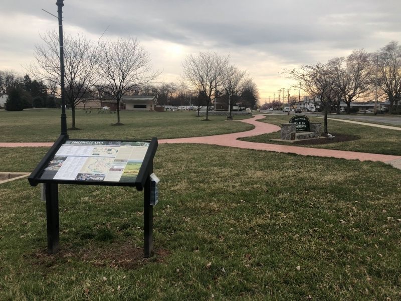
Location. 39° 8.706′ N, 77° 24.754′ W. Marker is in Poolesville, Maryland, in Montgomery County. Marker is on Fyffe Road north of Fisher Avenue (Maryland Route 107), on the left when traveling south. The marker stands on the grounds of Whalen Commons. Touch for map. Marker is in this post office area: Poolesville MD 20837, United States of America. Touch for directions.
Other nearby markers. At least 8 other markers are within walking distance of this marker. Veterans Memorial (within shouting distance of this marker); Poolesville (approx. 0.2 miles away); The Old Bank Building (approx. 0.2 miles away); a different marker also named Poolesville (approx. ¼ mile away); a different marker also named Welcome to Poolesville (approx. ¼ mile away); Lynching of George W. Peck / Lynching in Maryland (approx. ¼ mile away); The Civil War at Poolesville (approx. 0.3 miles away); Historic Poolesville (approx. 0.3 miles away). Touch for a list and map of all markers in Poolesville.
Related marker. Click here for another marker that is related to this marker. A marker with identical information can be found elsewhere in town.
Credits. This page was last revised on December 10, 2023. It was originally submitted on March 30, 2019, by Devry Becker Jones of Washington, District of Columbia. This page has been viewed 564 times since then and 88 times this year. Photos: 1, 2. submitted on March 30, 2019, by Devry Becker Jones of Washington, District of Columbia.

