Bacalar, Quintana Roo, Mexico — The Yucatan Peninsula (The Southeast)
Bacalar in the XVI Century
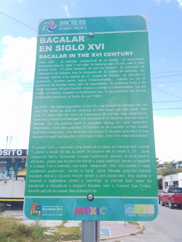
Para 1581, la mancha poblacional de la ciudad se encontraba contenida entre la calle 1 con calle 18 hasta la calle 30 con calle 9, esto apenas unos 37 años después de que se fundara la población de Salamanca de bacalar, tras la conquista de la ciudad de bakhalal, sin embargo debido a la lejanía de la ciudad de Mérida, se dificulta su población, durante varios siglos Posteriormente cuando se vio el potencial de bacalar como sitio de exportación de maderas finas y de recursos, fue que bacalar empezó a crecer y a desarrollarse, fue asi como se decidió levantar la fortificación que le da a bacalar uno de sus principales atractivos, el fuerte de san Felipe
Bacalar in the XVI Century
By 1581, the urban population of the city was contained between the 1st and 18th street up until the crossing of 30th street with 9th street. This only 37 years after the town of Salamanca de Bacalar was established after the conquest of bakhalal. Yet, because of its distance from the city of Mérida, the city proves hard to populate during the next centuries. Afterwards, when the potential of Bacalar as an exporter of fine woods and other resources, was when the city began to develop and when it was decided to start building the Fort of San Felipe, one of its main attractions.
Bacalar en el Siglo XVI
Tu ja'abil 1581, u xlimbalil u kajnáalilo'ob le kaaja' ku biimbal ichil u beelil yéetel u beelil 18 tak tu beelil 30 beyxan tak tu beelil 9, 37 jaab máano'ob tak tu chúunsajil u kaajil Salamanca Bacalar le ka'aj úuch le xiimbala', yéetel xan ka pée che'eta'ab u kaajil Bakhalal, ba'ale u náachili ti' u kaajil T-ho'e (merida), ma' séeb káajsa abi, lela bey úuchik u máan ya'abkach ja'abo'obo', ba'ale' le ka'aj la ab Bacalar jump'éel kúuchil ma'alob utia'al u ko'onol che'ob yéetel u jeel ba'alo'obe', bey úuchik u chúunul u kajtáalta al yéeteis U nojochtal, tu yoo'sal túun xane’ ka tukulta ab u meyajta'al u tuulumil Bacalar, lela' u Fuerteil San Felipe kúuchil jats'uts ku taasik táanxelkaajilo ob.
Erected by Gobierno del Estado de Quintana Roo 2011-2016.
Topics. This historical marker is listed in these topic lists: Industry & Commerce • Native Americans • Settlements & Settlers • Wars, Non-US. A significant historical year for this entry is 1581.
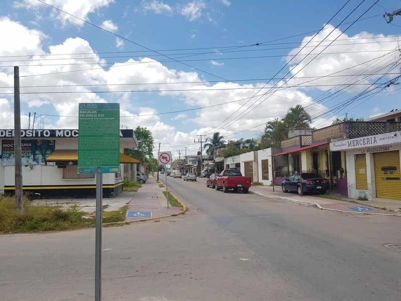
Location. 18° 40.592′ N, 88° 23.519′ W. Marker is in Bacalar, Quintana Roo. Marker is at the intersection of Avenida 7 and Calle 18, on the right when traveling north on Avenida 7. Touch for map. Marker is in this post office area: Bacalar QR 77930, Mexico. Touch for directions.
Other nearby markers. At least 8 other markers are within walking distance of this marker. Creation of the Municipality of Bacalar (about 150 meters away, measured in a direct line); Bacalar (about 210 meters away); Church of San Joaquín (about 240 meters away); Miguel Hidalgo y Costilla (approx. 0.3 kilometers away); Ichkabal Bacalar (approx. 0.3 kilometers away); San Felipe Fort (approx. 0.4 kilometers away); Bridge of the Fort of San Felipe (approx. 0.4 kilometers away); Fort of San Felipe (approx. 0.4 kilometers away). Touch for a list and map of all markers in Bacalar.
Credits. This page was last revised on June 4, 2019. It was originally submitted on June 4, 2019, by J. Makali Bruton of Accra, Ghana. This page has been viewed 87 times since then and 4 times this year. Photos: 1, 2. submitted on June 4, 2019, by J. Makali Bruton of Accra, Ghana.

