Escanaba in Delta County, Michigan — The American Midwest (Great Lakes)
Escanaba's Docks
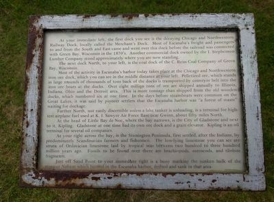
At your immediate left, the first dock you see is the decaying Chicago and Northwestern Railway Dock, locally called the Merchant's Dock. Most of Escanaba's freight and passengers to and from the South and East came and went over this dock before the railroad was connected with Green Bay, Wisconsin in the 1870's. Another commercial dock owned by the I. Stephenson Lumber Company stood approximately where you are now standing.
The next dock North, to your left, is the coal dock of the C. Reiss Coal Company of Green Bay, Wisconsin.
Most of the activity in Escanaba's harbor today takes place at the Chicago and Northwestern iron ore dock, which you can see in the middle distance at your left. Pelletized ore, which stands in large mounds of thousands of tons back of the docks is transported by conveyor belt into the iron ore boats at the docks. Over eight million tons of ore are shipped annually to Illinois, Indiana, Ohio and the Detroit area. This is more tonnage than shipped from the old wooden docks, which numbered six at one time. In the days before steamboats were common on the Great Lakes, it was said by pioneer settlers that the Escanaba harbor was "a forest of masts" waiting for dockage.
Farther North, not easily discernible unless a lake tanker is unloading, is a terminal for high-test airplane fuel used at K. I. Sawyer Air Force Base near Gwinn, about fifty miles North.
At the head of Little Bay de Noc, where the bay narrows, is the City of Gladstone and next to it, Kipling. Gladstone at one time had its own ore dock and a grain elevator. Kipling is an oil terminal for several oil companies.
At your right across the bay, is the Stonington Peninsula, first settled, after the Indians, by predominately Scandinavian farmers and fishermen. The low-lying limestone you can see are strata of Ordovician limestone laid by tropical seas between two hundred and three hundred million years ago. Fossils to be found over there are brachiopods, ostrocods, and trilobite fragments.
Just off Sand Point to your immediate right is a buoy marking the sunken hulk of the steamer Nahant which burned in the Escanaba harbor, drifted and sank in that area.
Topics. This historical marker is listed in these topic lists: Environment • Industry & Commerce • Railroads & Streetcars • Waterways & Vessels.
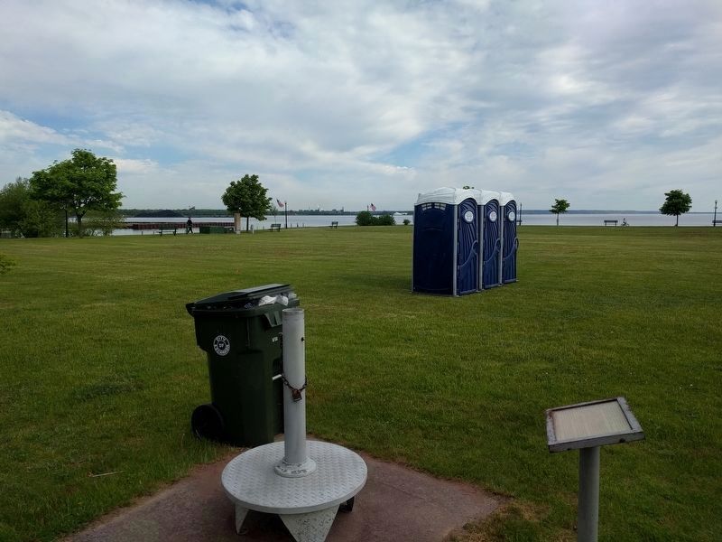
Location. 45° 44.751′ N, 87° 2.869′ W. Marker is in Escanaba, Michigan, in Delta County. Marker is on Ludington Street east of South 2nd Street, on the left when traveling east. Marker is in the park at the Ludington Street Municipal Docks. Touch for map.
Marker is at or near this postal address: 112 Ludington Street, Escanaba MI 49829, United States of America. Touch for directions.
Other nearby markers. At least 8 other markers are within walking distance of this marker. Escanaba (here, next to this marker); Before the Settlers (here, next to this marker); The Ore Pellet (a few steps from this marker); Iron Ore Centennial (a few steps from this marker); The Peninsula Railroad (a few steps from this marker); Little Bay de Noc (a few steps from this marker); The Port - Today (within shouting distance of this marker); The Port - Early Years (within shouting distance of this marker). Touch for a list and map of all markers in Escanaba.
Also see . . . Nahant (Propeller), U18766, fire, 29 Nov 1897. Web page that includes newspaper articles about the fire that destroyed the steamer Nahant on the Maritime History of the Great Lakes website. (Submitted on July 26, 2019, by Joel Seewald of Madison Heights, Michigan.)
Credits. This page was last revised on July 26, 2019. It was originally submitted on July 26, 2019, by Joel Seewald of Madison Heights, Michigan. This page has been viewed 630 times since then and 83 times this year. Photos: 1, 2, 3. submitted on July 26, 2019, by Joel Seewald of Madison Heights, Michigan.


