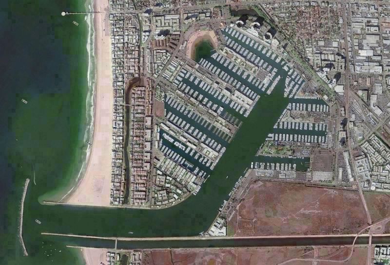
Marina del Rey in Los Angeles County, California — The American West (Pacific Coastal)
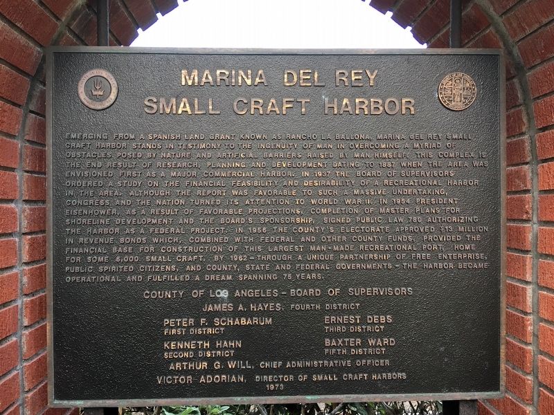
Marina del Rey Small Craft Harbor
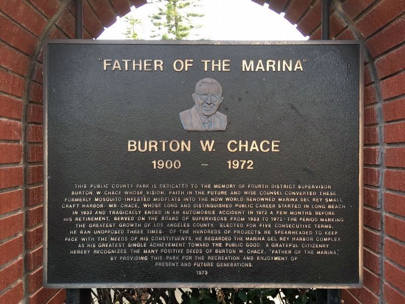
Burton W. Chace
Emerging from a Spanish land grant known as Rancho La Ballona, Marina Del Rey small craft harbor stands in testimony to the ingenuity of man in overcoming a myriad of obstacles posed by nature and artificial barriers raised by man himself. This complex is the end result of research, planning, and development dating to 1887 when the area was envisioned first as a major commercial harbor. In 1937 the Board of Supervisors ordered a study on the financial feasibility and desirability of a recreational harbor in the area. Although the report was favorable to such a massive undertaking, Congress and the nation turned his attention to World War II. In 1954 President Eisenhower, as a result of favorable projections, completion of master plans for shoreline development and the board’s sponsorship, signed public law 780 authorizing the harbor as a federal project. In 1956 the county’s electorate approved $13 million in revenue bonds which, combined with federal and other county funds, provided the financial base for construction of this largest man-made recreational port, home for some 6000 small craft. By 1962 — through a unique partnership of free enterprise, public spirited citizens, and county, state, and federal governments — the harbor became operational and fulfilled a dream spanning 75 years.
“Father of the Marina” Burton W. Chace, 1900-1972
This public county park is dedicated to the memory of Fourth District Supervisor Burton W. Chace whose vision, faith in the future and wise counsel converted these formally mosquito-infested mud flats into the now world-renowned Marina Del Rey small craft harbor. Mr. Chase, whose long and distinguished public career started in Long Beach in 1933 and tragically ended in an automobile accident in 1972 a few months before his retirement, served on the Board of Supervisors from 1953 to 1972, the period marking the greatest growth of Los Angeles County. Elected for five consecutive terms, he ran unopposed three times. Of the hundreds of projects he spearheaded to keep pace with the needs of his constituents, he regarded the Marina Del Rey Harbor complex as his greatest single achievement toward the public good. A grateful citizenry hereby recognizes the many positive deeds of Burton W. Chace, “Father of the Marina,” by providing this park for the recreation and enjoyment of present and future generations.
Erected 1973 by County of Los Angeles.
Topics. This historical marker is listed in these topic lists: Industry & Commerce • Parks & Recreational Areas • Waterways & Vessels.
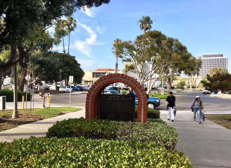
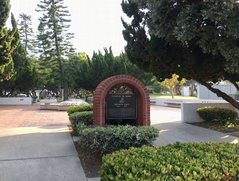
Location. 33° 58.667′ N, 118° 26.648′ W. Marker is in Marina del Rey, California, in Los Angeles County. Marker is on Mindanao Way, 0.3 miles west of Lincoln Boulevard. At the entrance to Burton Chace Park. Touch for map. Marker is at or near this postal address: 13650 Mindanao Way, Marina del Rey CA 90292, United States of America. Touch for directions.
Other nearby markers. At least 8 other markers are within 2 miles of this marker, measured as the crow flies. The Helmsman (approx. 0.2 miles away); Marina del Rey (approx. 0.9 miles away); History of Ballona Lagoon (approx. one mile away); Gabrielino-Tongva People (approx. 1.2 miles away); Dodd Playa Del Rey Residence (approx. 1.2 miles away); Venice Japanese American Memorial Monument (approx. 1.2 miles away); Ray Bradbury House (approx. 1.3 miles away); Saint Florian (approx. 1.3 miles away). Touch for a list and map of all markers in Marina del Rey.
Regarding Marina del Rey Small Craft Harbor. Coastal wetlands were once thought of as “mosquito-infested mud flats” that should be eliminated. They are now known to be critical to the health of rivers, oceans, and wildlife. A proposed expansion of the marina was recently canceled in favor of the creation of nearby Ballona Freshwater Marsh, and in 2017 planning began for restoration of Ballona Wetlands Ecological Reserve.
Credits. This page was last revised on February 7, 2023. It was originally submitted on August 31, 2019, by Craig Baker of Sylmar, California. This page has been viewed 258 times since then and 13 times this year. Photos: 1, 2, 3, 4, 5. submitted on August 31, 2019, by Craig Baker of Sylmar, California. • Andrew Ruppenstein was the editor who published this page.
