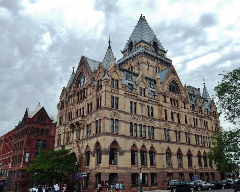
Downtown in Syracuse in Onondaga County, New York — The American Northeast (Mid-Atlantic)
The Banks of the Erie Canal
Erie Canalway National Heritage Corridor
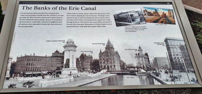
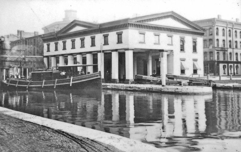
Several Syracuse banks sprouted here along the Erie Canal, each striving to benefit from the commerce of a fast growing city. When the first canal section opened here in 1820 the settlement had 60 people. By 1900 its population reached 108,000. Canal tolls, collected at weighlocks and toll stations, were deposited in banks like those shown in this 1912 panorama.
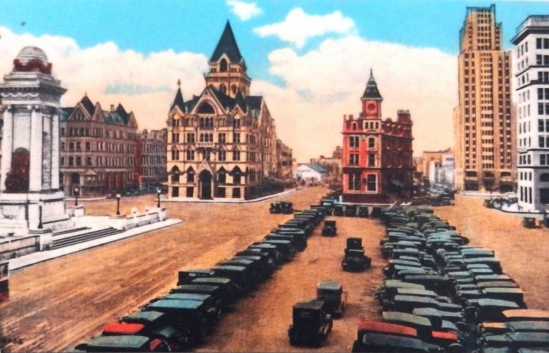
Today, water in Clinton Square reflects the importance of the Erie Canal in shaping the City of Syracuse. The Barge Canal opened in 1918. It used the Oneida and Seneca Rivers, about ten miles north of here, and bypassed the original Erie Canal through Syracuse. This section was closed, filled, and paved to become Erie Boulevard. Renovation of Clinton Square in 2001 exposed historic canal walls that remain visible today.
Erected by National Park Service, U.S. Department of the Interior.
Topics. This historical marker is listed in these topic lists: Industry & Commerce • Man-Made Features • Settlements & Settlers • Waterways & Vessels. A significant historical year for this entry is 1820.
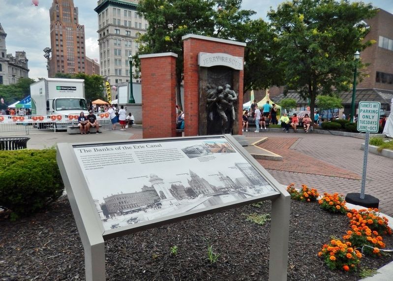
Location. 43° 3.048′ N, 76° 9.204′ W. Marker is in Syracuse, New York, in Onondaga County. It is in Downtown. Marker is at the intersection of South Clinton Street and Erie Boulevard West, on the left when traveling south on South Clinton Street. Marker is located beside the sidewalk at the west end of Clinton Square, overlooking Clinton Square to the east. Touch for map. Marker is at or near this postal address: 2 South Clinton Street, Syracuse NY 13202, United States of America. Touch for directions.
Other nearby markers. At least 8 other markers are within walking distance of this marker. The Jerry Rescue (a few steps from this marker); Lafayette's Tour (about 300 feet away, measured in a direct line); City Center (about 300 feet away); Alexis de Tocqueville (about 500 feet away); Hanover Square (about 600 feet away); Gunpowder Blast (approx. 0.2 miles away); Onondaga Indians (approx. 0.2 miles away); Pitts Park (approx. 0.2 miles away). Touch for a list and map of all markers in Syracuse.
Also see . . .
1. Syracuse Savings Bank Building. Wikipedia entry:
Syracuse Savings Bank Building, also known as Bank of America building, was built in 1875 adjacent to the Erie Canal, and, at 170 feet tall, was the tallest building in Syracuse. Its passenger elevator, the first in Syracuse, was a curiosity that drew visitors.
National Register of Historic Places #71000551. (Submitted on September 3, 2019, by Cosmos Mariner of Cape Canaveral, Florida.)
2. Clinton Square History. Freethought Trail website entry:
Clinton Square first came into being in the early 1800s where roadways from the north and south joined in what is now downtown Syracuse. By the mid 1800s, the construction of the Erie Canal, known then
as "Clinton's Ditch" after New York's Governor Clinton, further transformed this busy intersection into a bustling hub of trading and commerce. (Submitted on September 3, 2019, by Cosmos Mariner of Cape Canaveral, Florida.)
Credits. This page was last revised on February 16, 2023. It was originally submitted on September 2, 2019, by Cosmos Mariner of Cape Canaveral, Florida. This page has been viewed 639 times since then and 117 times this year. Photos: 1, 2. submitted on September 2, 2019, by Cosmos Mariner of Cape Canaveral, Florida. 3, 4. submitted on September 3, 2019, by Cosmos Mariner of Cape Canaveral, Florida. 5. submitted on September 2, 2019, by Cosmos Mariner of Cape Canaveral, Florida. 6. submitted on September 3, 2019, by Cosmos Mariner of Cape Canaveral, Florida.
