Port Morien in Cape Breton Region, Nova Scotia — The Atlantic Provinces (North America)
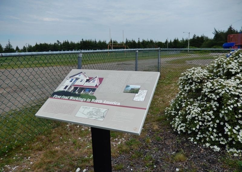
The First Coal Workings in North America
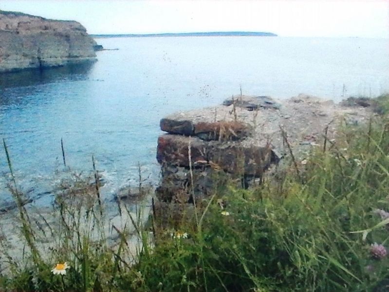
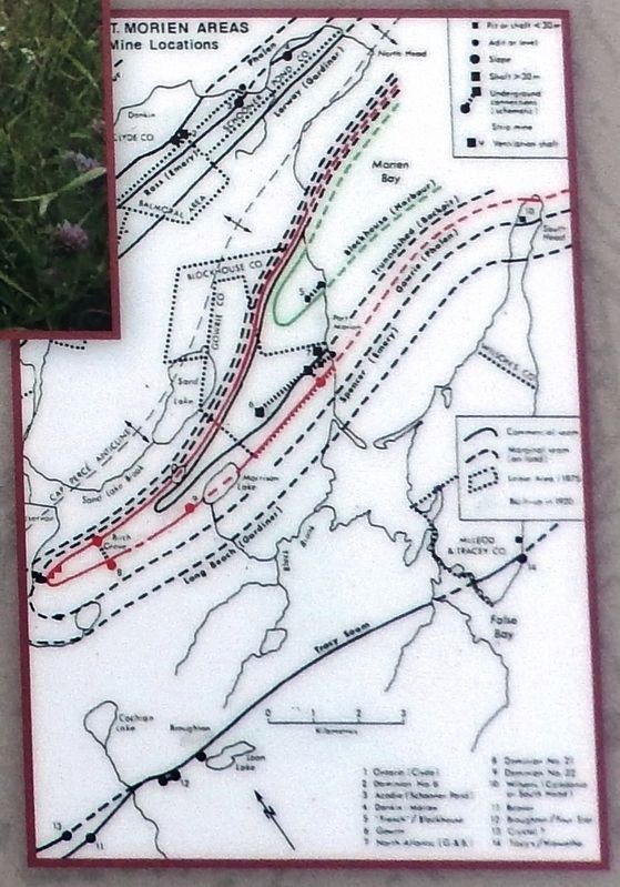
In 1859, Marshall Bourinot, a fish dealer from Port Morien, re-opened the mine. In 1863, the Belloni brothers, Robert, Charles, and Augustus, of New York, along with their brother-in-law Charles Havenmyer bought out Bourinot and formed the Blockhouse Mining Company. A few hundred meters directly from here to the shoreline a shaft was sunk to the level of the old mine. A slope was driven through the old French workings from the surface at the water's edge. A wharf was constructed so that the coal was hauled directly from the face to the ship's side. A thriving community existed around the mine.
During the American Civil War, the demand for coal could not be satisfied. Coal-bearing vessels could be waiting for months in Morien Bay to be filled. Coal was loaded onto ships at a cost of sixty cents per tonne, and sold in New York for nine dollars. The peak year for the blockhouse mine was 1866, when over 375 men and boys were employed.
A landmark year in Canada for coal miners was 1868. The miners went on strike twice that year for a total duration of three months. This strike was believed to be the first in Canada. As a result, the coal output dropped significantly to just over fifty thousand tonnes.
Unsteady coal markets and frequent wharf damage due to storms were a financial drain on the company and it finally closed in 1888.
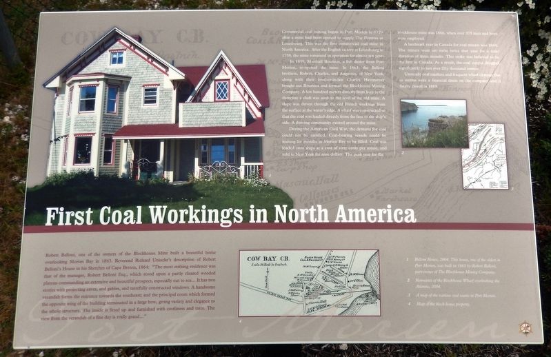
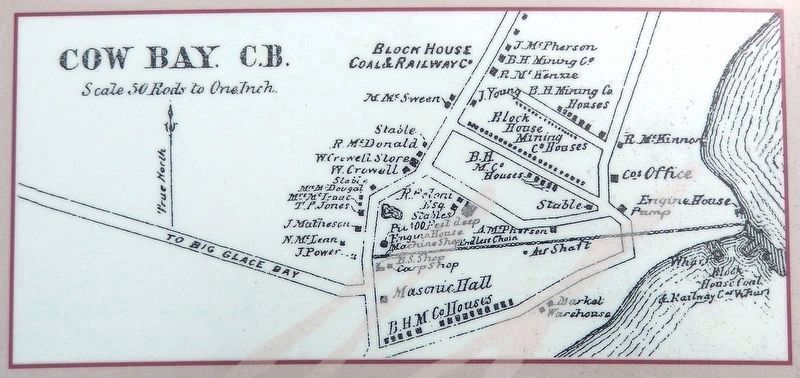
Robert Belloni, one of the owners of the Blockhouse Mine built a beautiful home overlooking Morien Bay in 1863. Reverend Richard Uniacke's description of Robert Belloni's House in his Sketches of Cape Breton, 1864: "The most striking residence was that of the manager, Robert Belloni Esq., which stood upon a partly cleared wooded plateau commanding an extensive and beautiful prospect, especially out to sea… It has two stories with projecting eaves, and gables, and tastefully constructed windows. A handsome verandah forms the entrance towards the southeast; and the principal room which formed the opposite wing of the building terminated in a large bow, giving variety and elegance to the whole structure. The inside is fitted up and furnished with costliness and taste. The view from the verandah of a fine day is really grand…"
Erected by Enterprise Cape Breton Corporation, Cape Breton County Economic Development Authority, and the Cape Breton Regional Municipality.
Topics and series. This historical marker is listed in these topic
lists: Architecture • Industry & Commerce • Labor Unions • War, US Civil. In addition, it is included in the Acadian History series list. A significant historical year for this entry is 1720.
Location. 46° 8.348′ N, 59° 52.249′ W. Marker is in Port Morien, Nova Scotia, in Cape Breton Region. Marker is on Long Beach Road north of Marconi Trail (Route 255), on the right when traveling north. Marker is located within a small, fenced plot on the east side of Long Beach Road. Touch for map. Marker is in this post office area: Port Morien NS B1B 1E6, Canada. Touch for directions.
Other nearby markers. At least 8 other markers are within walking distance of this marker. First Boy Scout Troop in North America (here, next to this marker); L'industrie du Charbon au Canada / Canada's Coal Industry (within shouting distance of this marker); Morien Businesses of the Past (approx. 0.6 kilometers away); Morien Institutions (approx. 0.6 kilometers away); Morien's Legacy (approx. 0.6 kilometers away); Flint Island Light Station (approx. 1.1 kilometers away); Gowrie and North Atlantic Collieries (approx. 1.1 kilometers away); The Fishery in Port Morien (approx. 1.1 kilometers away). Touch for a list and map of all markers in Port Morien.
Related markers. Click here for a list of markers that are related to this marker. Port Morien Interpretive Walking Tour
Also see . . . Port Morien (Wikipedia). When coal was discovered in Port Morien in the early eighteenth century, people began to live there. The village was officially settled in 1786. By the 1870s, the village grew to a population of 3000 as a result of the establishment of the blockhouse and mines. There were up to forty businesses in the village. Gradually, it dwindled in the twentieth century. (Submitted on September 10, 2019, by Cosmos Mariner of Cape Canaveral, Florida.)
Credits. This page was last revised on January 2, 2020. It was originally submitted on September 9, 2019, by Cosmos Mariner of Cape Canaveral, Florida. This page has been viewed 285 times since then and 24 times this year. Photos: 1, 2, 3, 4, 5, 6. submitted on September 10, 2019, by Cosmos Mariner of Cape Canaveral, Florida.
