Canastota in Madison County, New York — The American Northeast (Mid-Atlantic)
Industrial Growth / Canalway Trail
Industrial Growth (marker front panel)
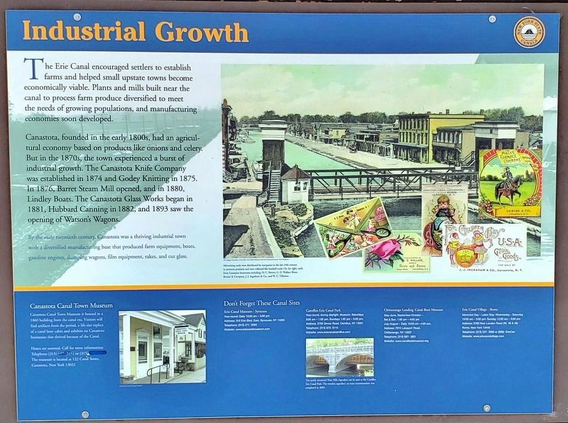
The Erie Canal encouraged settlers to establish farms and helped small upstate towns become economically viable. Plants and mills built near the canal to process farm produce diversified to meet the needs of growing populations, and manufacturing economies soon developed.
Canastota, founded in the early 1800s, had an agricultural economy based on products like onions and celery. But in the 1870s, the town experienced a burst of industrial growth. The Canastota Knife Company was established in 1874 and Godey Knitting in 1875. In 1876, Barret Steam Mill opened, and in 1880, Lindley Boats. The Canastota Glass Works began in 1881, Hubbard Canning in 1882, and 1893 saw the opening of Watson's Wagons.
By the early twentieth century, Canastota was a thriving industrial town with a diversified manufacturing base that produced farm equipment, boats, gasoline engines, dumping wagons, film equipment, rakes, and cut glass.
Don't Forget These Canal Sites:
Canastota Canal Town Museum (here)
Erie Canal Museum – Syracuse
Camillus Erie Canal Park
Chittenango Landing Canal Boat Museum
Erie Canal Village – Rome
Canalway Trail : Old Erie Canal State Park (marker back panel)
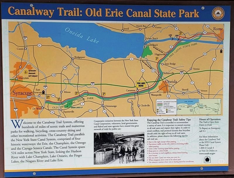
Welcome to the Canalway Trail System, offering hundreds of miles of scenic trails and numerous parks for walking, bicycling, cross-country skiing and other recreational activities. The Canalway Trail parallels the New York State Canal System, comprised of four historic waterways: the Erie, the Champlain, the Oswego and the Cayuga-Seneca Canals. The Canal System spans 524 miles across New York State, linking the Hudson River with Lake Champlain, Lake Ontario, the Finger Lakes, the Niagara River and Lake Erie.
Cooperative initiatives between the New York State Canal Corporation, volunteers, local governments, and federal and state agencies have created this great network of trails for public use.
Erected by New York State Canals.
Topics. This historical marker is listed in these topic lists: Agriculture • Industry & Commerce • Settlements & Settlers • Waterways & Vessels.
Location. 43° 4.763′ N, 75° 45.064′ W. Marker is in Canastota, New York, in Madison County. Marker is at the intersection of South Peterboro Street (New York State Route 13) and Canal Street (County Route 76), on the right when traveling north on South Peterboro Street. Marker is located beside the sidewalk at the southeast corner of the intersection, facing Peterboro Street. Touch for map. Marker is in this post office area: Canastota NY 13032, United States of America. Touch for directions.
Other nearby markers. At least 8 other markers are within walking distance of this marker. Canastota's First Commercial Activity Occurred Along the Canal Basin of the Erie Canal (a few steps from this marker); Reuben Perkins (within shouting distance of this marker); Peterboro Street Lift Bridge (within shouting distance of this marker); Canastota's Lift Bridge (within shouting distance of this marker); Canal Town (within shouting distance of this marker); Canal Street (within shouting distance of this marker); Bruce Opera House (within shouting distance of this marker); Canastota's Basin (about 300 feet away, measured in a direct line). Touch for a list and map of all markers in Canastota.
Related markers. Click here for a list of markers that are related to this marker. The Erie Canal in Canastota, New York
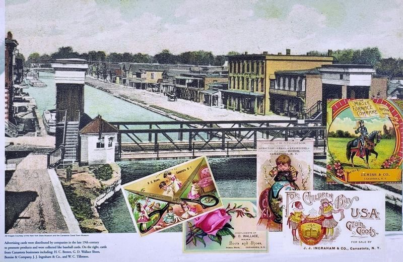
Courtesy of New York State Museum and Canastota Canal Town Museum
3. Marker detail: Late 19th Century Advertising Cards
Advertising cards were distributed by companies in the late 19th century to promote products and were collected like baseball cards. Above cards from Canastota businesses including: H. C. Brown, G. D. Wallace Shoes, Bemiss & Company, J. J. Ingraham & Co., and W. C. Tillotson.
Photographed By Cosmos Mariner, August 18, 2019
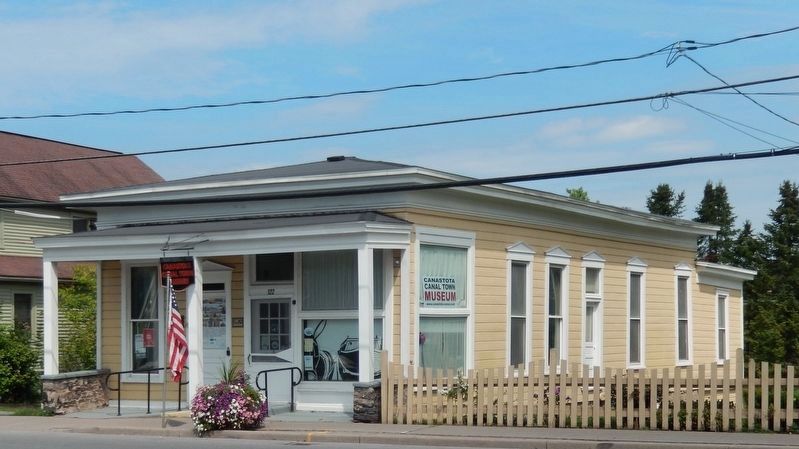
4. Canastota Canal Town Museum
Canastota Canal Town Museum is housed in a 1860 building from the canal era. Visitors will find artifacts from the period, a life-size replica of a canal boat cabin and exhibits on Canastota businesses that thrived because of the Canal.
Credits. This page was last revised on September 15, 2019. It was originally submitted on September 13, 2019, by Cosmos Mariner of Cape Canaveral, Florida. This page has been viewed 177 times since then and 33 times this year. Photos: 1, 2, 3, 4, 5, 6, 7. submitted on September 15, 2019, by Cosmos Mariner of Cape Canaveral, Florida.
