Riverton in Barkhamsted in Litchfield County, Connecticut — The American Northeast (New England)
Civilian Conservation Corps Fire Ponds
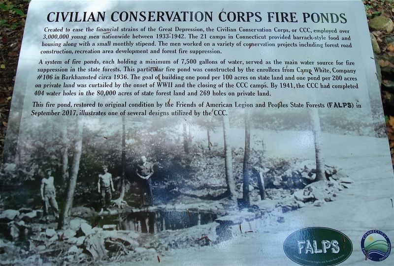
Created to ease the financial strains of the Great Depression, the Civilian Conservation Corps, or CCC, employed over 3,000,000 young men nationwide between 1933-1942. The 21 camps in Connecticut provided barrack-style food and housing along with a small monthly stipend. The men worked on a variety of conservation projects including forest road construction, recreation area development and forest fire suppression.
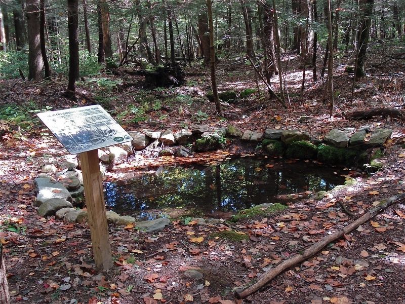
A system of fire ponds, each holding a minimum of 7,500 gallons of water, served as the main water source for fire suppression in the state forests. This particular fire pond was constructed by the enrollees from Camp White, Company #106 in Barkhamsted circa 1936. The goal of building one pond per 100 acres on state land and one pond per 200 acres on private land was curtailed by the onset of WWII and the closing of the CCC camps. By 1941, the CCC had completed 404 water holes in the 80,000 acres of state forest land and 269 holes on private land.
This fire pond, restored to original condition by the Friends of American Legion and Peoples State Forest (FALPS) in September 2017, illustrates one of several designs utilized by the CCC.
Erected 2019 by FALPS (Friends of American Legion and Peoples State Forest) and Department of Energy & Environmental Protection .
Topics. This historical marker is listed in these topic lists: Charity & Public Work • Environment • Horticulture & Forestry • Parks & Recreational Areas. A significant historical year for this entry is 1933.
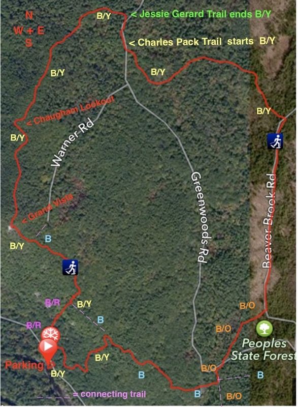
Location. 41° 57.21′ N, 73° 0.192′ W. Marker is in Barkhamsted, Connecticut, in Litchfield County. It is in Riverton. This marker is in Peoples State Forest on the Charles Pack Trail 50 feet east of Greenwoods Road (closed in winter). Touch for map. Marker is in this post office area: Barkhamsted CT 06063, United States of America. Touch for directions.
Other nearby markers. At least 8 other markers are within walking distance of this marker. Barkhamsted Lighthouse Village Charcoal Kilns (approx. ¾ mile away); Barkhamsted Lighthouse Village Cemetery (approx. ¾ mile away); Barkhamsted Lighthouse Village Stone Quarry (approx. 0.8 miles away); Barkhamsted Lighthouse Village Grind Stone (approx. 0.8 miles away); Barkhamsted Lighthouse Village Cellar Holes (approx. 0.8 miles away); Barkhamsted Lighthouse Village (approx. 0.8 miles away); Peoples State Forest (approx. 0.8 miles away); Henry Robinson Buck (approx. 0.9 miles away). Touch for a list and map of all markers in Barkhamsted.
Also see . . .
1. Hiking in Barkhamsted. Barkhamsted website entry (Submitted on October 7, 2019, by Michael Herrick of Southbury, Connecticut.)
2. The Civilian Conservation Corps’ Lasting Impact On Connecticut. Connecticut Public Radio website entry (Submitted on October 6, 2019, by Alan M. Perrie of Unionville, Connecticut.)
3. Civilian Conservation Corps in Connecticut. Connecticut Office of Legislative Research website entry (Submitted on October 6, 2019, by Alan M. Perrie of Unionville, Connecticut.)
4. Connecticut Conservation Corps’ Work Recognized. The Corps Network website entry (Submitted on October 6, 2019, by Alan M. Perrie of Unionville, Connecticut.)
Credits. This page was last revised on February 10, 2023. It was originally submitted on October 6, 2019, by Alan M. Perrie of Unionville, Connecticut. This page has been viewed 254 times since then and 44 times this year. Photos: 1, 2, 3. submitted on October 6, 2019, by Alan M. Perrie of Unionville, Connecticut. • Michael Herrick was the editor who published this page.


