Central Business District in Sacramento in Sacramento County, California — The American West (Pacific Coastal)
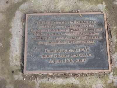
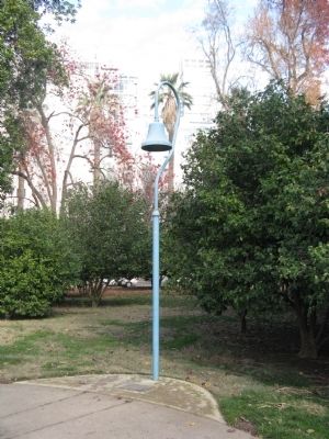
El Camino Real Bell
Erected 2000 by CFWC, Sutter District and CSAA, August 17th, 2000.
Topics and series. This historical marker is listed in these topic lists: Communications • Roads & Vehicles • Settlements & Settlers • Women. In addition, it is included in the El Camino Real, “The King's Highway” (California) series list.
Location. 38° 34.6′ N, 121° 29.469′ W. Marker is in Sacramento, California, in Sacramento County. It is in the Central Business District. Marker is located on the grounds of the California State Capital Park. Touch for map. Marker is at or near this postal address: 10th and L Street, Sacramento CA 95814, United States of America. Touch for directions.
Other nearby markers. At least 8 other markers are within walking distance of this marker. Pioneer Camellia Grove (a few steps from this marker); The Civil War Memorial Grove (within shouting distance of this marker); Thomas Starr King (within shouting distance of this marker); Liberty Bell Replica (within shouting distance of this marker); Civil War Symbol Yields To Time (within shouting distance of this marker); The California State Insectary (within shouting distance of this marker); USS California Bell Memorial (about 300 feet away, measured in a direct line); California State Capitol Park (about 300 feet away). Touch for a list and map of all markers in Sacramento.
Also see . . . The El Camino Real and its History. (Submitted on December 29, 2008, by Syd Whittle of Mesa, Arizona.)
Credits. This page was last revised on April 30, 2023. It was originally submitted on December 29, 2008, by Syd Whittle of Mesa, Arizona. This page has been viewed 1,811 times since then and 25 times this year. Photos: 1, 2. submitted on December 29, 2008, by Syd Whittle of Mesa, Arizona.

