Carlisle in Cumberland County, Pennsylvania — The American Northeast (Mid-Atlantic)
Carlisle Public Square
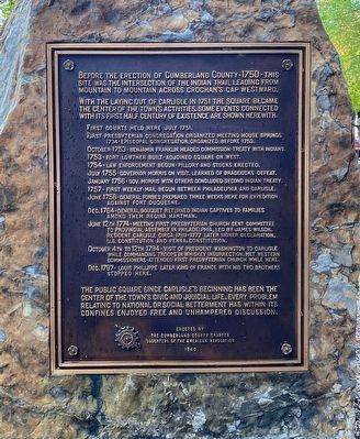
With the laying out of Carlisle in 1751 the square became the center of the town's activities. Some events connected with its first half century of existence are shown herewith.
First courts held here July 1751.
First Presbyterian congregation organized Meeting House Springs 1734 - Episcopal congregation, organized, before 1753.
October 1753 - Benjamin Franklin headed commission - treaty with Indians.
1753 - Fort Lowther built - adjoined square on west.
1754 - Law enforcement begun - pillory and stocks erected.
July 1755 - Governor Morris on visit. Learned of Braddock's defeat.
January 1756 - Gov. Morris with others concluded second Indian treaty.
1757 - First weekly mail begun between Philadelphia and Carlisle.
June 1758 - General Forbes prepared three weeks here for expedition against Fort Duquesne.
Dec. 1764 - General Bouquet returned Indian captives to families among them Regina Hartman.
June 12th 1774 - Meeting First Presbyterian Church sent committee to Provincial Assembly in Philadelphia, led by James Wilson, resident Carlisle circa 1769 - 1777 later Signer Declaration, U.S. Constitution and Penna. Constitution.
October 4th to 12th 1794 - visit of President Washington to Carlisle while commanding troops in Whiskey Insurrection. Met western commissioners - attended First Presbyterian Church while here.
Dec. 1797 - Louis Phillippe later King of France with his two brothers stopped here.
The Public Square since Carlisle's beginning has been the center of the town's civic and judicial life. Every problem relating to national or social betterment has within its confines enjoyed free and unhampered discussion.
Erected 1940 by The Cumberland County Chapter Daughters of the American Revolution.
Topics and series. This historical marker is listed in these topic lists: Colonial Era • Native Americans • Patriots & Patriotism • Settlements & Settlers. In addition, it is included in the Daughters of the American Revolution, the Former U.S. Presidents: #01 George Washington, and the Signers of the Declaration of Independence series lists. A significant historical month for this entry is January 1756.
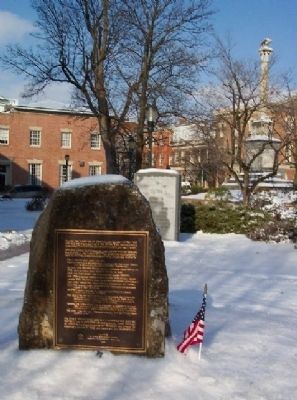
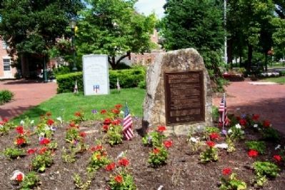
Location. 40° 12.07′ N, 77° 11.366′ W. Marker is in Carlisle, Pennsylvania, in Cumberland County. Marker is on Hanover Street (Pennsylvania Route 34), on the right when traveling south. Marker is immediately north of old courthouse. Touch for map. Marker is in this post office area: Carlisle PA 17013, United States of America. Touch for directions.
Other nearby markers.
At least 8 other markers are within walking distance of this marker. China Burma India Veteran's Memorial (here, next to this marker); Medal of Honor Recipients (here, next to this marker); Cumberland County (a few steps from this marker); Forbes Trail (a few steps from this marker); Historic Downtown Carlisle (a few steps from this marker); The Shelling of Carlisle (a few steps from this marker); Vietnam War Memorial (a few steps from this marker); Carlisle Court House (a few steps from this marker). Touch for a list and map of all markers in Carlisle.
Credits. This page was last revised on January 12, 2022. It was originally submitted on February 4, 2009, by William Fischer, Jr. of Scranton, Pennsylvania. This page has been viewed 1,304 times since then and 24 times this year. Photos: 1. submitted on December 19, 2021, by Shane Oliver of Richmond, Virginia. 2. submitted on February 4, 2009, by William Fischer, Jr. of Scranton, Pennsylvania. 3. submitted on May 18, 2010, by William Fischer, Jr. of Scranton, Pennsylvania. • Kevin W. was the editor who published this page.


