Three Chopt in Richmond, Virginia — The American South (Mid-Atlantic)
Three-Chopt Road
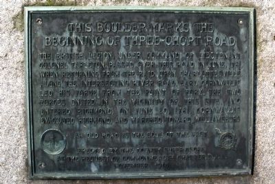
This boulder marks the beginning of the Three-Chopt Road
The British Legion under Command of Lieutenant Colonel Tarleton, passed over this road in June, 1781, when returning from the raid upon Charlottesville. Along the intersecting River Road, Earl Cornwallis led his force from the Point of Fork. The two forces united in the vicinity of this site, and entered Richmond. On June 20, 1781, Cornwallis evacuated Richmond, and marched toward Williamsburg.
An old road is the soul of the past
Erected 1916 by the County Supervisors at the request of Daughters of the American Revolution.
Topics and series. This historical marker is listed in these topic lists: Roads & Vehicles • War, US Revolutionary. In addition, it is included in the Daughters of the American Revolution series list. A significant historical month for this entry is June 1781.
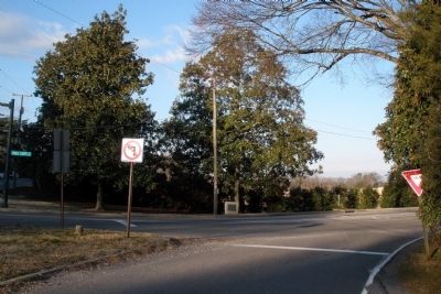
Location. 37° 34.167′ N, 77° 31.373′ W. Marker is in Richmond, Virginia. It is in Three Chopt. Marker is at the intersection of Three Chopt Road and River Road, on the left when traveling north on Three Chopt Road. Touch for map. Marker is in this post office area: Richmond VA 23226, United States of America. Touch for directions.
Other nearby markers. At least 8 other markers are within 2 miles of this marker, measured as the crow flies. Richmond Defences (within shouting distance of this marker); Wilton (approx. 0.4 miles away); a different marker also named Wilton (approx. half a mile away); Ampthill (approx. 0.6 miles away); Westwood Baptist Church (approx. 0.9 miles away); The Westwood Community (approx. 0.9 miles away); Windsor (approx. 1.2 miles away); Granite and History (approx. 1.2 miles away). Touch for a list and map of all markers in Richmond.
Also see . . . The Route of the Three Notch’d Road: A Preliminary Report (pdf file). "Known first as the Mountain Road, or Mountain Ridge Road, it derived its name Three Notch'd Road from a system of marks it had received by 1742 or 1743." Virginia Highway & Transportation Research Council (Submitted on February 11, 2009.)
Credits. This page was last revised on February 1, 2023. It was originally submitted on February 11, 2009, by Bernard Fisher of Richmond, Virginia. This page has been viewed 1,356 times since then and 40 times this year. Photos: 1, 2. submitted on February 11, 2009, by Bernard Fisher of Richmond, Virginia. • Kevin W. was the editor who published this page.

