Church Hill in Richmond, Virginia — The American South (Mid-Atlantic)
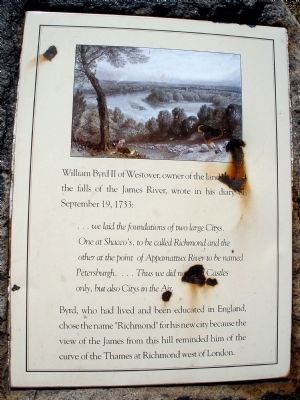
"Richmond"
…we laid the foundations of two large Citys. One at Shacco’s, to be called Richmond and the other at the point of Appamattux River to be named Petersburgh. …Thus we did not build Castles only, but also Citys in the Air.
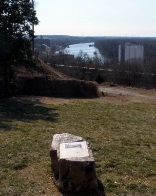
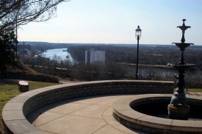
Byrd, who had lived and been educated in England, chose the name “Richmond” for his new city because the view of the James from this hill reminded him of the curve of the Thames at Richmond west of London.
Erected 1990 by Church Hill Association.
Topics. This historical marker is listed in these topic lists: Colonial Era • Settlements & Settlers. A significant historical month for this entry is September 1909.
Location. 37° 31.593′ N, 77° 25.044′ W. Marker is in Richmond, Virginia. It is in Church Hill. Marker is at the intersection of Libby Terrace and North 29th Street, on the right when traveling east on Libby Terrace. Touch for map. Marker is in this post office area: Richmond VA 23223, United States of America. Touch for directions.
Other nearby markers. At least 8 other markers are within walking distance of this marker. The View That Named The City (a few steps from this marker); Libby House (within shouting distance of this marker); 5 North 29th Street (within shouting distance of this marker); 2916 Libby Terrace (within shouting distance of this marker); 3013 Libby Terrace (about 300 feet away, measured in a direct line); Bloody Run (about 300 feet away); The Williamson Allen House (about 600 feet away); Myrtle Terrace (about 600 feet away). Touch for a list and map of all markers in Richmond.
Credits. This page was last revised on February 2, 2023. It was originally submitted on February 15, 2009, by Bernard Fisher of Richmond, Virginia. This page has been viewed 1,607 times since then and 55 times this year. Photos: 1, 2, 3, 4. submitted on February 15, 2009, by Bernard Fisher of Richmond, Virginia. • Kevin W. was the editor who published this page.


