Myrtle Beach in Horry County, South Carolina — The American South (South Atlantic)
Morris Island Lighthouse
Folly Beach, SC
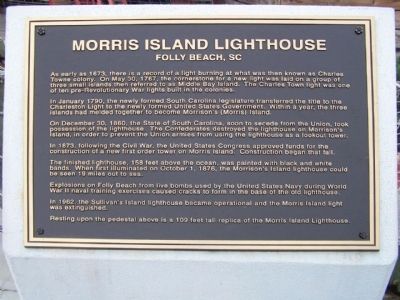
In January 1790, the newly formed South Carolina legislature transferred the title to the newly formed United States Government. Within a year, the three islands had melded together to become Morrison's (Morris) Island.
On December 30, 1860, the State of South Carolina, soon to secede from the Union, took possession of the lighthouse. The Confederates destroyed the lighthouse on Morrison's Island to prevent the Union armies from using the lighthouse as a lookout tower.
In 1873, following the Civil War, the United States Congress approved funds for the construction of a new first order tower on Morris Island. Construction began that fall.
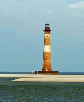
The finished lighthouse, 158 feet above the ocean, was painted with black and white bands. When first illuminated on October 1, 1876, the Morrison's Island lighthouse could be seen 19 miles out at sea.
Explosions on the Folly Beach from live bombs used by the United States Navy during World War II naval training exercises caused cracks to form in the base of the old lighthouse.
In 1962, the Sullivan's Island lighthouse became operational and the Morris Island light was extinguished.
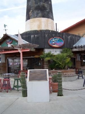
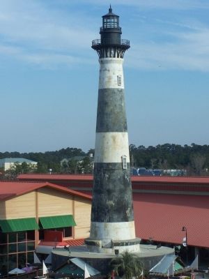
Resting upon the pedestal above is a 109 feet tall replica of the Morris Island Lighthouse.
Topics and series. This historical marker is listed in these topic lists: Notable Buildings • Waterways & Vessels. In addition, it is included in the Lighthouses series list. A significant historical month for this entry is January 1790.
Location. 33° 42.908′ N, 78° 52.587′ W. Marker is in Myrtle Beach, South Carolina, in Horry County. Marker can be reached from Celebrity Circle. Off Robert Grissom Pkwy at "Broadway at the Beach," southeast side. Touch for map. Marker is in this post office area: Myrtle Beach SC 29577, United States of America. Touch for directions.
Other nearby markers. At least 8 other markers are within 2 miles of this marker, measured as the crow flies. Charlie's Place (approx. ¾ mile away); Myrtle Beach Colored School (approx. 1.3 miles away); Justin W. Plyler Boardwalk Park (approx. 1½ miles away); Site Of The Seaside Hotel (approx. 1½ miles away); Grand Strand (approx. 1½ miles away); Nance Plaza (approx. 1½ miles away); Hurricane Hugo (approx. 1½ miles away); Hurricane Hazel (approx. 1.6 miles away). Touch for a list and map of all markers in Myrtle Beach.
Also see . . . Morris Island, SC. In 1673, the early settlers established
the first navigational aid on what would become Morris Island. The crude light consisted of a “fier” ball of oakum and pitch that was elevated in an open iron basket.
In 1880, the lighthouse stood 2,700 feet from the water. By 1938, the lighthouse was at the water’s edge, and today the lighthouse is its own island, roughly 1,600 feet offshore. (Submitted on February 25, 2009, by Mike Stroud of Bluffton, South Carolina.)
Credits. This page was last revised on December 9, 2021. It was originally submitted on February 25, 2009, by Mike Stroud of Bluffton, South Carolina. This page has been viewed 2,231 times since then and 34 times this year. Photos: 1, 2, 3, 4. submitted on February 25, 2009, by Mike Stroud of Bluffton, South Carolina. • Kevin W. was the editor who published this page.


