Fredericksburg, Virginia — The American South (Mid-Atlantic)
Fraternizing at the Ford
The Rappahannock River During the Civil War
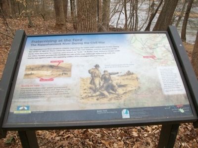
The Rappahannock River served as a barrier separating the Union and Confederate Armies during the winter of 1862-63. Places where the water level, the river bottom, and the steepness of the banks were favorable for crossings were known as "fords." At Banks' Ford, Alabama troops under Col. Hilary Herbert guarded the Confederate side of the river. Although fraternizing with the enemy was against orders, the opposing soldiers often arranged informal truces.
Warning the Troops
Detachments of soldiers called "pickets" guarded places along the river that were of military value. Their mission was to give warning if an opposing force should advance. The Union pickets in the foreground of this image were directly across the river from this point.
Erected by Friends of the Rappahannock.
Topics. This historical marker is listed in these topic lists: War, US Civil • Waterways & Vessels.
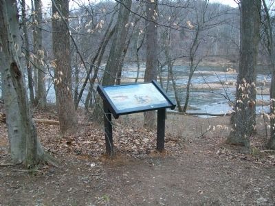
Location. 38° 18.491′ N, 77° 31.715′ W. Marker is in Fredericksburg, Virginia. Marker is on River Road, 0.7 miles west of Bragg Road, on the right when traveling west. Touch for map. Marker is at or near this postal address: 5462 River Rd, Fredericksburg VA 22404, United States of America. Touch for directions.
Other nearby markers. At least 8 other markers are within 2 miles of this marker, measured as the crow flies. The Rise & Fall of the Rappahannock Navigation System (approx. ¾ mile away); The Mannahoac Indigenous Tribe (approx. one mile away); 15th Reg’t. N. J. Vol’s (approx. 1.2 miles away); 23rd Regt., N. J. Vols. (approx. 1.3 miles away); Battle of Salem Church (approx. 1.3 miles away); a different marker also named Battle of Salem Church (approx. 1.3 miles away); a different marker also named The Battle of Salem Church (approx. 1.3 miles away); From Church to Hospital (approx. 1.3 miles away). Touch for a list and map of all markers in Fredericksburg.
More about this marker. On the left with the main text is a sketch of the Rappahannock at this point showing the location of the Union pickets. In the center is an Edwin Forbes sketch of Soldiers trading goods with the enemy across the River using toy boats.
On the right is a map of this bend of the Rappahannock. This military atlas shows a sketch of the area during the Civil War. Banks' (AKA Scott's) Dam was directly across from you are now and Banks' Ford (prewar) was about a tenth of a mile downstream to your right. Stones from the dam abutment can still be found near River Road. The map is from "The Official Military Atlas of the Civil War," plate XLI, map 1. Published by the Government Printing Office,
1891-1895.
Also see . . .
1. Friends of the Rappahannock. (Submitted on February 28, 2009, by Kathy Walker of Stafford, Virginia.)
2. Chesapeake Bay Gateways Network - Your Chesapeake Connection. (Submitted on February 28, 2009, by Kathy Walker of Stafford, Virginia.)
Credits. This page was last revised on March 2, 2024. It was originally submitted on February 28, 2009, by Kathy Walker of Stafford, Virginia. This page has been viewed 1,906 times since then and 47 times this year. Photos: 1, 2, 3, 4, 5. submitted on February 28, 2009, by Kathy Walker of Stafford, Virginia. • Craig Swain was the editor who published this page.
