Near McDowell in Highland County, Virginia — The American South (Mid-Atlantic)
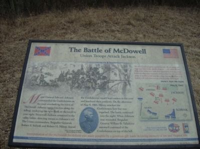
The Battle of McDowell
Union Troops Attack Jackson
“We were posted along the crest of this hill… We are within full range and their bullets whistle about us… We return the fire. More of the enemy now make their appearance from the valley below and they seem resolved to drive us from the hill. A batter opens on us from a hill near the village, but our [position] is so high that the balls pass over us without doing much harm.”
Charles C. Wight, 58th Virginia
Erected by Civil War Preservation Trust & Shenandoah Valley Battlefields Foundation.
Topics. This historical marker is listed in this topic list: War, US Civil. A significant historical date for this entry is May 8, 1884.
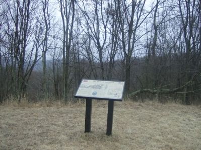
Location. Marker has been reported permanently removed. It was located near 38° 19.39′ N, 79° 28.478′ W. Marker was near McDowell, Virginia, in Highland County. Marker could be reached from U.S. 250, on the right when traveling east. Located in the Civil War Preservation's Trust McDowell Battlefield. Touch for map. Marker was in this post office area: Mc Dowell VA 24458, United States of America.
We have been informed that this sign or monument is no longer there and will not be replaced. This page is an archival view of what was.
Other nearby markers. At least 8 other markers are within walking distance of this location. The Battle Rages (a few steps from this marker); The 12th Georgia (about 400 feet away, measured in a direct line); A Spectacular Show (about 400 feet away); The Confederate Right (about 500 feet away); Sitlington's Hill (about 600 feet away); An Attack Repulsed (approx. 0.2 miles away); The Ravines (approx. ¼ mile away); A Reconnaissance In Force (approx. 0.3 miles away). Touch for a list and map of all markers in McDowell.
More about this marker. On the upper left is a sketch depicting the infantry line during the battle. In the lower center is a portrait of Union commander Brigadier General Robert H. Milroy. To the right is a map depicting the unit positions at this stage of the battle.
Related markers. Click here for a list of markers that are related to this marker. To better understand the relationship, study each marker in the order shown.
Credits. This page was last revised on October 18, 2023. It was originally submitted on March 4, 2009, by Robert H. Moore, II of Winchester, Virginia. This page has been viewed 1,495 times since then and 13 times this year. Photos: 1. submitted on March 4, 2009, by Robert H. Moore, II of Winchester, Virginia. 2. submitted on March 30, 2009. 3. submitted on March 4, 2009, by Robert H. Moore, II of Winchester, Virginia. • Craig Swain was the editor who published this page.


