Near Providence Forge in New Kent County, Virginia — The American South (Mid-Atlantic)
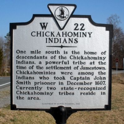
Chickahominy Indians
Erected 1998 by Department of Historic Resources. (Marker Number W-22.)
Topics and series. This historical marker is listed in these topic lists: Colonial Era • Native Americans. In addition, it is included in the Virginia Department of Historic Resources (DHR) series list. A significant historical month for this entry is December 1607.
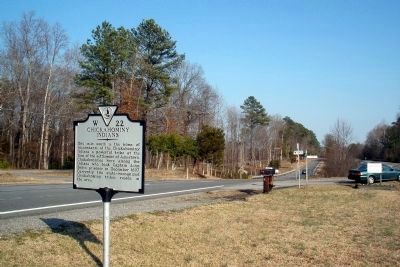
Location. 37° 25.537′ N, 76° 58.158′ W. Marker is near Providence Forge, Virginia, in New Kent County. Marker is at the intersection of Pocahontas Trail (U.S. 60) and Tsena Road, on the right when traveling east on Pocahontas Trail. Touch for map. Marker is in this post office area: Providence Forge VA 23140, United States of America. Touch for directions.
Other nearby markers. At least 8 other markers are within 4 miles of this marker, measured as the crow flies. Destruction of Chickahominy Indian Towns (a few steps from this marker); State Game Farm (approx. 1.4 miles away); Chickahominy Water Trail (approx. 2.2 miles away); Fort James (approx. 3 miles away); Piney Grove (approx. 3.7 miles away); Piney Grove and Southalls (approx. 3.7 miles away); Binns Hall (approx. 4 miles away); Tyree's Plantation (approx. 4.1 miles away). Touch for a list and map of all markers in Providence Forge.
Also see . . .
1. Chickahominy Tribe. (Submitted on November 10, 2021.)
2. Chickahominy Tribe. Encyclopedia Virignia (Submitted on November 10, 2021.)
3. Chickahominy people. Wikipedia (Submitted on November 10, 2021.)
Credits. This page was last revised on November 10, 2021. It was originally submitted on March 7, 2009, by Bernard Fisher of Richmond, Virginia. This page has been viewed 1,211 times since then and 34 times this year. Photos: 1, 2. submitted on March 7, 2009, by Bernard Fisher of Richmond, Virginia.

