Near Prince George in Prince George County, Virginia — The American South (Mid-Atlantic)
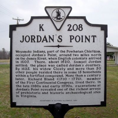
Jordan's Point
Erected 1999 by Department of Historic Resources. (Marker Number K-208.)
Topics and series. This historical marker is listed in these topic lists: Colonial Era • Native Americans • Settlements & Settlers. In addition, it is included in the Virginia Department of Historic Resources (DHR) series list. A significant historical year for this entry is 1607.
Location. 37° 14.475′ N, 77° 14.844′ W. Marker is near Prince George, Virginia, in Prince George County. Marker is at the intersection of Ruffin Road and Old Stage Road, on the right when traveling north on Ruffin Road. Touch for map. Marker is in this post office area: Prince George VA 23875, United States of America. Touch for directions.
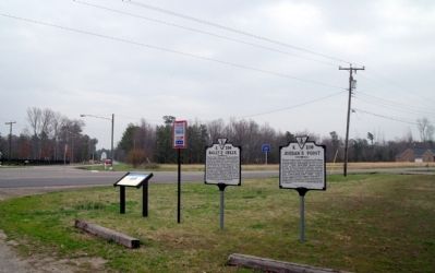
Other nearby markers. At least 8 other markers are within 3 miles of this marker, measured as the crow flies. Bailey's Creek (here, next to this marker); The Beefsteak Raid (here, next to this marker); World War II Memorial (approx. 2˝ miles away); Prince George Court House (approx. 2.6 miles away); a different marker also named Prince George Court House (approx. 2.6 miles away); The Clerk's Office (approx. 2.6 miles away); In Memoriam (approx. 2.6 miles away); Confederate Soldiers of Prince George Co. (approx. 2.6 miles away). Touch for a list and map of all markers in Prince George.
Also see . . . Jordan Point, Virginia. Wikipedia (Submitted on April 7, 2009.)
Credits. This page was last revised on November 11, 2021. It was originally submitted on April 7, 2009, by Bernard Fisher of Richmond, Virginia. This page has been viewed 1,666 times since then and 101 times this year. Photos: 1, 2. submitted on April 7, 2009, by Bernard Fisher of Richmond, Virginia.

