Fremont in Sandusky County, Ohio — The American Midwest (Great Lakes)
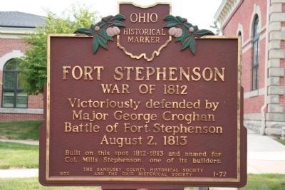
Fort Stephenson
War of 1812
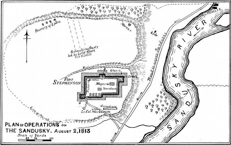
Victoriously defended by Major George Croghan. Battle of Fort Stephenson, August 2, 1813.
Built on this spot 1812-1813 and named for Col. Mills Stephenson, one of its builders.
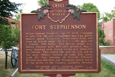
Major George Croghan, age 21, took command in July 1813. He was surrounded Aug. 1 by 2,000 Indians under Tecumseh, bombarded from the river by British ships. He had but 160 men and 1 cannon, Old Betsy. The British under Gen. Henry Proctor with 400 men attacked Aug. 2, were repulsed with heavy loses and retreated to Canada. This ended the war on U.S. soil in the west. Perry's victory on Lake Erie came Sept. 10. Our invasion of Canada followed. Proctor was defeated and Tecumseh killed Oct. 5 in the Battle of the Thames, southern Ontario.
Erected 1972 by The Sandusky County Historical Society and The Ohio Historical Society. (Marker Number 1-72.)
Topics and series. This historical marker is listed in these topic lists: Forts and Castles • Native Americans • War of 1812. In addition, it is included in the Ohio Historical Society / The Ohio History Connection series list. A significant historical month for this entry is July 1813.
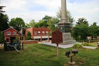
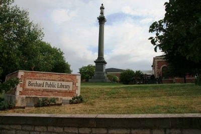
Location. 41° 20.766′ N, 83° 6.936′ W. Marker is in Fremont, Ohio, in Sandusky County. Marker is at the intersection of Croghan Street and High Street, on the right when traveling east on Croghan Street. This historical marker is located on the north side of the Birchard Public Library, which was built on the site of Fort Stephenson,. Touch for map. Marker is at or near this postal address: 423 Croghan St, Fremont OH 43420, United States of America. Touch for directions.
Other nearby markers. At least 8 other markers are within walking distance of this marker. A different marker also named Fort Stephenson (a few steps from this marker); Old Betsy (within shouting distance of this marker); Soldier's Monument (within shouting distance of this marker); Emerson Camp No. 53 (about 400 feet away, measured in a direct line); Flag Memorial Park (about 400 feet away); Minnie Louise Failing Home (about 400 feet away); Fremont (about 400 feet away); Near This Spot (about 400 feet away). Touch for a list and map of all markers in Fremont.
More about this marker. This historical marker is located on a rise, over looking the Sandusky River Valley, on the former site of Fort Stephenson, surrounded by a cluster of additional memorials, plaques, and monuments, all of which are there to commemorate the events that took place at Fort Stephenson during the war of 1812.
Regarding Fort Stephenson. As part of his preparations to recapture Detroit and invade Canada, General William Henry Harrison built a chain of forts northward, along both the Sandusky River Valley and the Sandusky-Scioto Trail, from what is now Upper Sandusky, Ohio (Fort Ferree), to what is now Tiffin, Ohio (Fort Ball), to what is now Old Fort, Ohio (Fort Seneca), all the way to what is now Fremont, Ohio (Fort Stephenson). These forts were intended to protect the American lines of supply and communication as General Harrison attempted to both position and build up his forces while he was seeking the opportunity for an invasion of British controlled Canada.
The British General Henry Proctor, on the other hand, was seeking to take the battle to the Americans and deal them a set back in their invasion plans. He had been unsuccessful in his attempt to hand the Americans a major defeat in his seige of Fort Meigs on the Maumee River, but rather than returning to Canada and appearing weak to his Native American allies he sought to gain some advantage by attacking what he felt would be a softer and more vulnerable target, the considerably smaller fortification and garrison at Fort Stephenson on the banks of the Sandusky River.
Credits. This page was last revised on November 8, 2021. It was originally submitted on April 19, 2009, by Dale K. Benington of Toledo, Ohio. This page has been viewed 2,210 times since then and 61 times this year. Photos: 1, 2, 3, 4. submitted on April 19, 2009, by Dale K. Benington of Toledo, Ohio. 5. submitted on April 23, 2018, by Allen C. Browne of Silver Spring, Maryland. • Kevin W. was the editor who published this page.
