Shippensburg in Cumberland County, Pennsylvania — The American Northeast (Mid-Atlantic)
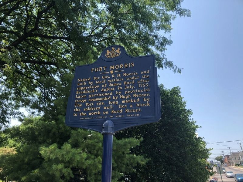
Fort Morris
Erected 1961 by Pennsylvania Historical and Museum Commission.
Topics and series. This historical marker is listed in these topic lists: Colonial Era • Forts and Castles • War, French and Indian. In addition, it is included in the Pennsylvania Historical and Museum Commission series list. A significant historical month for this entry is July 1755.
Location. 40° 3.257′ N, 77° 30.785′ W. Marker is in Shippensburg, Pennsylvania, in Cumberland County. Marker is on East King Street (U.S. 11) near Queen Street. Touch for map. Marker is at or near this postal address: 342 E King St, Shippensburg PA 17257, United States of America. Touch for directions.
Other nearby markers. At least 8 other markers are within walking distance of this marker. Old Court House (a few steps from this marker); The Ones He Left Behind: The Widow and Children of Jacob Agle (within shouting distance of this marker); The First Court House of Cumberland County (within shouting distance of this marker); The Original Site of the German Reformed and Lutheran Congregations (about 600 feet away, measured in a direct line); On this hill stood Fort Morris (about 700 feet away); Locust Grove Cemetery (approx. 0.2 miles away); This tablet is placed (approx. ¼ mile away); These Soldiers of the Revolutionary War Who Lie Buried Here (approx. ¼ mile away). Touch for a list and map of all markers in Shippensburg.
Credits. This page was last revised on July 4, 2020. It was originally submitted on May 4, 2009, by Robert H. Moore, II of Winchester, Virginia. This page has been viewed 1,353 times since then and 70 times this year. Photo 1. submitted on July 4, 2020, by Devry Becker Jones of Washington, District of Columbia. • Christopher Busta-Peck was the editor who published this page.
