Near Hopewell in Prince George County, Virginia — The American South (Mid-Atlantic)
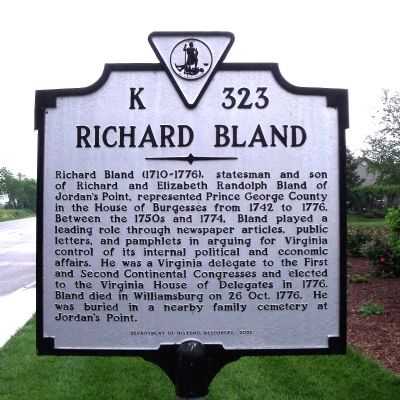
Richard Bland
Erected 2005 by Department of Historic Resources. (Marker Number K-323.)
Topics and series. This historical marker is listed in these topic lists: Cemeteries & Burial Sites • Colonial Era • Communications • Industry & Commerce • War, US Revolutionary. In addition, it is included in the Virginia Department of Historic Resources (DHR) series list. A significant historical year for this entry is 1742.
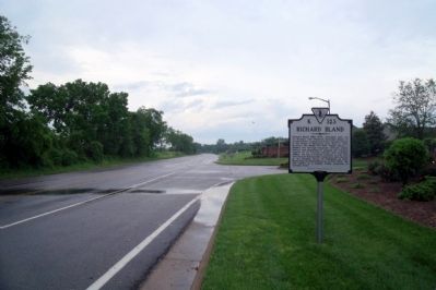
Location. 37° 18.347′ N, 77° 13.364′ W. Marker is near Hopewell, Virginia, in Prince George County. Marker is at the intersection of Jordan Point Road (Virginia Route 156) and Jordan Point Parkway, on the right on Jordan Point Road. Touch for map. Marker is in this post office area: Hopewell VA 23860, United States of America. Touch for directions.
Other nearby markers. At least 8 other markers are within 3 miles of this marker, measured as the crow flies. Evergreen (approx. 1.7 miles away); Capt. John Woodliffe (approx. 2.4 miles away); Origin of Taps (approx. 2.4 miles away); First Official Thanksgiving (approx. 2˝ miles away); Herring Creek & Kimages (approx. 2˝ miles away); Westover (approx. 2˝ miles away); Berkeley Plantation or Harrison's Landing (approx. 2˝ miles away); First English Thanksgiving in Virginia (approx. 2˝ miles away).
Credits. This page was last revised on December 26, 2019. It was originally submitted on May 8, 2009, by Bernard Fisher of Richmond, Virginia. This page has been viewed 1,196 times since then and 45 times this year. Photos: 1, 2. submitted on May 8, 2009, by Bernard Fisher of Richmond, Virginia.

