Melrose in Paulding County, Ohio — The American Midwest (Great Lakes)
The Indians
Inscription.
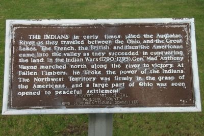
The Indians in early times plied the Auglaize River as they traveled between the Ohio and the Great Lakes. The French, the British, and then the Americans came into the valley as they succeeded in conquering the land. In the Indian Wars (1790 - 1795), Gen. "Mad" Anthony Wayne marched north along the river to victory. At Fallen Timbers, he broke the power of the Indians. The Northwest Territory was firmly in the grasp of the Americans, and a part of Ohio was soon opened to peaceful settlement.
Erected 1953 by The Paulding County Ohio Sesquicentennial Committee.
Topics. This historical marker is listed in these topic lists: Military • Native Americans • Wars, US Indian.
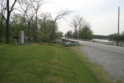
Location. 41° 6.699′ N, 84° 24.881′ W. Marker is in Melrose, Ohio, in Paulding County. Marker is on County Route 171, 0.2 miles south of County Route 177, on the left when traveling north. This Historical marker is located south of Defiance, Ohio, in a remote area of rural Paulding County, Ohio, on the west side of the Auglaize River, just to the south of where the Little Auglaize River flows into the Auglaize River. Touch for map. Marker is in this post office area: Melrose OH 45861, United States of America. Touch for directions.
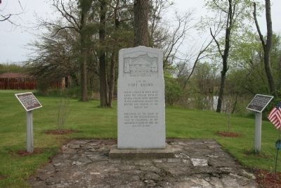
Other nearby markers. At least 8 other markers are within 8 miles of this marker, measured as the crow flies . Site of Fort Brown (here, next to this marker); Fort Brown (here, next to this marker); Charloe (approx. 1.7 miles away); Imaginary Likeness Of Chief Charloe Peter (approx. 1.7 miles away); Charloe Community Park (approx. 1.7 miles away); Miami-Erie and Wabash-Erie Canals (approx. 6.1 miles away); Joshua A. Ramsey Memorial (approx. 6.1 miles away); Grover Hill Town Hall Bell (approx. 7.2 miles away). Touch for a list and map of all markers in Melrose.
More about this marker. This historical marker shares it's location with two additional historical markers (both of the other markers refer events related to the War of 1812).
Regarding The Indians. In the "Historical Sketch - Paulding County, Ohio," when discussing the early military history of the county, it states the following: "It was first traversed by Americans under Gen. 'Mad' Anthony Wayne in 1794 enroute to the Battle of Fallen Timbers.
Credits. This page was last revised on June 16, 2016. It was originally submitted on May 25, 2009, by Dale K. Benington of Toledo, Ohio. This page has been viewed 1,475 times since then and 42 times this year. Photos: 1, 2, 3. submitted on May 25, 2009, by Dale K. Benington of Toledo, Ohio. • Syd Whittle was the editor who published this page.


