Fort Recovery in Mercer County, Ohio — The American Midwest (Great Lakes)
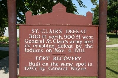
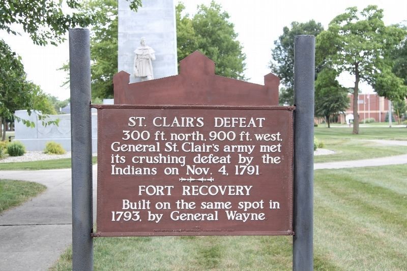
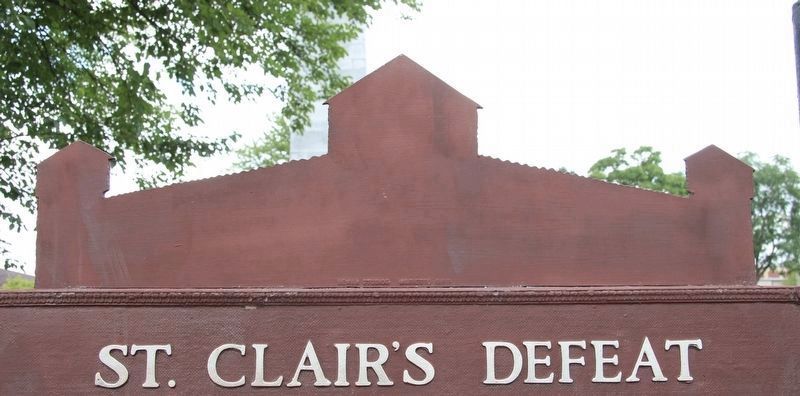
St. Clair's Defeat / Fort Recovery
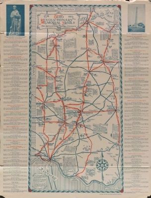
Ohio Revolutionary Memorial Trail
300 ft. north, 900 ft. west,
General St. Clair's army met
its crushing defeat by the
Indians on November 4, 1791.
Built on the same spot in
1793, by General Wayne.
Erected 1930 by Ohio Revolutionary Memorial Commission. (Marker Number C150.)
Topics and series. This historical marker is listed in these topic lists: Forts and Castles • Military • Native Americans • Wars, US Indian. In addition, it is included in the Ohio Revolutionary Memorial Commission series list. A significant historical month for this entry is November 1781.
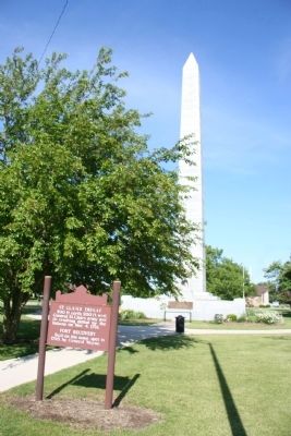
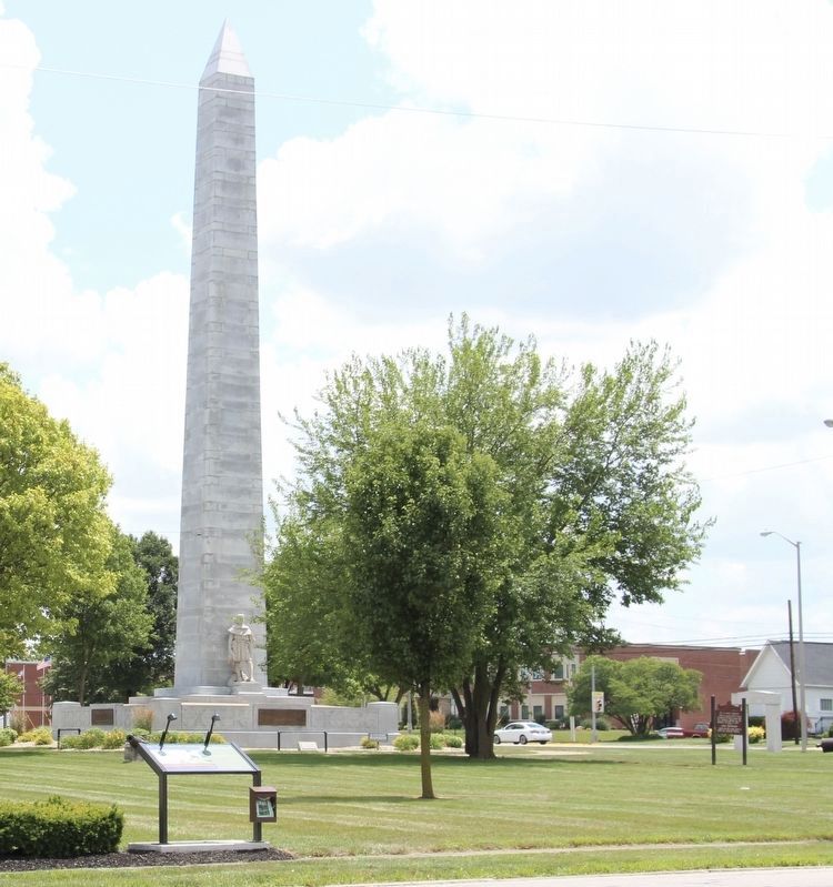
Location. 40° 24.793′ N, 84° 46.572′ W. Marker is in Fort Recovery, Ohio, in Mercer County. Marker is on North Elm Street (Ohio Route 49) north of Butler Street (Ohio Route 119), on the right when traveling south. Upon driving into Fort Recovery, Ohio go to the intersection of State Route 119 (Butler Street) and State Route 49 (North Elm Street). Upon arriving there you will notice that on the northeast corner of this intersection there is a park (that takes up one square block) and right in the center of this park you will see a rather large and tall, stone, state memorial monument situated upon it. Between the front of this state memorial monument and North Elm Street is where this particular historical marker is located. Touch for map. Marker is at or near this postal address: 140 North Elm Street, Fort Recovery OH 45846, United States of America. Touch for directions.
Other nearby markers. At least 8 other markers are within walking distance of this marker. Dr. Victor Grasson (a few steps from this marker); Fort Recovery Monument (a few steps from this marker); Towards a Better Understanding / Remembering the Fallen (within shouting distance of this marker); Fort Recovery Civil War Veterans Memorial (within shouting distance of this marker); Weaponry at the Battle of the Wabash and the Battle of Fort Recovery (approx. 0.2 miles away); 114-116 North Wayne Street (approx. 0.2 miles away); Gen. Richard Butler (approx. 0.2 miles away); 109 North Wayne Street (approx. 0.2 miles away). Touch for a list and map of all markers in Fort Recovery.
More about this marker. This historical marker is part of the Ohio Revolutionary Memorial Trail series (type C) which was put in place in 1930 to celebrate the 150th anniversary of the Ohio's Revolutionary War era Battle of Piqua, by the Ohio Revolutionary Memorial Commission.
In order to accomplish this, in 1929 the state of Ohio created the Ohio Revolutionary Memorial Commission, and then in 1930 this commission created 22 military trails, throughout western Ohio,
between Cincinnati, Ohio on the state's southern border and Toledo, Ohio on the state's northern border. Each of these military trails represented the routes, or trails, used by military leaders during either the Revolutionary War, the Indian Wars of 1790 to 1795, or the War of 1812. Each of these military routes connected various related historical sites, that were marked with Ohio Revolutionary Memorial Commission (type C) markers, along each of the military trails.
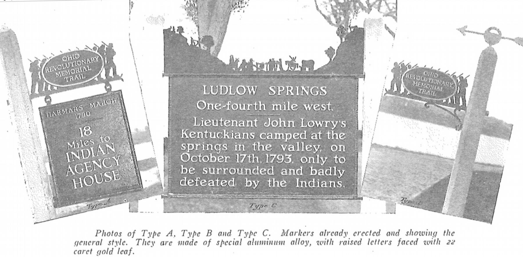
The routes of these military trails were in turn marked by type A and type B Ohio Revolutionary Memorial Commission markers that served as directional (type B) and distance (type A) markers.
Originally, back in 1930, there were erected 70 some of these Ohio Revolutionary Memorial Commission, type C, markers. To date, there are only 20 some of them that have been located and posted on the Historical Marker database. A number of them are presently missing, and presumed to be permanently lost.
Of the 20 some original markers that have been included in the historical marker database only a small number of them have the original art work, sometimes referred to as silhouettes, across the top of the historical marker. This is a feature that makes these markers quite unique from most other historical markers. This "St. Clair's Defeat / Fort Recovery" marker is one of those very few markers.
Also see . . .
1. St. Clair's Defeat. This link is published and made available by, "Ohio History Central," an online encyclopedia of Ohio History. (Submitted on June 11, 2009, by Dale K. Benington of Toledo, Ohio.)
2. Ohio Revolutionary Memorial Trail System. A description of the Revolutionary Memorial Trail System developed by the state of Ohio in 1929 - 1930. (Submitted on June 10, 2010, by Dale K. Benington of Toledo, Ohio.)
Photographed By Dale K. Benington, June 26, 2019
8. St. Clair's Defeat / Fort Recovery Marker
View of the three types of markers used by the Ohio Revolutionary Memorial Commission. The marker on the left is a type A marker, the marker in the middle is a type C (just like our featured marker), and the marker on the right is a type B. For a better view double click on this picture.
Credits. This page was last revised on January 20, 2020. It was originally submitted on June 11, 2009, by Dale K. Benington of Toledo, Ohio. This page has been viewed 2,248 times since then and 28 times this year. Photos: 1, 2. submitted on June 11, 2009, by Dale K. Benington of Toledo, Ohio. 3, 4, 5, 6. submitted on July 18, 2019, by Dale K. Benington of Toledo, Ohio. 7. submitted on September 7, 2014, by Dale K. Benington of Toledo, Ohio. 8. submitted on June 27, 2019, by Dale K. Benington of Toledo, Ohio. • Syd Whittle was the editor who published this page.
