Zanesfield in Logan County, Ohio — The American Midwest (Great Lakes)
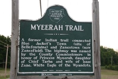
Myeerah Trail
Logan County, On Top of Ohio
Erected 1954 by Logan County Historical Society.
Topics. This historical marker is listed in these topic lists: Native Americans • Roads & Vehicles • Settlements & Settlers.
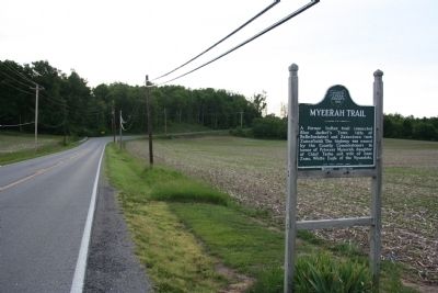
Location. 40° 20.399′ N, 83° 40.89′ W. Marker is in Zanesfield, Ohio, in Logan County. Marker is on County Route 10, 0.1 miles west of Main Street, on the right when traveling west. This historical marker is located on County Road 10, just outside of Zanesfield, Ohio, on the north side of the road. Touch for map. Marker is in this post office area: Zanesfield OH 43360, United States of America. Touch for directions.
Other nearby markers. At least 8 other markers are within walking distance of this marker. Historic Logan County (here, next to this marker); China Flats (approx. ¼ mile away); Jefferson Township Veterans Memorial (approx. ¼ mile away); Ebenezer Zane Cabin (approx. ¼ mile away); Helen Wonders Blue Memorial Park (approx. ¼ mile away); Zanesfield (approx. ¼ mile away); In Memory of Isaac Zane (approx. 0.3 miles away); Gen. Simon Kenton (approx. 0.3 miles away). Touch for a list and map of all markers in Zanesfield.
Also see . . . The Story of Myeerah. This web link provides insights and information on Myeerah, her father the Wyandot Chief Tarhe, and her husband the white captive Isaac Zane. (Submitted on June 19, 2009, by Dale K. Benington of Toledo, Ohio.)
Credits. This page was last revised on June 16, 2016. It was originally submitted on June 19, 2009, by Dale K. Benington of Toledo, Ohio. This page has been viewed 1,510 times since then and 66 times this year. Photos: 1, 2. submitted on June 19, 2009, by Dale K. Benington of Toledo, Ohio. • Craig Swain was the editor who published this page.

