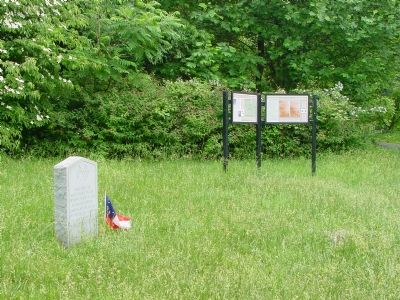
Near Boonsboro in Washington County, Maryland — The American Northeast (Mid-Atlantic)
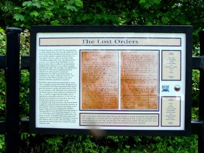
The Lost Orders
No other document of the Civil War has generated so much controversy as Lee's Special Orders No. 191. These “Lost Orders” detailed the movements of Lee's army for the operation against Harpers Ferry. On September 9 Lee sent copies of the order to his subordinate commanders. The copy that General George B. McClellan read on September 13 was found by three Federal soldiers in an abandoned campsite near Frederick in an envelope wrapped around three cigars. The envelope was addressed to General D. H. Hill. Due to confusion between General Lee's and General T. J. Jackson's headquarters over Hill's place in the chain of command, two copies of Special Orders No. 191 were sent to Hill. Hill received his copy from Jackson while the copy from Lee was lost.
McClellan's good fortune permitted him to move with a certainty he had never before displayed. Lee was puzzled by McClellan's uncharacteristic speed and took actions to protect his army until it could be concentrated. Later McClellan was criticized for not destroying Lee's army. Whatever criticism was due, it is unfair to argue that McClellan lost an opportunity presented to him by S. O. No. 191. By the time the Federals found the orders, they were already dated. Jackson was safely on the Confederate side of the Potomac and General James Longstreet could easily have crossed the Potomac at Williamsport. Had Lee chosen to seek safety across the Potomac, the Union troops in the Catoctin Valley could not have prevented him from doing so. On September 12 even before learning of S. O. No. 191, McClellan issued orders that would lead to the Battle of South Mountain. These orders placed the vanguard of General Ambrose E. Burnside's troops in the Catoctin Valley on the 13th. McClellan's main force did not arrive at the foot of South Mountain until the 14th.
If the Lost Orders had never been found, the battles of South Mountain and Antietam still would have occurred and Lee's gamble in Maryland still would have failed. Lee's chance for success was lost, not because his orders were found, but because his army remained divided too long and McClellan moved faster than Lee expected.
This is your heritage. To learn about battlefield preservation and interpretation, ask your park rangers. • Donated to the people of the United States by Barton C. Allen, D.D.S of Texas.
Topics and series. This historical marker is listed in this topic list: War, US Civil. In addition, it is included in the Believe It or Not series list. A significant historical month for this entry is September 1841.
Location. 39° 28.228′ N, 77° 37.045′ W. Marker is near Boonsboro, Maryland, in Washington County. Marker is at the intersection of Reno Monument Road and the Appalachian Trail, on the left when traveling west on Reno Monument Road. Touch for map. Marker is at or near this postal address: 21605 Reno Monument Rd, Boonsboro MD 21713, United States of America. Touch for directions.
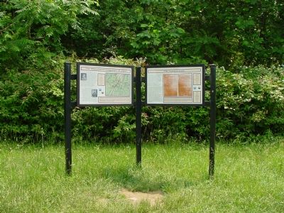
Other nearby markers. At least 8 other markers are within walking distance of this marker. The Maryland Campaign of 1862 (here, next to this marker); Deaths of Two Generals (here, next to this marker); The Battle for Fox’s Gap (a few steps from this marker); Welcome to Historic Wise's Field (a few steps from this marker); Near Here in Wise’s Field (a few steps from this marker); The "Wiregrass" Georgians (a few steps from this marker); 13th N.C. Regiment of Gen. Garland's Brigade (within shouting distance of this marker); Maj. Gen. Jesse L. Reno (within shouting distance of this marker). Touch for a list and map of all markers in Boonsboro.
Related markers. Click here for a list of markers that are related to this marker. Lost Special Orders 191 markers
Also see . . .
1. Corporal Barton W. Mitchell and the Lost Orders. Historynet website entry (Submitted on March 26, 2022, by Larry Gertner of New York, New York.)
2. The Lost Order. Civil War in the East website entry (Submitted on March 26, 2022, by Larry Gertner of New York, New York.)
Additional commentary.
1. Special Orders No. 191
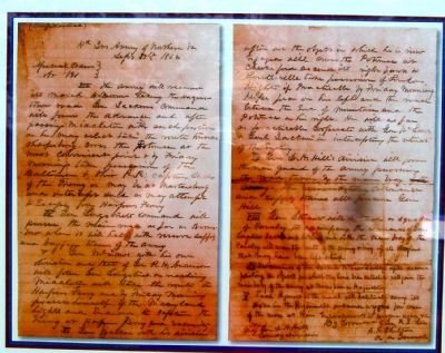
Transcript of The Lost Orders
(Confidential)
HdQrs.
Army of Northern Va
September 9th, 1862
Special Orders
No. 191
III. The army will resume its march to-morrow, taking the Hagerstown road. Gen. Jackson's command will form the advance, and, after passing Middletown, with such portion as he may select, take the route toward Sharpsburg, cross the Potomac at the most convenient point, and by Friday morning take possession of the Baltimore and Ohio R.R., capture such of the enemy as may be at Martinsburg, and intercept such as may attempt to Escape from Harpers Ferry.
IV. Gen. Longstreet's command will pursue the main road as far as Boonsboro, where it will halt, with reserve, supply, and baggage trains of the army.
V. Gen. McLaws, with his own division and that of General R. H. Anderson, will follow General Longstreet. On reaching Middletown will take the route to Harper's Ferry, and by Friday morning possess himself of the Maryland heights and Endeavor to capture the enemy at Harper's Ferry and vicinity.
VI. Gen. Walker, with his division, after acc.[accomplishing] the object in which he is now engaged,will cross the Potomac at Cheek's ford, ascend its right bank to Lovettsville, take possession of Loudoun Heights, if Practicable, by Friday morning, Keys Ford on his left, and the road between the end of the mountain and the Potomac on his right. He will, as far as practicable,
Cooperate with Gen. McLaws and Gen. Jackson, and intercept retreat of the Enemy.
VII. Gen. D. H. Hill's division will form the rear guard of the army, pursuing the road taken by the main body. The reserve artillery, ordnance, and supply trains will precede Gen. Hill.
VIII. Gen. Stuart will detach a squadron of Cavalry to accompany the Commands of Gens. Longstreet, Jackson, and McLaws, and with the main body of the Cavalry, will cover the route of the Army, bringing up all stragglers that may have been left behind.
IX. The commands of Gen. Jackson, McLaws, and Walker, after accomplishing the objects for which they have been detached, will join the main body of the Army at Boonsboro or Hagerstown.
X. Each Regiment on the march will habitually carry its axes in the regimental ordnance wagons, for use of the men at their encampments, to procure wood, &c.
By command of Gen. R. E. Lee
R. H. CHILTON,
Assistant A. General
For Maj Gen. D. H. Hill, Command Division
— Submitted July 23, 2006, by J. J. Prats of Powell, Ohio.
Credits. This page was last revised on March 26, 2022. It was originally submitted on July 22, 2006, by J. J. Prats of Powell, Ohio. This page has been viewed 3,620 times since then and 48 times this year. Last updated on August 11, 2007, by Craig Swain of Leesburg, Virginia. Photos: 1. submitted on July 22, 2006, by J. J. Prats of Powell, Ohio. 2. submitted on July 23, 2006, by J. J. Prats of Powell, Ohio. 3. submitted on July 22, 2006, by J. J. Prats of Powell, Ohio. 4, 5. submitted on July 23, 2006, by J. J. Prats of Powell, Ohio.
