Point Pleasant in Mason County, West Virginia — The American South (Appalachia)
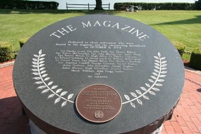
The Magazine
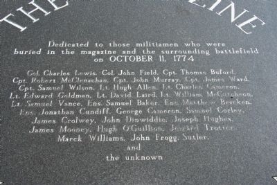
[Top Inscription on Marker]
buried in the magazine and the surrounding battlefield
on OCTOBER 11, 1774
Col. Charles Lewis, Col. John Field, Capt. Thomas Buford,
Cpt. Robert McClenachan, Capt. John Murray, Cpt. James Ward,
Capt. Samuel Wilson, Lt. Hugh Allen, Lt. Charles Cameron,
Lt. Edward Goldman, Lt. David Laird, Lt. William McCutcheon,
Lt. Samuel Vance, Ens. Samuel Baker, Ens. Matthew Bracken,
Ens. Jonathan Cundiff, George Cameron, Samuel Corley,
James Crolwey, John Dinwiddie, Joseph Hughes,
James Mooney, Hugh O'Guillion,Jerrard Trotter,
Marck Williams, John Frogg, Sutler
and
the unknown
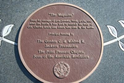
Used for the storage of gun powder, food, grain, etc.
After the battle it was used to entomb the body of
Col. Charles Lewis and others who died in the battle.
Erected by The Gordon C. & Mildred R. Jackson Foundation and The Point Pleasant Chapter Sons of the American Revolution.
Topics and series. This historical marker is listed in these topic lists: Cemeteries & Burial Sites • War, US Revolutionary • Wars, US Indian. In addition, it is included in the Sons of the American Revolution (SAR) series list. A significant historical date for this entry is October 11, 1774.
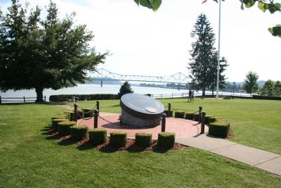
Location. 38° 50.338′ N, 82° 8.454′ W. Marker is in Point Pleasant, West Virginia, in Mason County. Marker is on Main Street, 0.1 miles 1st Street, on the right when traveling south. This historical marker is just one of several historical markers that are situated at the Point Pleasant Battlefield State Park, in downtown Point Pleasant, West Virginia. The park itself is located on the east side of the Kanawha River at the point of its confluence with the Ohio River. Touch for map. Marker is in this post office area: Point Pleasant WV 25550, United States of America. Touch for directions.
Other nearby markers. At least 8 other markers are within walking distance of this marker. Col. Charles Lewis (here, next to this marker); Liberty Tree (within shouting distance of this marker); French Oak (within shouting distance of this marker); a different marker also named French Oak (within shouting distance of this marker); Colonel Andrew Lewis (within shouting distance of this marker); The Sallie Marmet Anchor (within shouting distance of this marker); The Battle of Point Pleasant (within shouting
distance of this marker); Revolutionary Soldiers (within shouting distance of this marker). Touch for a list and map of all markers in Point Pleasant.
Also see . . .
1. Lord Dunmore's War and the Battle of Point Pleasant. This link is published and made available by, "Ohio History Central," an online encyclopedia of Ohio History. (Submitted on July 13, 2009, by Dale K. Benington of Toledo, Ohio.)
2. Tu-Endie-Wei Point Pleasant Battlefield Monument. The Magazine Marker is located at Tu-Endie-Wei State Park. Visit this link to find dates for special walks conducted this summer (2009) – 'Battle Remembered'. (Submitted on July 22, 2009, by Sissie Summers of Charleston, West Virginia.)
Credits. This page was last revised on January 19, 2022. It was originally submitted on July 13, 2009, by Dale K. Benington of Toledo, Ohio. This page has been viewed 1,360 times since then and 44 times this year. Photos: 1, 2, 3, 4. submitted on July 13, 2009, by Dale K. Benington of Toledo, Ohio. • Craig Swain was the editor who published this page.


