Monroe in Monroe County, Michigan — The American Midwest (Great Lakes)
Tecumseh's Headquarters
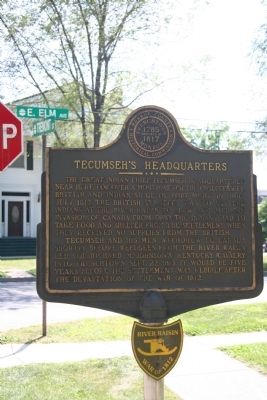
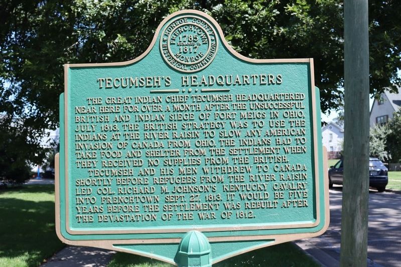
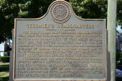
The Great Indian Chief Tecumseh headquartered near here for over a month after the unsuccessful British And Indian siege of Fort Meigs in Ohio, July 1813. The British strategy was to use the Indians at the River Raisin to slow down any American invasion of Canada from Ohio. The Indians had to take food and shelter from the settlement when they received no supplies from the British.
Tecumseh and his men withdrew to Canada shortly before refugees from the River Raisin led Col. Richard M. Johnson's Kentucky Cavalry into Frenchtown Sept. 27, 1813. It would be five years before the settlement was rebuilt after the devastation of the War of 1812.
Erected by Monroe County Historical Commission.
Topics. This historical marker is listed in these topic lists: Native Americans • Settlements & Settlers • War of 1812. A significant historical month for this entry is July 1813.
Location. 41° 55.068′ N, 83° 23.66′ W. Marker is in Monroe, Michigan, in Monroe County. Marker is at the intersection of Tremont Street and East Elm Avenue (Michigan Highway 50), on the right when traveling south on Tremont Street. This historical marker, along with a number of other historical markers that are related to the River Raisin Massacre, is located along East Elm Avenue, which runs along the north side of the River Raisin. This marker, like all of the rest, is on the north side of East Elm Avenue, in a residential neighborhood, between Interstate 75 and the downtown area (much closer to the downtown area). Touch for map. Marker is in this post office area: Monroe MI 48162, United States of America. Touch for directions.
Other nearby markers. At least 8 other markers are within walking distance of this marker. The Gov. Robt. McCelland House (within shouting distance of this marker); Indian Trading Post (within shouting distance of this marker); First Flag Raised In Michigan Territory (about 600 feet away, measured in a direct line); First American Flag (about 600 feet away); George Armstrong Custer / Sighting the Enemy (about 600 feet away); St. Mary of the Immaculate Conception (about 600 feet away); Monroe Street Bridge (about 700 feet away); General George A. Custer (about 700 feet away). Touch for a list and map of all markers in Monroe.
Also see . . .
1. Tecumseh. This link is published and made available by, "Ohio History Central," an online encyclopedia of Ohio History. (Submitted on July 18, 2009, by Dale K. Benington of Toledo, Ohio.)
2. Tecumseh. This web link was both published and made available by, "Absolute Astronomy.com," in it's quest to enable "exploring the universe of knowledge." (Submitted on July 18, 2009, by Dale K. Benington of Toledo, Ohio.)
3. Richard Mentor Johnson. This web link was both published and made available by, "Absolute Astronomy.com," in it's quest to enable "exploring the universe of knowledge." (Submitted on July 18, 2009, by Dale K. Benington of Toledo, Ohio.)

Photographed By Dale K. Benington, July 16, 2009
3. Tecumseh's Headquarters Marker
View of the historical marker (showing the River Raisin Battlefield symbol beneath it) looking south toward East Elm Avenue (street sign seen behind upper left corner of marker). The River Raisin runs eastward, behind the house on the far side of East Elm Street.

Photographed By Dale K. Benington, July 16, 2009
4. Tecumseh's Headquarters Marker
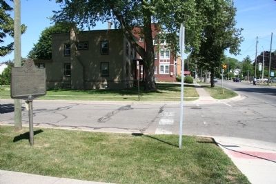
View of historical marker in the left foreground and a view looking eastward down East Elm Avenue in the direction of the River Raisin Battlefield Visitor Center. East Elm Avenue follows along the north side of the River Raisin.
Credits. This page was last revised on June 19, 2022. It was originally submitted on July 18, 2009, by Dale K. Benington of Toledo, Ohio. This page has been viewed 1,727 times since then and 63 times this year. Photos: 1. submitted on June 19, 2022, by Trevor L Whited of Kokomo, Indiana. 2, 3, 4. submitted on July 18, 2009, by Dale K. Benington of Toledo, Ohio. • Craig Swain was the editor who published this page.

